13761 Meadowbrook Rd
Woodbridge, VA 22193
- 3Beds
- 2Baths
- 816ft²Living Area
- 9,043ft²Lot Size
- -Pool
- 1Car
- 1977Year Built
- -DOM
- 2Permits
Property Valuations
Latest estimates for 13761 Meadowbrook Rd based on TopHap automated valuation model (AVM).
TopHap Estimate
$414,647
$508/ft²
Updated 2 months ago
13761 Meadowbrook Rd is valued at $414,647 by TopHap AVM 2 months ago.
Permits
13761 Meadowbrook Rd has 2 permit records of total value of $3,927.
Current Ownership
Information about the current owner(s).
Taxes Billed
Taxes billed in 2023$3,627.18From latest Total Assessed Value1.04%Total Assessed Value$348,600=Land+
Assessed Value$132,400Additions
Assessed Value$216,200
In 2023, taxes billed for 13761 Meadowbrook Rd were $3,627.18, which is 1.04% from latest Total Assessed Value of $348,600.
Property History
13761 Meadowbrook Rd has undefined property events records (listings, deeds, permits, tax, foreclosure, loan).
Environment
Environmental factors around 13761 Meadowbrook Rd
Hazard Risks
Nat'l Avg100Hurricane96Particulates89Air Pollution83Ozone82Weather81Wind81Carb Mono77Tornado57Hail50Lead44Earthquake41
12 hazards (Carbon Monoxide, Earthquake Risk, Hail Index, Tornado Index, Hurricane Index, Air Pollution Index, Ozone Index, Wind Index, Weather Risk, Lead Index, Particulate Matter, National Average) are above the national average around 13761 Meadowbrook Rd.
Walkability Index
5 /20
Most Walkable
20-18
Very Walkable
17-15
Somewhat Walkable
14-10
Car Dependent
9-0
13761 Meadowbrook Rd has a walkability score of 5 out of 20, which means that it is in a car dependent area.
Temperature
Seasonal temperature sampled over multiple years
Winter
Average
Low
26°F
High
46°F
Summer
Average
Low
64°F
High
85°F
In the winter at 13761 Meadowbrook Rd, temperatures range from 26.39°F to 46.49°F with an average of 36.44°F. In the summer, the temperature ranges from 64.12°F to 85.31°F with and average of 74.72°F.
School Information
Public/private schools serving 13761 Meadowbrook Rd
Public Schools
Nearby public schools serving 13761 Meadowbrook Rd have ratings undefined, undefined, and undefined.
Neighborhood
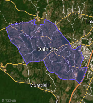
This property is located in Dale City, Woodbridge, VA 22193.
Seasonal Housing units 22193
9%of housing is for seasonal rent.
Daytime Population for 22193
-30%of people during work hours.
Boundary map of Dale City.
Crime Index for 22193
71
The crime index in 22193 is 71, which is 0.7 times lower than national average.
Market Trends
Historical market data near 13761 Meadowbrook Rd over selected time period.
Nearby Properties on Meadowbrook Rd
- 13847 Meadowbrook Rd, Woodbridge, VA 22193 (Dale City) is a 960 square foot, 3 bedroom, 1 bathroom, 0.22 acre property. It was built in 1976 and has an estimate of $380,455 with a price per ft² of $396.
- 13803 Meadowbrook Rd, Woodbridge, VA 22193 (Dale City) is a 816 square foot, 3 bedroom, 2.25 bathroom, 0.21 acre property. It was built in 1976 and has an estimate of $406,517 with a price per ft² of $498.
- 13828 Meadowbrook Rd, Woodbridge, VA 22193 (Dale City) is a 960 square foot, 3 bedroom, 1 bathroom, 0.2 acre property. It was built in 1976 and has an estimate of $347,528 with a price per ft² of $362.
- 13836 Meadowbrook Rd, Woodbridge, VA 22193 (Dale City) is a 816 square foot, 3 bedroom, 2 bathroom, 0.18 acre property. It was built in 1976 and has an estimate of $414,148 with a price per ft² of $508.
- 13802 Meadowbrook Rd, Woodbridge, VA 22193 (Dale City) is a 1,668 square foot, 4 bedroom, 3.25 bathroom, 0.18 acre property. It was built in 1976 and has an estimate of $502,926 with a price per ft² of $302.
- 13845 Meadowbrook Rd, Woodbridge, VA 22193 (Dale City) is a 960 square foot, 3 bedroom, 1 bathroom, 0.21 acre property. It was built in 1976 and has an estimate of $344,610 with a price per ft² of $359.
- 13849 Meadowbrook Rd, Woodbridge, VA 22193 (Dale City) is a 988 square foot, 4 bedroom, 3.25 bathroom, 0.24 acre property. It was built in 1978 and has an estimate of $485,304 with a price per ft² of $491.
- 13843 Meadowbrook Rd, Woodbridge, VA 22193 (Dale City) is a 816 square foot, 3 bedroom, 2.25 bathroom, 0.19 acre property. It was built in 1976 and has an estimate of $411,971 with a price per ft² of $505.
- 13851 Meadowbrook Rd, Woodbridge, VA 22193 (Dale City) is a 1,696 square foot, 3 bedroom, 4.5 bathroom, 0.19 acre property. It was built in 1996 and has an estimate of $575,532 with a price per ft² of $339.
- 13853 Meadowbrook Rd, Woodbridge, VA 22193 (Dale City) is a 1,964 square foot, 3 bedroom, 4.25 bathroom, 0.23 acre property. It was built in 1996 and has an estimate of $679,969 with a price per ft² of $346.
- 13841 Meadowbrook Rd, Woodbridge, VA 22193 (Dale City) is a 816 square foot, 3 bedroom, 2.25 bathroom, 0.19 acre property. It was built in 1975 and has an estimate of $407,753 with a price per ft² of $500.
- 13848 Meadowbrook Rd, Woodbridge, VA 22193 (Dale City) is a 988 square foot, 4 bedroom, 3.25 bathroom, 0.23 acre property. It was built in 1978 and has an estimate of $463,944 with a price per ft² of $470.
- 13846 Meadowbrook Rd, Woodbridge, VA 22193 (Dale City) is a 816 square foot, 3 bedroom, 2.25 bathroom, 0.22 acre property. It was built in 1976 and has an estimate of $426,393 with a price per ft² of $523.
- 13839 Meadowbrook Rd, Woodbridge, VA 22193 (Dale City) is a 1,280 square foot, 3 bedroom, 1 bathroom, 0.19 acre property. It was built in 1976 and has an estimate of $408,570 with a price per ft² of $319.
- 13855 Meadowbrook Rd, Woodbridge, VA 22193 (Dale City) is a 1,696 square foot, 3 bedroom, 4.25 bathroom, 0.26 acre property. It was built in 1996 and has an estimate of $643,447 with a price per ft² of $379.
- 13852 Meadowbrook Rd, Woodbridge, VA 22193 (Dale City) is a 1,996 square foot, 3 bedroom, 4.25 bathroom, 0.28 acre property. It was built in 1996 and has an estimate of $724,840 with a price per ft² of $363.
- 13798 Meadowbrook Rd, Woodbridge, VA 22193 (Dale City) is a 1,104 square foot, 3 bedroom, 3 bathroom, 0.18 acre property. It was built in 1976 and has an estimate of $486,390 with a price per ft² of $441.
- 13813 Meadowbrook Rd, Woodbridge, VA 22193 (Dale City) is a 816 square foot, 2 bedroom, 2 bathroom, 0.18 acre property. It was built in 1976 and has an estimate of $401,172 with a price per ft² of $492.
- 13812 Meadowbrook Rd, Woodbridge, VA 22193 (Dale City) is a 1,428 square foot, 4 bedroom, 2 bathroom, 0.18 acre property. It was built in 1976 and has an estimate of $445,733 with a price per ft² of $312.
- 13762 Meadowbrook Rd, Woodbridge, VA 22193 (Dale City) is a 816 square foot, 3 bedroom, 3.25 bathroom, 0.21 acre property. It was built in 1977 and has an estimate of $406,982 with a price per ft² of $499.
- 13857 Meadowbrook Rd, Woodbridge, VA 22193 (Dale City) is a 1,972 square foot, 3 bedroom, 4.5 bathroom, 0.2 acre property. It was built in 1995 and has an estimate of $673,577 with a price per ft² of $342.
- 13783 Meadowbrook Rd, Woodbridge, VA 22193 (Dale City) is a 816 square foot, 3 bedroom, 2 bathroom, 0.18 acre property. It was built in 1977 and has an estimate of $410,701 with a price per ft² of $503.
- 13823 Meadowbrook Rd, Woodbridge, VA 22193 (Dale City) is a 960 square foot, 3 bedroom, 2.25 bathroom, 0.19 acre property. It was built in 1976 and has an estimate of $355,261 with a price per ft² of $370.
- 13763 Meadowbrook Rd, Woodbridge, VA 22193 (Dale City) is a 960 square foot, 4 bedroom, 2 bathroom, 0.17 acre property. It was built in 1977 and has an estimate of $425,493 with a price per ft² of $443.
- 13784 Meadowbrook Rd, Woodbridge, VA 22193 (Dale City) is a 816 square foot, 3 bedroom, 1 bathroom, 0.18 acre property. It was built in 1977 and has an estimate of $375,645 with a price per ft² of $460.
- View more properties on Meadowbrook Rd