177 Hartsdale Rd
Rochester, NY 14622
- 3Beds
- 1Bath
- 1,532ft²Living Area
- 6,534ft²Lot Size
- -Pool
- 2Car
- 1929Year Built
- -DOM
- -Permit
Property Valuations
Latest estimates for 177 Hartsdale Rd based on TopHap automated valuation model (AVM).
TopHap Estimate
$150,111
$97/ft²
+$41K above Sold Price
Updated 2 months ago
Last Sold Price
$109,100
$71/ft²
8 years ago
177 Hartsdale Rd is valued at $150,111 by TopHap AVM 2 months ago.
177 Hartsdale Rd was last sold in 2015 for $109,100.
Current Ownership
Information about the current owner(s).
Taxes Billed
Taxes billed in 2021$5,305.00From latest Total Assessed Value4.84%Total Assessed Value$109,500=Land+
Assessed Value$24,800Additions
Assessed Value$84,700
In 2021, taxes billed for 177 Hartsdale Rd were $5,305, which is 4.84% from latest Total Assessed Value of $109,500.
Property History
177 Hartsdale Rd has undefined property events records (listings, deeds, permits, tax, foreclosure, loan).
Environment
Environmental factors around 177 Hartsdale Rd
Hazard Risks
Particulates134Nat'l Avg100Air Pollution89Ozone85Wind81Carb Mono76Earthquake54Lead50Hail39Hurricane36Weather23Tornado6
12 hazards (Carbon Monoxide, Earthquake Risk, Hail Index, Tornado Index, Hurricane Index, Air Pollution Index, Ozone Index, Wind Index, Weather Risk, Lead Index, Particulate Matter, National Average) are above the national average around 177 Hartsdale Rd.
Walkability Index
9 /20
Most Walkable
20-18
Very Walkable
17-15
Somewhat Walkable
14-10
Car Dependent
9-0
177 Hartsdale Rd has a walkability score of 9 out of 20, which means that it is in a car dependent area.
Temperature
Seasonal temperature sampled over multiple years
Winter
Average
Low
20°F
High
34°F
Summer
Average
Low
59°F
High
80°F
In the winter at 177 Hartsdale Rd, temperatures range from 19.78°F to 34.49°F with an average of 27.14°F. In the summer, the temperature ranges from 58.75°F to 79.6°F with and average of 69.18°F.
School Information
Public/private schools serving 177 Hartsdale Rd
Public Schools
Nearby public schools serving 177 Hartsdale Rd have ratings undefined, undefined, undefined, and undefined.
Neighborhood
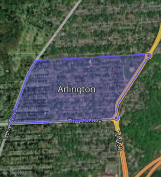
This property is located in Arlington, Rochester, NY 14622.
Seasonal Housing units 14622
6%of housing is for seasonal rent.
Daytime Population for 14622
-19%of people during work hours.
Boundary map of Arlington.
Crime Index for 14622
84
The crime index in 14622 is 84, which is 0.8 times lower than national average.
Market Trends
Historical market data near 177 Hartsdale Rd over selected time period.
Nearby Properties on Hartsdale Rd
- 198 Hartsdale Rd, Rochester, NY 14622 (Arlington) is a 1,506 square foot, 3 bedroom, 1 bathroom, 0.16 acre property. It was built in 1929 and has an estimate of $145,867 with a price per ft² of $97.
- 60 Hartsdale Rd, Rochester, NY 14622 (Arlington) is a 1,477 square foot, 3 bedroom, 3.25 bathroom, 0.15 acre property. It was built in 1935 and has an estimate of $195,839 with a price per ft² of $133.
- 146 Hartsdale Rd, Rochester, NY 14622 (Arlington) is a 1,368 square foot, 3 bedroom, 2 bathroom, 0.16 acre property. It was built in 1927 and has an estimate of $146,346 with a price per ft² of $107.
- 232 Hartsdale Rd, Rochester, NY 14622 (Arlington) is a 949 square foot, 2 bedroom, 2.25 bathroom, 0.16 acre property. It was built in 1949 and has an estimate of $98,901 with a price per ft² of $104.
- 246 Hartsdale Rd, Rochester, NY 14622 (Arlington) is a 1,667 square foot, 5 bedroom, 2 bathroom, 0.16 acre property. It was built in 1922 and has an estimate of $175,488 with a price per ft² of $105.
- 118 Hartsdale Rd, Rochester, NY 14622 (Arlington) is a 1,624 square foot, 3 bedroom, 1 bathroom, 0.15 acre property. It was built in 1924 and has an estimate of $151,936 with a price per ft² of $94.
- 152 Hartsdale Rd, Rochester, NY 14622 (Arlington) is a 1,360 square foot, 3 bedroom, 1 bathroom, 0.16 acre property. It was built in 1926 and has an estimate of $144,864 with a price per ft² of $107.
- 138 Hartsdale Rd, Rochester, NY 14622 (Arlington) is a 934 square foot, 2 bedroom, 1 bathroom, 0.2 acre property. It was built in 1927 and has an estimate of $126,047 with a price per ft² of $135.
- 158 Hartsdale Rd, Rochester, NY 14622 (Arlington) is a 1,672 square foot, 4 bedroom, 1 bathroom, 0.16 acre property. It was built in 1929 and has an estimate of $161,212 with a price per ft² of $96.
- 145 Hartsdale Rd, Rochester, NY 14622 (Arlington) is a 1,568 square foot, 4 bedroom, 2.25 bathroom, 0.15 acre property. It was built in 1958 and has an estimate of $154,913 with a price per ft² of $99.
- 151 Hartsdale Rd, Rochester, NY 14622 (Arlington) is a 1,556 square foot, 4 bedroom, 2 bathroom, 0.15 acre property. It was built in 1928 and has an estimate of $129,226 with a price per ft² of $83.
- 139 Hartsdale Rd, Rochester, NY 14622 (Arlington) is a 1,595 square foot, 3 bedroom, 2 bathroom, 0.15 acre property. It was built in 1939 and has an estimate of $169,801 with a price per ft² of $106.
- 157 Hartsdale Rd, Rochester, NY 14622 (Arlington) is a 1,707 square foot, 3 bedroom, 2 bathroom, 0.15 acre property. It was built in 1946 and has an estimate of $154,102 with a price per ft² of $90.
- 166 Hartsdale Rd, Rochester, NY 14622 (Arlington) is a 1,104 square foot, 2 bedroom, 1 bathroom, 0.16 acre property. It was built in 1928 and has an estimate of $125,273 with a price per ft² of $113.
- 131 Hartsdale Rd, Rochester, NY 14622 (Arlington) is a 1,770 square foot, 3 bedroom, 1 bathroom, 0.15 acre property. It was built in 1946 and has an estimate of $185,000 with a price per ft² of $105.
- 165 Hartsdale Rd, Rochester, NY 14622 (Arlington) is a 1,556 square foot, 2 bedroom, 1 bathroom, 0.15 acre property. It was built in 1930 and has an estimate of $142,849 with a price per ft² of $92.
- 288 Hartsdale Rd, Rochester, NY 14622 (Arlington) is a 1,380 square foot, 3 bedroom, 2.25 bathroom, 0.2 acre property. It was built in 1950 and has an estimate of $164,412 with a price per ft² of $119.
- 32 Hartsdale Rd, Rochester, NY 14622 (Arlington) is a 1,502 square foot, 4 bedroom, 2 bathroom, 0.14 acre property. It was built in 1928 and has an estimate of $195,178 with a price per ft² of $130.
- 171 Hartsdale Rd, Rochester, NY 14622 (Arlington) is a 1,073 square foot, 3 bedroom, 2 bathroom, 0.15 acre property. It was built in 1937 and has an estimate of $135,002 with a price per ft² of $126.
- 260 Hartsdale Rd, Rochester, NY 14622 (Arlington) is a 1,320 square foot, 3 bedroom, 1 bathroom, 0.2 acre property. It was built in 1951 and has an estimate of $155,824 with a price per ft² of $118.
- 291 Hartsdale Rd, Rochester, NY 14622 (Arlington) is a 1,357 square foot, 3 bedroom, 1 bathroom, 0.21 acre property. It was built in 1952 and has an estimate of $171,816 with a price per ft² of $127.
- 308 Hartsdale Rd, Rochester, NY 14622 (Arlington) is a 1,320 square foot, 3 bedroom, 2.25 bathroom, 0.2 acre property. It was built in 1953 and has an estimate of $155,977 with a price per ft² of $118.
- 37 Hartsdale Rd, Rochester, NY 14622 (Arlington) is a 1,401 square foot, 3 bedroom, 2.25 bathroom, 0.15 acre property. It was built in 1928 and has an estimate of $165,318 with a price per ft² of $118.
- 287 Hartsdale Rd, Rochester, NY 14622 (Arlington) is a 1,668 square foot, 3 bedroom, 2.25 bathroom, 0.17 acre property. It was built in 1955 and has an estimate of $214,177 with a price per ft² of $128.
- 218 Hartsdale Rd, Rochester, NY 14622 (Arlington) is a 1,326 square foot, 3 bedroom, 2.25 bathroom, 0.16 acre property. It was built in 1930 and has an estimate of $141,637 with a price per ft² of $107.
- View more properties on Hartsdale Rd