320 Jon Dr
Brockton, MA 02302
- 3Beds
- 1Bath
- 1,232ft²Living Area
- 0.4acLot Size
- 1Pool
- 1Car
- 1960Year Built
- -DOM
- 11Permits
Property Valuations
Latest estimates for 320 Jon Dr based on TopHap automated valuation model (AVM).
TopHap Estimate
$458,252
$371/ft²
+$370K above Sold Price
Updated 2 months ago
Last Sold Price
$88,500
$72/ft²
23 years ago
320 Jon Dr is valued at $458,252 by TopHap AVM 2 months ago.
320 Jon Dr was last sold in 2000 for $88,500.
Permits
320 Jon Dr has 11 permit records of total value of $55,123.
Current Ownership
Information about the current owner(s).
Taxes Billed
Taxes billed in 2023$4,896.00From latest Total Assessed Value1.3%Total Assessed Value$377,200=Land+
Assessed Value$120,000Additions
Assessed Value$257,200
In 2023, taxes billed for 320 Jon Dr were $4,896, which is 1.30% from latest Total Assessed Value of $377,200.
Property History
320 Jon Dr has undefined property events records (listings, deeds, permits, tax, foreclosure, loan).
Environment
Environmental factors around 320 Jon Dr
Hazard Risks
Hurricane131Lead110Wind108Particulates105Nat'l Avg100Air Pollution99Ozone95Weather91Carb Mono84Earthquake69Hail50Tornado48
12 hazards (Carbon Monoxide, Earthquake Risk, Hail Index, Tornado Index, Hurricane Index, Air Pollution Index, Ozone Index, Wind Index, Weather Risk, Lead Index, Particulate Matter, National Average) are above the national average around 320 Jon Dr.
Walkability Index
13 /20
Most Walkable
20-18
Very Walkable
17-15
Somewhat Walkable
14-10
Car Dependent
9-0
320 Jon Dr has a walkability score of 13 out of 20, which means that it is in a somewhat walkable area.
Temperature
Seasonal temperature sampled over multiple years
Winter
Average
Low
21°F
High
39°F
Summer
Average
Low
59°F
High
80°F
In the winter at 320 Jon Dr, temperatures range from 20.66°F to 38.61°F with an average of 29.64°F. In the summer, the temperature ranges from 59.11°F to 80.1°F with and average of 69.61°F.
School Information
Public/private schools serving 320 Jon Dr
Public Schools
Nearby public schools serving 320 Jon Dr have ratings undefined, undefined, undefined, undefined, undefined, undefined, undefined, undefined, undefined, undefined, undefined, undefined, undefined, undefined, undefined, undefined, undefined, undefined, undefined, and undefined.
Neighborhood
This property is located in Brookfield Heights, Brockton, MA 02302.
Seasonal Housing units 02302
6%of housing is for seasonal rent.
Daytime Population for 02302
-25%of people during work hours.
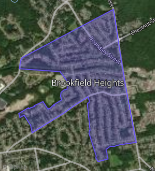
Boundary map of Brookfield Heights.
Crime Index for 02302
105
The crime index in 02302 is 105, which is 1.1 times higher than national average.
Market Trends
Historical market data near 320 Jon Dr over selected time period.
Nearby Properties on Jon Dr
- 226 Jon Dr, Brockton, MA 02302 (Brookfield Heights) is a 1,060 square foot, 3 bedroom, 1 bathroom, 0.36 acre property. It was built in 1960 and has an estimate of $404,643 with a price per ft² of $382.
- 305 Jon Dr, Brockton, MA 02302 (Brookfield Heights) is a 1,440 square foot, 4 bedroom, 1 bathroom, 0.23 acre property. It was built in 1960 and has an estimate of $415,055 with a price per ft² of $288.
- 232 Jon Dr, Brockton, MA 02302 (Brookfield Heights) is a 1,172 square foot, 3 bedroom, 1 bathroom, 0.36 acre property. It was built in 1960 and has an estimate of $357,830 with a price per ft² of $305.
- 319 Jon Dr, Brockton, MA 02302 (Brookfield Heights) is a 1,248 square foot, 3 bedroom, 2.25 bathroom, 0.22 acre property. It was built in 2014 and has an estimate of $458,916 with a price per ft² of $368.
- 275 Jon Dr, Brockton, MA 02302 (Brookfield Heights) is a 1,120 square foot, 3 bedroom, 1 bathroom, 0.24 acre property. It was built in 1960 and has an estimate of $419,897 with a price per ft² of $375.
- 299 Jon Dr, Brockton, MA 02302 (Brookfield Heights) is a 2,619 square foot, 3 bedroom, 3.25 bathroom, 0.24 acre property. It was built in 1960 and has an estimate of $488,834 with a price per ft² of $187.
- 198 Jon Dr, Brockton, MA 02302 (Brookfield Heights) is a 1,060 square foot, 3 bedroom, 1 bathroom, 0.36 acre property. It was built in 1960 and has an estimate of $404,180 with a price per ft² of $381.
- 220 Jon Dr, Brockton, MA 02302 (Brookfield Heights) is a 1,200 square foot, 3 bedroom, 1 bathroom, 0.36 acre property. It was built in 1960 and has an estimate of $441,112 with a price per ft² of $368.
- 300 Jon Dr, Brockton, MA 02302 (Brookfield Heights) is a 1,248 square foot, 3 bedroom, 1 bathroom, 0.42 acre property. It was built in 1960 and has an estimate of $424,658 with a price per ft² of $340.
- 320 Jon Dr, Brockton, MA 02302 (Brookfield Heights) is a 1,232 square foot, 3 bedroom, 1 bathroom, 0.41 acre property. It was built in 1960 and has an estimate of $436,309 with a price per ft² of $354.
- 353 Jon Dr, Brockton, MA 02302 (Brookfield Heights) is a 1,504 square foot, 4 bedroom, 1.5 bathroom, 0.25 acre property. It was built in 1960 and has an estimate of $420,509 with a price per ft² of $280.
- 212 Jon Dr, Brockton, MA 02302 (Brookfield Heights) is a 1,056 square foot, 3 bedroom, 2.25 bathroom, 0.36 acre property. It was built in 1960 and has an estimate of $422,778 with a price per ft² of $400.
- 306 Jon Dr, Brockton, MA 02302 (Brookfield Heights) is a 1,272 square foot, 3 bedroom, 1 bathroom, 0.41 acre property. It was built in 1960 and has an estimate of $416,886 with a price per ft² of $328.
- 291 Jon Dr, Brockton, MA 02302 (Brookfield Heights) is a 864 square foot, 3 bedroom, 1 bathroom, 0.24 acre property. It was built in 1960 and has an estimate of $390,410 with a price per ft² of $452.
- 283 Jon Dr, Brockton, MA 02302 (Brookfield Heights) is a 1,280 square foot, 3 bedroom, 1 bathroom, 0.24 acre property. It was built in 1960 and has an estimate of $408,772 with a price per ft² of $319.
- 135 Jon Dr, Brockton, MA 02302 is a 1,452 square foot, 3 bedroom, 2.25 bathroom, 28.9 acre property.
- 326 Jon Dr, Brockton, MA 02302 (Brookfield Heights) is a 1,216 square foot, 3 bedroom, 1 bathroom, 0.4 acre property. It was built in 1960 and has an estimate of $428,741 with a price per ft² of $353.
- 205 Jon Dr, Brockton, MA 02302 (Brookfield Heights) is a 2,500 square foot, 7 bedroom, 2 bathroom, 0.28 acre property. It was built in 1960 and has an estimate of $611,717 with a price per ft² of $245.
- 286 Jon Dr, Brockton, MA 02302 (Brookfield Heights) is a 864 square foot, 3 bedroom, 1 bathroom, 0.44 acre property. It was built in 1956 and has an estimate of $410,142 with a price per ft² of $475.
- 339 Jon Dr, Brockton, MA 02302 (Brookfield Heights) is a 1,568 square foot, 3 bedroom, 1 bathroom, 0.23 acre property. It was built in 1960 and has an estimate of $412,658 with a price per ft² of $263.
- 206 Jon Dr, Brockton, MA 02302 (Brookfield Heights) is a 1,060 square foot, 3 bedroom, 1 bathroom, 0.39 acre property. It was built in 1958 and has an estimate of $426,957 with a price per ft² of $403.
- 340 Jon Dr, Brockton, MA 02302 (Brookfield Heights) is a 1,280 square foot, 4 bedroom, 1 bathroom, 0.41 acre property. It was built in 1960 and has an estimate of $410,258 with a price per ft² of $321.
- 325 Jon Dr, Brockton, MA 02302 (Brookfield Heights) is a 1,376 square foot, 4 bedroom, 1 bathroom, 0.23 acre property. It was built in 1960 and has an estimate of $440,108 with a price per ft² of $320.
- 314 Jon Dr, Brockton, MA 02302 (Brookfield Heights) is a 1,168 square foot, 3 bedroom, 1 bathroom, 0.41 acre property. It was built in 1960 and has an estimate of $429,763 with a price per ft² of $368.
- 233 Jon Dr, Brockton, MA 02302 (Brookfield Heights) is a 2,806 square foot, 6 bedroom, 3 bathroom, 0.23 acre property. It was built in 1960 and has an estimate of $607,000 with a price per ft² of $216.
- View more properties on Jon Dr