436 Sundance Dr
Richland, WA 99352
- 4Beds
- 2Baths
- 2,493ft²Living Area
- 0.3acLot Size
- -Pool
- 3Car
- 2011Year Built
- -DOM
- -Permit
Property Valuations
Latest estimates for 436 Sundance Dr based on TopHap automated valuation model (AVM).
TopHap Estimate
$669,684
$268/ft²
+$597K above Sold Price
Updated 2 months ago
Last Sold Price
$72,750
$29/ft²
13 years ago
436 Sundance Dr is valued at $669,684 by TopHap AVM 2 months ago.
436 Sundance Dr was last sold in 2010 for $72,750.
Current Ownership
Information about the current owner(s).
Taxes Billed
Taxes billed in 2023$6,085.36From latest Total Assessed Value0.99%Total Assessed Value$612,600=Land+
Assessed Value$85,000Additions
Assessed Value$527,600
In 2023, taxes billed for 436 Sundance Dr were $6,085.36, which is 0.99% from latest Total Assessed Value of $612,600.
Property History
436 Sundance Dr has undefined property events records (listings, deeds, permits, tax, foreclosure, loan).
Environment
Environmental factors around 436 Sundance Dr
Hazard Risks
Carb Mono193Lead158Ozone121Air Pollution115Earthquake113Nat'l Avg100Particulates82Wind2Hail0Hurricane0Tornado0Weather0
8 hazards (Carbon Monoxide, Earthquake Risk, Air Pollution Index, Ozone Index, Wind Index, Lead Index, Particulate Matter, National Average) are above the national average around 436 Sundance Dr.
Walkability Index
12 /20
Most Walkable
20-18
Very Walkable
17-15
Somewhat Walkable
14-10
Car Dependent
9-0
436 Sundance Dr has a walkability score of 12 out of 20, which means that it is in a somewhat walkable area.
Temperature
Seasonal temperature sampled over multiple years
Winter
Average
Low
28°F
High
42°F
Summer
Average
Low
56°F
High
86°F
In the winter at 436 Sundance Dr, temperatures range from 27.6°F to 42.45°F with an average of 35.03°F. In the summer, the temperature ranges from 55.96°F to 86.35°F with and average of 71.16°F.
School Information
Public/private schools serving 436 Sundance Dr
Public Schools
Nearby public schools serving 436 Sundance Dr have ratings undefined, undefined, and undefined.
Neighborhood
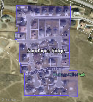
This property is located in Sundance Ridge, Richland, WA 99352.
Seasonal Housing units 99352
24%of housing is for seasonal rent.
Daytime Population for 99352
+29%of people during work hours.
Boundary map of Sundance Ridge.
Crime Index for 99352
74
The crime index in 99352 is 74, which is 0.7 times lower than national average.
Market Trends
Historical market data near 436 Sundance Dr over selected time period.
Nearby Properties on Sundance Dr
- 437 Sundance Dr, Richland, WA 99352 (Sundance Ridge) is a 2,663 square foot, 4 bedroom, 3.25 bathroom, 0.26 acre property. It was built in 2013 and has an estimate of $801,161 with a price per ft² of $301.
- 435 Sundance Dr, Richland, WA 99352 (Sundance Ridge) is a 2,705 square foot, 4 bedroom, 3.25 bathroom, 0.26 acre property. It was built in 2009 and has an estimate of $728,718 with a price per ft² of $269.
- 430 Sundance Dr, Richland, WA 99352 (Sundance Ridge) is a 2,302 square foot, 4 bedroom, 3.25 bathroom, 0.29 acre property. It was built in 2008 and has an estimate of $628,070 with a price per ft² of $273.
- 446 Sundance Dr, Richland, WA 99352 (Sundance Ridge) is a 2,312 square foot, 3 bedroom, 3 bathroom, 0.27 acre property. It was built in 2006 and has an estimate of $796,818 with a price per ft² of $345.
- 460 Sundance Dr, Richland, WA 99352 (Sundance Ridge) is a 2,860 square foot, 4 bedroom, 4.25 bathroom, 0.61 acre property. It was built in 2006 and has an estimate of $889,087 with a price per ft² of $311.
- 467 Sundance Dr, Richland, WA 99352 (Sundance Ridge) is a 3,241 square foot, 3 bedroom, 3.25 bathroom, 0.38 acre property. It was built in 2006 and has an estimate of $782,291 with a price per ft² of $241.
- 431 Sundance Dr, Richland, WA 99352 (Sundance Ridge) is a 5,755 square foot, 5 bathroom, 0.27 acre property. It was built in 2008 and has an estimate of $1,534,607 with a price per ft² of $267.
- 433 Sundance Dr, Richland, WA 99352 (Sundance Ridge) is a 0.28 acre property.
- 421 Sundance Dr, Richland, WA 99352 (Sundance Ridge) is a 2,886 square foot, 4 bedroom, 5.25 bathroom, 0.33 acre property. It was built in 2009 and has an estimate of $753,951 with a price per ft² of $261.
- 436 Sundance Dr, Richland, WA 99352 (Sundance Ridge) is a 2,494 square foot, 4 bedroom, 2 bathroom, 0.28 acre property. It was built in 2011 and has an estimate of $766,925 with a price per ft² of $308.
- 427 Sundance Dr, Richland, WA 99352 (Sundance Ridge) is a 2,394 square foot, 3 bathroom, 0.28 acre property. It was built in 2014 and has an estimate of $767,654 with a price per ft² of $321.
- 450 Sundance Dr, Richland, WA 99352 (Sundance Ridge) is a 2,523 square foot, 3 bedroom, 5.25 bathroom, 0.31 acre property. It was built in 2011 and has an estimate of $1,152,822 with a price per ft² of $457.
- 463 Sundance Dr, Richland, WA 99352 (Sundance Ridge) is a 2,730 square foot, 4 bedroom, 3 bathroom, 0.34 acre property. It was built in 2010 and has an estimate of $844,014 with a price per ft² of $309.
- 424 Sundance Dr, Richland, WA 99352 (Sundance Ridge) is a 3,018 square foot, 4.25 bathroom, 0.28 acre property. It was built in 2010 and has an estimate of $841,787 with a price per ft² of $279.
- 451 Sundance Dr, Richland, WA 99352 (Sundance Ridge) is a 2,593 square foot, 4 bedroom, 3.25 bathroom, 0.34 acre property. It was built in 2016 and has an estimate of $768,424 with a price per ft² of $296.
- 420 Sundance Dr, Richland, WA 99352 (Sundance Ridge) is a 2,854 square foot, 4 bedroom, 4.25 bathroom, 0.32 acre property. It was built in 2010 and has an estimate of $854,404 with a price per ft² of $299.
- 423 Sundance Dr, Richland, WA 99352 (Sundance Ridge) is a 2,145 square foot, 3 bedroom, 4.5 bathroom, 0.28 acre property. It was built in 2016 and has an estimate of $707,773 with a price per ft² of $330.
- 440 Sundance Dr, Richland, WA 99352 (Sundance Ridge) is a 2,976 square foot, 4 bedroom, 3 bathroom, 0.28 acre property. It was built in 2006 and has an estimate of $763,696 with a price per ft² of $257.
- 439 Sundance Dr, Richland, WA 99352 (Sundance Ridge) is a 2,134 square foot, 4 bedroom, 2 bathroom, 0.28 acre property. It was built in 2014 and has an estimate of $737,598 with a price per ft² of $346.
- 454 Sundance Dr, Richland, WA 99352 (Sundance Ridge) is a 2,781 square foot, 4 bedroom, 2 bathroom, 0.65 acre property. It was built in 2008 and has an estimate of $876,238 with a price per ft² of $315.
- 456 Sundance Dr, Richland, WA 99352 (Sundance Ridge) is a 2,924 square foot, 4 bedroom, 1 bathroom, 0.56 acre property. It was built in 2014 and has an estimate of $907,897 with a price per ft² of $310.
- 464 Sundance Dr, Richland, WA 99352 (Sundance Ridge) is a 2,902 square foot, 3 bedroom, 2 bathroom, 0.66 acre property. It was built in 2006 and has an estimate of $820,000 with a price per ft² of $283.
- 428 Sundance Dr, Richland, WA 99352 (Sundance Ridge) is a 0.88 acre property.
- 431 Sundance Dr, Richland, WA 99352 (Sundance Ridge) is a 0.27 acre property.