60 Michael Dr
Saratoga Springs, NY 12866
- 3Beds
- 2Baths
- 1,728ft²Living Area
- 0.3acLot Size
- -Pool
- 1Car
- 1971Year Built
- -DOM
- -Permit
Property Valuations
Latest estimates for 60 Michael Dr based on TopHap automated valuation model (AVM).
TopHap Estimate
$417,038
$241/ft²
Updated 2 months ago
60 Michael Dr is valued at $417,038 by TopHap AVM 2 months ago.
Current Ownership
Information about the current owner(s).
Property History
60 Michael Dr has undefined property events records (listings, deeds, permits, tax, foreclosure, loan).
Environment
Environmental factors around 60 Michael Dr
Hazard Risks
Wind164Nat'l Avg100Particulates96Air Pollution85Ozone82Carb Mono73Earthquake68Hail56Weather53Lead47Hurricane43Tornado36
12 hazards (Carbon Monoxide, Earthquake Risk, Hail Index, Tornado Index, Hurricane Index, Air Pollution Index, Ozone Index, Wind Index, Weather Risk, Lead Index, Particulate Matter, National Average) are above the national average around 60 Michael Dr.
Walkability Index
6 /20
Most Walkable
20-18
Very Walkable
17-15
Somewhat Walkable
14-10
Car Dependent
9-0
60 Michael Dr has a walkability score of 6 out of 20, which means that it is in a car dependent area.
Temperature
Seasonal temperature sampled over multiple years
Winter
Average
Low
14°F
High
33°F
Summer
Average
Low
57°F
High
81°F
In the winter at 60 Michael Dr, temperatures range from 13.88°F to 32.88°F with an average of 23.38°F. In the summer, the temperature ranges from 57.02°F to 80.73°F with and average of 68.88°F.
School Information
Public/private schools serving 60 Michael Dr
Public Schools
Nearby public schools serving 60 Michael Dr have ratings undefined, undefined, and undefined.
Neighborhood
This property is located in Saratoga Springs.
Seasonal Housing units 12866
39%of housing is for seasonal rent.
Daytime Population for 12866
+9%of people during work hours.
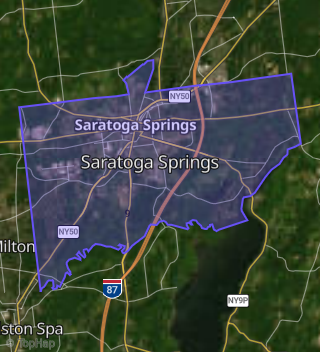
Boundary map of Saratoga Springs.
Crime Index for 12866
102
The crime index in 12866 is 102, which is 1.0 times higher than national average.
Market Trends
Historical market data near 60 Michael Dr over selected time period.
Nearby Properties on Michael Dr
- 12 Michael Dr, Saratoga Springs, NY 12866 is a 1,728 square foot, 4 bedroom, 2.25 bathroom, 0.36 acre property. It was built in 1970 and has an estimate of $332,210 with a price per ft² of $192.
- 4 Michael Dr, Saratoga Springs, NY 12866 is a 1,116 square foot, 3 bedroom, 1 bathroom, 0.24 acre property. It was built in 1969 and has an estimate of $267,805 with a price per ft² of $240.
- 11 Michael Dr, Saratoga Springs, NY 12866 is a 1,616 square foot, 3 bedroom, 2 bathroom, 0.29 acre property. It was built in 1970 and has an estimate of $304,834 with a price per ft² of $189.
- 36 Michael Dr, Saratoga Springs, NY 12866 is a 1,728 square foot, 4 bedroom, 3.25 bathroom, 0.26 acre property. It was built in 1970 and has an estimate of $342,552 with a price per ft² of $198.
- 9 Michael Dr, Saratoga Springs, NY 12866 is a 1,378 square foot, 3 bedroom, 2.25 bathroom, 0.29 acre property. It was built in 1969 and has an estimate of $292,105 with a price per ft² of $212.
- 42 Michael Dr, Saratoga Springs, NY 12866 is a 2,094 square foot, 3 bedroom, 2.25 bathroom, 0.23 acre property. It was built in 1971 and has an estimate of $365,187 with a price per ft² of $174.
- 52 Michael Dr, Saratoga Springs, NY 12866 is a 1,728 square foot, 3 bedroom, 2.25 bathroom, 0.24 acre property. It was built in 1971 and has an estimate of $343,730 with a price per ft² of $199.
- 34 Michael Dr, Saratoga Springs, NY 12866 is a 1,431 square foot, 3 bedroom, 2.25 bathroom, 0.48 acre property. It was built in 1970 and has an estimate of $323,886 with a price per ft² of $226.
- 8 Michael Dr, Saratoga Springs, NY 12866 is a 1,378 square foot, 3 bedroom, 2.25 bathroom, 0.24 acre property. It was built in 1969 and has an estimate of $289,269 with a price per ft² of $210.
- 20 Michael Dr, Saratoga Springs, NY 12866 is a 2,078 square foot, 4 bedroom, 2.25 bathroom, 0.23 acre property. It was built in 1971 and has an estimate of $379,563 with a price per ft² of $183.
- 60 Michael Dr, Saratoga Springs, NY 12866 is a 1,728 square foot, 3 bedroom, 1.5 bathroom, 0.26 acre property. It was built in 1971 and has an estimate of $351,802 with a price per ft² of $204.
- 46 Michael Dr, Saratoga Springs, NY 12866 is a 1,728 square foot, 3 bedroom, 2.25 bathroom, 0.23 acre property. It was built in 1971 and has an estimate of $350,015 with a price per ft² of $203.
- 6 Michael Dr, Saratoga Springs, NY 12866 is a 2,086 square foot, 5 bedroom, 2.25 bathroom, 0.24 acre property. It was built in 1969 and has an estimate of $347,748 with a price per ft² of $167.
- 29 Michael Dr, Saratoga Springs, NY 12866 is a 2,088 square foot, 4 bedroom, 2.25 bathroom, 0.24 acre property. It was built in 1969 and has an estimate of $385,592 with a price per ft² of $185.
- 66 Michael Dr, Saratoga Springs, NY 12866 is a 1,378 square foot, 3 bedroom, 2.25 bathroom, 0.27 acre property. It was built in 1971 and has an estimate of $339,834 with a price per ft² of $247.
- 40 Michael Dr, Saratoga Springs, NY 12866 is a 1,798 square foot, 4 bedroom, 3.25 bathroom, 0.23 acre property. It was built in 1970 and has an estimate of $359,443 with a price per ft² of $200.
- 10 Michael Dr, Saratoga Springs, NY 12866 is a 1,310 square foot, 3 bedroom, 2 bathroom, 0.24 acre property. It was built in 1969 and has an estimate of $292,742 with a price per ft² of $223.
- 7 Michael Dr, Saratoga Springs, NY 12866 is a 1,400 square foot, 3 bedroom, 2 bathroom, 0.26 acre property. It was built in 1968 and has an estimate of $284,302 with a price per ft² of $203.
- 5 Michael Dr, Saratoga Springs, NY 12866 is a 1,378 square foot, 3 bedroom, 2.25 bathroom, 0.26 acre property. It was built in 1970 and has an estimate of $293,245 with a price per ft² of $213.
- 18 Michael Dr, Saratoga Springs, NY 12866 is a 1,728 square foot, 4 bedroom, 3 bathroom, 0.33 acre property. It was built in 1972 and has an estimate of $332,800 with a price per ft² of $193.
- 21 Michael Dr, Saratoga Springs, NY 12866 is a 2,066 square foot, 4 bedroom, 2.25 bathroom, 0.25 acre property. It was built in 1970 and has an estimate of $359,050 with a price per ft² of $174.
- 1 Michael Dr, Saratoga Springs, NY 12866 is a 1,120 square foot, 3 bedroom, 1 bathroom, 0.29 acre property. It was built in 1979 and has an estimate of $284,918 with a price per ft² of $254.
- 13 Michael Dr, Saratoga Springs, NY 12866 is a 1,120 square foot, 3 bedroom, 1 bathroom, 0.29 acre property. It was built in 1971 and has an estimate of $257,090 with a price per ft² of $230.
- 16 Michael Dr, Saratoga Springs, NY 12866 is a 2,509 square foot, 5 bedroom, 4.25 bathroom, 0.35 acre property. It was built in 1971 and has an estimate of $347,193 with a price per ft² of $138.
- 15 Michael Dr, Saratoga Springs, NY 12866 is a 1,120 square foot, 3 bedroom, 1 bathroom, 0.24 acre property. It was built in 1993 and has an estimate of $259,405 with a price per ft² of $232.
- View more properties on Michael Dr