7138 Neff St
Houston, TX 77074
- 3Beds
- 1Bath
- 1,380ft²Living Area
- 8,041ft²Lot Size
- -Pool
- 1Car
- 1958Year Built
- -DOM
- -Permit
Property Valuations
Latest estimates for 7138 Neff St based on TopHap automated valuation model (AVM).
TopHap Estimate
$207,796
$150/ft²
Updated 2 months ago
7138 Neff St is valued at $207,796 by TopHap AVM 2 months ago.
Current Ownership
Information about the current owner(s).
Taxes Billed
Taxes billed in 2020$769.34From latest Total Assessed Value0.36%Total Assessed Value$212,590=Land+
Assessed Value$116,580Additions
Assessed Value$96,010
In 2020, taxes billed for 7138 Neff St were $769.34, which is 0.36% from latest Total Assessed Value of $212,590.
Property History
7138 Neff St has undefined property events records (listings, deeds, permits, tax, foreclosure, loan).
Environment
Environmental factors around 7138 Neff St
Hazard Risks
Hurricane393Weather330Tornado322Carb Mono102Nat'l Avg100Air Pollution91Ozone88Particulates83Hail78Lead37Earthquake24Wind24
12 hazards (Carbon Monoxide, Earthquake Risk, Hail Index, Tornado Index, Hurricane Index, Air Pollution Index, Ozone Index, Wind Index, Weather Risk, Lead Index, Particulate Matter, National Average) are above the national average around 7138 Neff St.
Walkability Index
13 /20
Most Walkable
20-18
Very Walkable
17-15
Somewhat Walkable
14-10
Car Dependent
9-0
7138 Neff St has a walkability score of 13 out of 20, which means that it is in a somewhat walkable area.
Temperature
Seasonal temperature sampled over multiple years
Winter
Average
Low
44°F
High
64°F
Summer
Average
Low
73°F
High
93°F
In the winter at 7138 Neff St, temperatures range from 43.5°F to 64.22°F with an average of 53.86°F. In the summer, the temperature ranges from 72.67°F to 92.66°F with and average of 82.67°F.
School Information
Public/private schools serving 7138 Neff St
Public Schools
Nearby public schools serving 7138 Neff St have ratings undefined, undefined, and undefined.
Neighborhood
This property is located in Sharpstown, Houston, TX 77074.
Seasonal Housing units 77074
2%of housing is for seasonal rent.
Daytime Population for 77074
+12%of people during work hours.
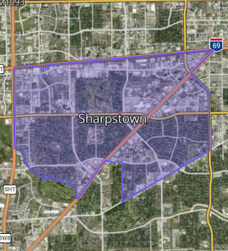
Boundary map of Sharpstown.
Crime Index for 77074
116
The crime index in 77074 is 116, which is 1.2 times higher than national average.
Market Trends
Historical market data near 7138 Neff St over selected time period.
Nearby Properties on Neff St
- 8118 Neff St, Houston, TX 77036 (Sharpstown) is a 2,105 square foot, 3 bedroom, 2 bathroom, 0.22 acre property. It was built in 1963 and has an estimate of $336,266 with a price per ft² of $160.
- 8122 Neff St, Houston, TX 77036 (Sharpstown) is a 1,851 square foot, 3 bedroom, 1.25 bathroom, 0.22 acre property. It was built in 1963 and has an estimate of $275,726 with a price per ft² of $149.
- 8206 Neff St, Houston, TX 77036 (Sharpstown) is a 1,902 square foot, 3 bedroom, 2 bathroom, 0.22 acre property. It was built in 1963 and has an estimate of $279,110 with a price per ft² of $147.
- 8210 Neff St, Houston, TX 77036 (Sharpstown) is a 2,430 square foot, 4 bedroom, 2 bathroom, 0.22 acre property. It was built in 1963 and has an estimate of $301,581 with a price per ft² of $124.
- 8302 Neff St, Houston, TX 77036 (Sharpstown) is a 1,773 square foot, 3 bedroom, 2 bathroom, 0.19 acre property. It was built in 1964 and has an estimate of $273,128 with a price per ft² of $154.
- 8310 Neff St, Houston, TX 77036 (Sharpstown) is a 1,665 square foot, 3 bedroom, 2 bathroom, 0.19 acre property. It was built in 1963 and has an estimate of $259,334 with a price per ft² of $156.
- 8322 Neff St, Houston, TX 77036 (Sharpstown) is a 1,949 square foot, 3 bedroom, 2 bathroom, 0.18 acre property. It was built in 1963 and has an estimate of $284,588 with a price per ft² of $146.
- 8326 Neff St, Houston, TX 77036 (Sharpstown) is a 1,665 square foot, 3 bedroom, 2 bathroom, 0.18 acre property. It was built in 1963 and has an estimate of $260,156 with a price per ft² of $156.
- 8334 Neff St, Houston, TX 77036 (Sharpstown) is a 1,688 square foot, 3 bedroom, 2 bathroom, 0.18 acre property. It was built in 1963 and has an estimate of $263,240 with a price per ft² of $156.
- 8314 Neff St, Houston, TX 77036 (Sharpstown) is a 1,865 square foot, 3 bedroom, 2 bathroom, 0.18 acre property. It was built in 1963 and has an estimate of $331,081 with a price per ft² of $178.
- 9418 Neff St, Houston, TX 77036 (Sharpstown) is a 2,316 square foot, 5 bedroom, 3 bathroom, 0.19 acre property. It was built in 1968 and has an estimate of $317,257 with a price per ft² of $137.
- 9414 Neff St, Houston, TX 77036 (Sharpstown) is a 1,905 square foot, 4 bedroom, 2 bathroom, 0.19 acre property. It was built in 1968 and has an estimate of $284,699 with a price per ft² of $149.
- 9410 Neff St, Houston, TX 77036 (Sharpstown) is a 1,880 square foot, 4 bedroom, 2 bathroom, 0.2 acre property. It was built in 1968 and has an estimate of $281,245 with a price per ft² of $150.
- 9402 Neff St, Houston, TX 77036 (Sharpstown) is a 1,876 square foot, 3 bedroom, 2 bathroom, 0.21 acre property. It was built in 1968 and has an estimate of $283,919 with a price per ft² of $151.
- 9322 Neff St, Houston, TX 77036 (Sharpstown) is a 1,869 square foot, 3 bedroom, 2 bathroom, 0.22 acre property. It was built in 1968 and has an estimate of $275,913 with a price per ft² of $148.
- 9314 Neff St, Houston, TX 77036 (Sharpstown) is a 3,214 square foot, 4 bedroom, 2.25 bathroom, 0.23 acre property. It was built in 1968 and has an estimate of $320,939 with a price per ft² of $100.
- 9310 Neff St, Houston, TX 77036 (Sharpstown) is a 1,958 square foot, 3 bedroom, 2 bathroom, 0.23 acre property. It was built in 1968 and has an estimate of $278,845 with a price per ft² of $142.
- 9302 Neff St, Houston, TX 77036 (Sharpstown) is a 2,270 square foot, 3 bedroom, 2 bathroom, 0.27 acre property. It was built in 1968 and has an estimate of $287,212 with a price per ft² of $127.
- 9246 Neff St, Houston, TX 77036 (Sharpstown) is a 3,430 square foot, 4 bedroom, 2 bathroom, 0.32 acre property. It was built in 1969 and has an estimate of $311,598 with a price per ft² of $91.
- 9242 Neff St, Houston, TX 77036 (Sharpstown) is a 1,995 square foot, 3 bedroom, 2 bathroom, 0.28 acre property. It was built in 1969 and has an estimate of $340,458 with a price per ft² of $171.
- 9238 Neff St, Houston, TX 77036 (Sharpstown) is a 1,832 square foot, 4 bedroom, 2 bathroom, 0.3 acre property. It was built in 1969 and has an estimate of $297,617 with a price per ft² of $162.
- 11703 Neff St, Houston, TX 77072 (Bellaire West) is a 1,651 square foot, 4 bedroom, 2 bathroom, 0.33 acre property. It was built in 1968 and has an estimate of $237,982 with a price per ft² of $144.
- 11707 Neff St, Houston, TX 77072 (Bellaire West) is a 2,474 square foot, 3 bedroom, 2.25 bathroom, 0.24 acre property. It was built in 2002 and has an estimate of $432,474 with a price per ft² of $175.
- 11711 Neff St, Houston, TX 77072 (Bellaire West) is a 1,510 square foot, 3 bedroom, 2 bathroom, 0.17 acre property. It was built in 1966 and has an estimate of $220,957 with a price per ft² of $146.
- 11615 Neff St, Houston, TX 77072 (Bellaire West) is a 1,900 square foot, 3 bedroom, 2 bathroom, 0.16 acre property. It was built in 1968 and has an estimate of $248,357 with a price per ft² of $131.
- View more properties on Neff St