737 Irving Dr
Thousand Oaks, CA 91360
- 2Beds
- 1Bath
- 1,186ft²Living Area
- 6,167ft²Lot Size
- -Pool
- 1Car
- 1984Year Built
- -DOM
- -Permit
Property Valuations
Latest estimates for 737 Irving Dr based on TopHap automated valuation model (AVM).
TopHap Estimate
$683,500
$576/ft²
+$291K above Sold Price
Updated 2 months ago
Last Sold Price
$393,000
$331/ft²
19 years ago
737 Irving Dr is valued at $683,500 by TopHap AVM 2 months ago.
737 Irving Dr was last sold in 2004 for $393,000.
Current Ownership
Information about the current owner(s).
Taxes Billed
Taxes billed in 2022$5,784.86From latest Total Assessed Value1.1%Total Assessed Value$526,520=Land+
Assessed Value$455,520Additions
Assessed Value$71,000
In 2022, taxes billed for 737 Irving Dr were $5,784.86, which is 1.10% from latest Total Assessed Value of $526,520.
Property History
737 Irving Dr has undefined property events records (listings, deeds, permits, tax, foreclosure, loan).
Environment
Environmental factors around 737 Irving Dr
Hazard Risks
Earthquake371Carb Mono137Air Pollution109Lead106Ozone105Nat'l Avg100Particulates98Tornado10Weather7Hurricane2Hail0Wind0
10 hazards (Carbon Monoxide, Earthquake Risk, Tornado Index, Hurricane Index, Air Pollution Index, Ozone Index, Weather Risk, Lead Index, Particulate Matter, National Average) are above the national average around 737 Irving Dr.
Walkability Index
16 /20
Most Walkable
20-18
Very Walkable
17-15
Somewhat Walkable
14-10
Car Dependent
9-0
737 Irving Dr has a walkability score of 16 out of 20, which means that it is in a very walkable area.
Noise Level
36 dB
Quiet Suburban Residential 0-49
Suburban Residential 50-54
Urban Residential 55-59
Noisy Urban Residential 60-64
Very Noisy Urban Residential 65+
Noise at 737 Irving Dr is around 36dBs, which is comparable to a Quiet Suburban Residential area.
Temperature
Seasonal temperature sampled over multiple years
Winter
Average
Low
43°F
High
65°F
Summer
Average
Low
57°F
High
84°F
In the winter at 737 Irving Dr, temperatures range from 43.37°F to 65.15°F with an average of 54.26°F. In the summer, the temperature ranges from 56.84°F to 84.34°F with and average of 70.59°F.
School Information
Public/private schools serving 737 Irving Dr
Public Schools
Nearby public schools serving 737 Irving Dr have ratings undefined, undefined, and undefined.
Neighborhood
This property is located in Thousand Oaks, Thousand Oaks, CA 91360.
Seasonal Housing units 91360
28%of housing is for seasonal rent.
Daytime Population for 91360
+22%of people during work hours.
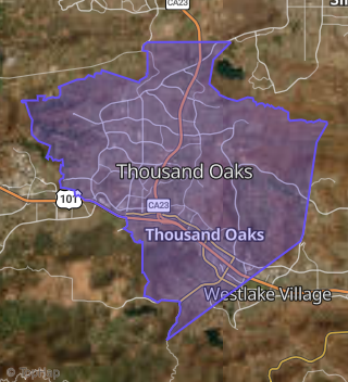
Boundary map of Thousand Oaks.
Crime Index for 91360
83
The crime index in 91360 is 83, which is 0.8 times lower than national average.
Market Trends
Historical market data near 737 Irving Dr over selected time period.
Nearby Properties on Irving Dr
- 930 Irving Dr, Thousand Oaks, CA 91360 (Thousand Oaks) is a 2,931 square foot, 2 bedroom, 1.75 bathroom, 0.4 acre property. It was built in 1950 and has an estimate of $1,252,442 with a price per ft² of $427.
- 507 Irving Dr, Thousand Oaks, CA 91360 (Thousand Oaks) is a 1,269 square foot, 2 bedroom, 2 bathroom, 0.19 acre property. It was built in 1961 and has an estimate of $753,138 with a price per ft² of $593.
- 915 Irving Dr, Thousand Oaks, CA 91360 (Thousand Oaks) is a 1,700 square foot, 4 bedroom, 3 bathroom, 0.08 acre property. It was built in 1985 and has an estimate of $385,900 with a price per ft² of $227.
- View more properties on Irving Dr