486 Robert Rd
Vacaville, CA 95687
- 3Beds
- 2Baths
- 1,430ft²Living Area
- 5,662ft²Lot Size
- -Pool
- 2Car
- 1976Year Built
- -DOM
- 3Permits
Property Valuations
Latest estimates for 486 Robert Rd based on TopHap automated valuation model (AVM).
TopHap Estimate
$566,750
$396/ft²
+$42K above Sold Price
Updated 3 months ago
Last Sold Price
$525,000
$367/ft²
2 years ago
486 Robert Rd is valued at $566,750 by TopHap AVM 3 months ago.
486 Robert Rd was last sold in 2021 for $525,000.
Permits
486 Robert Rd has 3 permit records of total value of $12,000.
Current Ownership
Information about the current owner(s).
Taxes Billed
Taxes billed in 2022$6,174.26From latest Total Assessed Value1.15%Total Assessed Value$535,500=Land+
Assessed Value$132,600Additions
Assessed Value$402,900
In 2022, taxes billed for 486 Robert Rd were $6,174.26, which is 1.15% from latest Total Assessed Value of $535,500.
Property History
486 Robert Rd has undefined property events records (listings, deeds, permits, tax, foreclosure, loan).
Environment
Environmental factors around 486 Robert Rd
Hazard Risks
Earthquake377Nat'l Avg100Particulates89Ozone87Carb Mono83Air Pollution83Lead45Tornado3Wind2Hail1Weather1Hurricane0
11 hazards (Carbon Monoxide, Earthquake Risk, Hail Index, Tornado Index, Air Pollution Index, Ozone Index, Wind Index, Weather Risk, Lead Index, Particulate Matter, National Average) are above the national average around 486 Robert Rd.
Walkability Index
16 /20
Most Walkable
20-18
Very Walkable
17-15
Somewhat Walkable
14-10
Car Dependent
9-0
486 Robert Rd has a walkability score of 16 out of 20, which means that it is in a very walkable area.
Temperature
Seasonal temperature sampled over multiple years
Winter
Average
Low
38°F
High
57°F
Summer
Average
Low
56°F
High
89°F
In the winter at 486 Robert Rd, temperatures range from 38.47°F to 56.9°F with an average of 47.69°F. In the summer, the temperature ranges from 55.71°F to 89.04°F with and average of 72.38°F.
School Information
Public/private schools serving 486 Robert Rd
Public Schools
Nearby public schools serving 486 Robert Rd have ratings undefined, undefined, and undefined.
Neighborhood
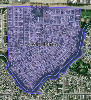
This property is located in Lewis Homes, Vacaville, CA 95687.
Seasonal Housing units 95687
13%of housing is for seasonal rent.
Daytime Population for 95687
-11%of people during work hours.
Boundary map of Lewis Homes.
Crime Index for 95687
71
The crime index in 95687 is 71, which is 0.7 times lower than national average.
Market Trends
Historical market data near 486 Robert Rd over selected time period.
Nearby Properties on Robert Rd
- 429 Robert Rd, Vacaville, CA 95687 (Lewis Homes) is a 1,513 square foot, 3 bedroom, 2 bathroom, 0.15 acre property. It was built in 1976 and has an estimate of $541,679 with a price per ft² of $358.
- 417 Robert Rd, Vacaville, CA 95687 (Lewis Homes) is a 1,470 square foot, 4 bedroom, 2 bathroom, 0.14 acre property. It was built in 1976 and has an estimate of $526,423 with a price per ft² of $358.
- 462 Robert Rd, Vacaville, CA 95687 (Lewis Homes) is a 1,374 square foot, 3 bedroom, 2 bathroom, 0.13 acre property. It was built in 1976 and has an estimate of $543,775 with a price per ft² of $396.
- 438 Robert Rd, Vacaville, CA 95687 (Lewis Homes) is a 1,512 square foot, 4 bedroom, 2 bathroom, 0.13 acre property. It was built in 1976 and has an estimate of $544,666 with a price per ft² of $360.
- 486 Robert Rd, Vacaville, CA 95687 (Lewis Homes) is a 1,430 square foot, 3 bedroom, 2 bathroom, 0.13 acre property. It was built in 1976 and has an estimate of $503,433 with a price per ft² of $352.
- 474 Robert Rd, Vacaville, CA 95687 (Lewis Homes) is a 1,374 square foot, 3 bedroom, 2 bathroom, 0.13 acre property. It was built in 1976 and has an estimate of $551,020 with a price per ft² of $401.
- 423 Robert Rd, Vacaville, CA 95687 (Lewis Homes) is a 1,494 square foot, 3 bedroom, 2 bathroom, 0.16 acre property. It was built in 1976 and has an estimate of $527,800 with a price per ft² of $353.
- 426 Robert Rd, Vacaville, CA 95687 (Lewis Homes) is a 1,512 square foot, 4 bedroom, 2 bathroom, 0.13 acre property. It was built in 1976 and has an estimate of $549,955 with a price per ft² of $364.
- 420 Robert Rd, Vacaville, CA 95687 (Lewis Homes) is a 1,730 square foot, 4 bedroom, 2 bathroom, 0.15 acre property. It was built in 1976 and has an estimate of $533,126 with a price per ft² of $308.
- 411 Robert Rd, Vacaville, CA 95687 (Lewis Homes) is a 1,512 square foot, 4 bedroom, 2 bathroom, 0.16 acre property. It was built in 1976 and has an estimate of $547,498 with a price per ft² of $362.
- 432 Robert Rd, Vacaville, CA 95687 (Lewis Homes) is a 1,374 square foot, 3 bedroom, 2 bathroom, 0.14 acre property. It was built in 1976 and has an estimate of $551,404 with a price per ft² of $401.
- 435 Robert Rd, Vacaville, CA 95687 (Lewis Homes) is a 1,374 square foot, 3 bedroom, 2 bathroom, 0.15 acre property. It was built in 1976 and has an estimate of $542,977 with a price per ft² of $395.
- 414 Robert Rd, Vacaville, CA 95687 (Lewis Homes) is a 1,470 square foot, 4 bedroom, 2 bathroom, 0.16 acre property. It was built in 1976 and has an estimate of $531,522 with a price per ft² of $362.
- 396 Robert Rd, Vacaville, CA 95687 (Lewis Homes) is a 1,470 square foot, 4 bedroom, 2 bathroom, 0.18 acre property. It was built in 1976 and has an estimate of $553,140 with a price per ft² of $376.
- 447 Robert Rd, Vacaville, CA 95687 (Lewis Homes) is a 1,512 square foot, 4 bedroom, 2 bathroom, 0.13 acre property. It was built in 1976 and has an estimate of $552,602 with a price per ft² of $365.
- 405 Robert Rd, Vacaville, CA 95687 (Lewis Homes) is a 1,430 square foot, 3 bedroom, 2 bathroom, 0.15 acre property. It was built in 1976 and has an estimate of $546,063 with a price per ft² of $382.
- 408 Robert Rd, Vacaville, CA 95687 (Lewis Homes) is a 1,512 square foot, 4 bedroom, 2 bathroom, 0.14 acre property. It was built in 1976 and has an estimate of $523,525 with a price per ft² of $346.
- 441 Robert Rd, Vacaville, CA 95687 (Lewis Homes) is a 1,430 square foot, 3 bedroom, 2 bathroom, 0.14 acre property. It was built in 1976 and has an estimate of $538,660 with a price per ft² of $377.
- 455 Robert Rd, Vacaville, CA 95687 (Lewis Homes) is a 1,513 square foot, 3 bedroom, 2 bathroom, 0.17 acre property. It was built in 1976 and has an estimate of $529,814 with a price per ft² of $350.
- 444 Robert Rd, Vacaville, CA 95687 (Lewis Homes) is a 1,430 square foot, 3 bedroom, 2 bathroom, 0.15 acre property. It was built in 1976 and has an estimate of $537,412 with a price per ft² of $376.
- 450 Robert Rd, Vacaville, CA 95687 (Lewis Homes) is a 1,374 square foot, 3 bedroom, 2 bathroom, 0.14 acre property. It was built in 1976 and has an estimate of $534,505 with a price per ft² of $389.
- 461 Robert Rd, Vacaville, CA 95687 (Lewis Homes) is a 1,755 square foot, 3 bedroom, 2 bathroom, 0.15 acre property. It was built in 1976 and has an estimate of $553,730 with a price per ft² of $316.
- 456 Robert Rd, Vacaville, CA 95687 (Lewis Homes) is a 1,912 square foot, 4 bedroom, 2 bathroom, 0.14 acre property. It was built in 1976 and has an estimate of $527,709 with a price per ft² of $276.
- 479 Robert Rd, Vacaville, CA 95687 (Lewis Homes) is a 1,513 square foot, 3 bedroom, 2 bathroom, 0.14 acre property. It was built in 1977 and has an estimate of $538,357 with a price per ft² of $356.
- 485 Robert Rd, Vacaville, CA 95687 (Lewis Homes) is a 1,512 square foot, 4 bedroom, 2 bathroom, 0.15 acre property. It was built in 1976 and has an estimate of $528,461 with a price per ft² of $350.
- View more properties on Robert Rd