1013 Sandstone Dr
Hanford, CA 93230
- 4Beds
- 2Baths
- 1,645ft²Living Area
- 7,886ft²Lot Size
- -Pool
- 2Car
- 2001Year Built
- -DOM
- 1Permit
Property Valuations
Latest estimates for 1013 Sandstone Dr based on TopHap automated valuation model (AVM).
TopHap Estimate
$369,500
$224/ft²
+$231K above Sold Price
Updated 3 months ago
Last Sold Price
$139,000
$85/ft²
22 years ago
1013 Sandstone Dr is valued at $369,500 by TopHap AVM 3 months ago.
1013 Sandstone Dr was last sold in 2001 for $139,000.
Permits
1013 Sandstone Dr has 1 permit records.
Current Ownership
Information about the current owner(s).
Taxes Billed
Taxes billed in 2023$2,248.18From latest Total Assessed Value1.14%Total Assessed Value$197,107=Land+
Assessed Value$42,598Additions
Assessed Value$154,509
In 2023, taxes billed for 1013 Sandstone Dr were $2,248.18, which is 1.14% from latest Total Assessed Value of $197,107.
Property History
1013 Sandstone Dr has undefined property events records (listings, deeds, permits, tax, foreclosure, loan).
Environment
Environmental factors around 1013 Sandstone Dr
Hazard Risks
Earthquake121Particulates119Nat'l Avg100Carb Mono97Air Pollution93Ozone92Lead53Tornado27Weather13Hail0Hurricane0Wind0
9 hazards (Carbon Monoxide, Earthquake Risk, Tornado Index, Air Pollution Index, Ozone Index, Weather Risk, Lead Index, Particulate Matter, National Average) are above the national average around 1013 Sandstone Dr.
Walkability Index
7 /20
Most Walkable
20-18
Very Walkable
17-15
Somewhat Walkable
14-10
Car Dependent
9-0
1013 Sandstone Dr has a walkability score of 7 out of 20, which means that it is in a car dependent area.
Temperature
Seasonal temperature sampled over multiple years
Winter
Average
Low
37°F
High
57°F
Summer
Average
Low
61°F
High
96°F
In the winter at 1013 Sandstone Dr, temperatures range from 36.76°F to 57.29°F with an average of 47.03°F. In the summer, the temperature ranges from 61.35°F to 95.6°F with and average of 78.48°F.
School Information
Public/private schools serving 1013 Sandstone Dr
Public Schools
Nearby public schools serving 1013 Sandstone Dr have ratings undefined, undefined, and undefined.
Neighborhood
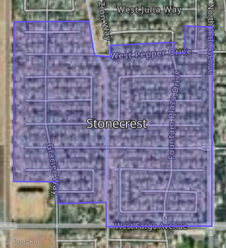
This property is located in Stonecrest, Hanford, CA 93230.
Seasonal Housing units 93230
7%of housing is for seasonal rent.
Daytime Population for 93230
-12%of people during work hours.
Boundary map of Stonecrest.
Crime Index for 93230
109
The crime index in 93230 is 109, which is 1.1 times higher than national average.
Market Trends
Historical market data near 1013 Sandstone Dr over selected time period.
Nearby Properties on Sandstone Dr
- 1087 W Sandstone Dr, Hanford, CA 93230 (Stonecrest) is a 1,800 square foot, 3 bedroom, 2 bathroom, 0.18 acre property. It was built in 2001 and has an estimate of $383,501 with a price per ft² of $213.
- 1014 W Sandstone Dr, Hanford, CA 93230 (Stonecrest) is a 1,645 square foot, 4 bedroom, 2 bathroom, 0.18 acre property. It was built in 2001 and has an estimate of $367,439 with a price per ft² of $223.
- 1049 W Sandstone Dr, Hanford, CA 93230 (Stonecrest) is a 1,512 square foot, 3 bedroom, 2 bathroom, 0.17 acre property. It was built in 2003 and has an estimate of $349,777 with a price per ft² of $231.
- 1150 W Sandstone Dr, Hanford, CA 93230 (Stonecrest) is a 1,812 square foot, 3 bedroom, 2 bathroom, 0.17 acre property. It was built in 2003 and has an estimate of $382,041 with a price per ft² of $211.
- View more properties on Sandstone Dr