118 120 A Porter St 120
San Francisco, CA 94110
- 4Beds
- 3Baths
- 2,620ft²Living Area
- 1,932ft²Lot Size
- -Pool
- -Car
- 1928Year Built
- -DOM
- -Permit
Current Ownership
Information about the current owner(s).
Taxes Billed
Taxes billed in 2023$4,721.48From latest Total Assessed Value1.41%Total Assessed Value$335,874=Land+
Assessed Value$112,576Additions
Assessed Value$223,298
In 2023, taxes billed for 118 120 A Porter St 120 were $4,721.48, which is 1.41% from latest Total Assessed Value of $335,874.
Property History
118 120 A Porter St 120 has undefined property events records (listings, deeds, permits, tax, foreclosure, loan).
Environment
Environmental factors around 118 120 A Porter St 120
Hazard Risks
Earthquake412Carb Mono101Particulates101Nat'l Avg100Air Pollution90Ozone89Lead44Tornado6Weather1Hail0Hurricane0Wind0
9 hazards (Carbon Monoxide, Earthquake Risk, Tornado Index, Air Pollution Index, Ozone Index, Weather Risk, Lead Index, Particulate Matter, National Average) are above the national average around 118 120 A Porter St 120.
Walkability Index
14 /20
Most Walkable
20-18
Very Walkable
17-15
Somewhat Walkable
14-10
Car Dependent
9-0
118 120 A Porter St 120 has a walkability score of 14 out of 20, which means that it is in a somewhat walkable area.
Noise Level
48 dB
Quiet Suburban Residential 0-49
Suburban Residential 50-54
Urban Residential 55-59
Noisy Urban Residential 60-64
Very Noisy Urban Residential 65+
Noise at 118 120 A Porter St 120 is around 48dBs, which is comparable to a Quiet Suburban Residential area.
Temperature
Seasonal temperature sampled over multiple years
Winter
Average
Low
44°F
High
58°F
Summer
Average
Low
54°F
High
69°F
In the winter at 118 120 A Porter St 120, temperatures range from 43.93°F to 57.94°F with an average of 50.94°F. In the summer, the temperature ranges from 53.62°F to 68.52°F with and average of 61.07°F.
School Information
Public/private schools serving 118 120 A Porter St 120
Public Schools
Nearby public schools serving 118 120 A Porter St 120 have ratings undefined, undefined, undefined, undefined, undefined, undefined, undefined, undefined, undefined, undefined, undefined, undefined, undefined, undefined, undefined, and undefined.
Neighborhood
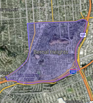
This property is located in Bernal Heights, San Francisco, CA 94110.
Seasonal Housing units 94110
19%of housing is for seasonal rent.
Daytime Population for 94110
+5%of people during work hours.
Boundary map of Bernal Heights.
Crime Index for 94110
96
The crime index in 94110 is 96, which is 1.0 times lower than national average.
Market Trends
Historical market data near 118 120 A Porter St 120 over selected time period.
Nearby Properties on Porter St
- 46 Porter St, San Francisco, CA 94110 (Bernal Heights) is a 1,420 square foot, 2 bedroom, 2 bathroom, 0.03 acre property. It was built in 1900 and has an estimate of $1,047,721 with a price per ft² of $738.
- 13 Porter St, San Francisco, CA 94110 (Bernal Heights) is a 1,332 square foot, 2 bedroom, 2 bathroom, 0.04 acre property. It was built in 1907 and has an estimate of $1,167,467 with a price per ft² of $876.
- 8 Porter St, San Francisco, CA 94110 (Bernal Heights) is a 2,040 square foot, 4 bedroom, 4 bathroom, 0.04 acre property. It was built in 1908 and has an estimate of $1,817,384 with a price per ft² of $909.
- 133 Porter St, San Francisco, CA 94110 (Bernal Heights) is a 1,406 square foot, 3 bedroom, 1 bathroom, 0.04 acre property. It was built in 1908 and has an estimate of $1,001,171 with a price per ft² of $712.
- 19 Porter St, San Francisco, CA 94110 (Bernal Heights) is a 1,275 square foot, 2 bedroom, 1 bathroom, 0.04 acre property. It was built in 1907 and has an estimate of $1,090,168 with a price per ft² of $855.
- 134 Porter St # V, San Francisco, CA 94110 (Bernal Heights) is a 0.04 acre property.
- 6 Porter St, San Francisco, CA 94110 (Bernal Heights) is a 1,435 square foot, 2 bedroom, 1 bathroom, 0.04 acre property. It was built in 1908 and has an estimate of $1,282,706 with a price per ft² of $894.
- 138 Porter St # V, San Francisco, CA 94110 (Bernal Heights) is a 0.04 acre property.
- 141 Porter St, San Francisco, CA 94110 (Bernal Heights) is a 1,746 square foot, 3 bedroom, 2.5 bathroom, 0.04 acre property. It was built in 2004 and has an estimate of $1,393,384 with a price per ft² of $798.
- 142 Porter St # V, San Francisco, CA 94110 (Bernal Heights) is a 0.04 acre property.
- 114 Porter St, San Francisco, CA 94110 (Bernal Heights) is a 1,176 square foot, 3 bedroom, 2 bathroom, 0.04 acre property. It was built in 1928 and has an estimate of $1,043,313 with a price per ft² of $887.
- 101 Porter St, San Francisco, CA 94110 (Bernal Heights) is a 1,025 square foot, 2 bedroom, 1 bathroom, 0.04 acre property. It was built in 1946 and has an estimate of $852,812 with a price per ft² of $832.
- 21 Porter St, San Francisco, CA 94110 (Bernal Heights) is a 851 square foot, 1 bedroom, 1 bathroom, 0.04 acre property. It was built in 1907 and has an estimate of $764,927 with a price per ft² of $899.
- 137-139 Porter St, San Francisco, CA 94110 (Bernal Heights) is a 2,200 square foot, 6 bedroom, 4 bathroom, 0.04 acre property. It was built in 2008 and has an estimate of $1,392,743 with a price per ft² of $633.
- 70 Porter St, San Francisco, CA 94110 (Bernal Heights) is a 1,156 square foot, 2 bedroom, 1 bathroom, 0.05 acre property. It was built in 1908 and has an estimate of $970,820 with a price per ft² of $840.
- 109 Porter St, San Francisco, CA 94110 (Bernal Heights) is a 1,795 square foot, 3 bedroom, 4 bathroom, 0.04 acre property. It was built in 1946 and has an estimate of $1,615,002 with a price per ft² of $939.
- 150 Porter St # V, San Francisco, CA 94110 (Bernal Heights) is a 0.04 acre property.
- 126 Porter St, San Francisco, CA 94110 (Bernal Heights) is a 858 square foot, 2 bedroom, 1 bathroom, 0.08 acre property. It was built in 1949 and has an estimate of $1,047,405 with a price per ft² of $1,221.
- 5 Porter St, San Francisco, CA 94110 (Bernal Heights) is a 1,400 square foot, 1 bathroom, 0.04 acre property. It was built in 1906 and has an estimate of $1,072,186 with a price per ft² of $766.
- 7 Porter St, San Francisco, CA 94110 (Bernal Heights) is a 1,800 square foot, 1 bathroom, 0.04 acre property. It was built in 1906 and has an estimate of $1,409,738 with a price per ft² of $783.
- 52 Porter St, San Francisco, CA 94110 (Bernal Heights) is a 1,100 square foot, 2 bedroom, 1 bathroom, 0.03 acre property. It was built in 1900 and has an estimate of $922,190 with a price per ft² of $1,272.
- 48 Porter St, San Francisco, CA 94110 (Bernal Heights) is a 1,264 square foot, 2 bedroom, 1 bathroom, 0.03 acre property. It was built in 1998 and has an estimate of $1,002,919 with a price per ft² of $793.
- 60 Porter St, San Francisco, CA 94110 (Bernal Heights) is a 1,200 square foot, 2 bedroom, 1 bathroom, 0.04 acre property. It was built in 1925 and has an estimate of $1,151,583 with a price per ft² of $960.
- 131 Porter St, San Francisco, CA 94110 (Bernal Heights) is a 1,218 square foot, 2 bedroom, 1 bathroom, 0.04 acre property. It was built in 1914 and has an estimate of $977,434 with a price per ft² of $802.
- 121 Porter St, San Francisco, CA 94110 (Bernal Heights) is a 1,100 square foot, 1 bathroom, 0.04 acre property. It was built in 1962 and has an estimate of $716,399 with a price per ft² of $651.
- View more properties on Porter St