118 Mohawk Rd
Santa Barbara, CA 93109
- 4Beds
- 2Baths
- 1,776ft²Living Area
- 6,534ft²Lot Size
- -Pool
- -Car
- 1949Year Built
- -DOM
- 4Permits
Property Valuations
Latest estimates for 118 Mohawk Rd based on TopHap automated valuation model (AVM).
TopHap Estimate
$2,590,750
$1,458/ft²
Updated 3 months ago
118 Mohawk Rd is valued at $2,590,750 by TopHap AVM 3 months ago.
Permits
118 Mohawk Rd has 4 permit records.
Current Ownership
Information about the current owner(s).
Taxes Billed
Taxes billed in 2023$4,041.12From latest Total Assessed Value1.05%Total Assessed Value$384,626=Land+
Assessed Value$149,339Additions
Assessed Value$235,287
In 2023, taxes billed for 118 Mohawk Rd were $4,041.12, which is 1.05% from latest Total Assessed Value of $384,626.
Property History
118 Mohawk Rd has undefined property events records (listings, deeds, permits, tax, foreclosure, loan).
Environment
Environmental factors around 118 Mohawk Rd
Hazard Risks
Earthquake413Nat'l Avg100Ozone100Particulates100Lead99Carb Mono95Air Pollution93Tornado8Weather5Hurricane2Wind1Hail0
11 hazards (Carbon Monoxide, Earthquake Risk, Tornado Index, Hurricane Index, Air Pollution Index, Ozone Index, Wind Index, Weather Risk, Lead Index, Particulate Matter, National Average) are above the national average around 118 Mohawk Rd.
Walkability Index
8 /20
Most Walkable
20-18
Very Walkable
17-15
Somewhat Walkable
14-10
Car Dependent
9-0
118 Mohawk Rd has a walkability score of 8 out of 20, which means that it is in a car dependent area.
Noise Level
35 dB
Quiet Suburban Residential 0-49
Suburban Residential 50-54
Urban Residential 55-59
Noisy Urban Residential 60-64
Very Noisy Urban Residential 65+
Noise at 118 Mohawk Rd is around 35dBs, which is comparable to a Quiet Suburban Residential area.
Temperature
Seasonal temperature sampled over multiple years
Winter
Average
Low
43°F
High
65°F
Summer
Average
Low
56°F
High
74°F
In the winter at 118 Mohawk Rd, temperatures range from 43.35°F to 64.7°F with an average of 54.03°F. In the summer, the temperature ranges from 55.85°F to 73.72°F with and average of 64.79°F.
School Information
Public/private schools serving 118 Mohawk Rd
Public Schools
Nearby public schools serving 118 Mohawk Rd have ratings undefined, undefined, and undefined.
Neighborhood
This property is located in Mesa, Santa Barbara, CA 93109.
Seasonal Housing units 93109
46%of housing is for seasonal rent.
Daytime Population for 93109
-1%of people during work hours.
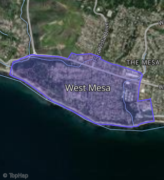
Boundary map of Mesa.
Crime Index for 93109
116
The crime index in 93109 is 116, which is 1.2 times higher than national average.
Market Trends
Historical market data near 118 Mohawk Rd over selected time period.
Nearby Properties on Mohawk Rd
- 205 Mohawk Rd, Santa Barbara, CA 93109 (West Mesa) is a 2,849 square foot, 4 bedroom, 3 bathroom, 0.27 acre property. It was built in 1964 and has an estimate of $2,737,242 with a price per ft² of $961.
- 143 Mohawk Rd, Santa Barbara, CA 93109 (West Mesa) is a 2,299 square foot, 3 bedroom, 2 bathroom, 0.27 acre property. It was built in 1953 and has an estimate of $2,427,644 with a price per ft² of $1,056.
- 137 Mohawk Rd, Santa Barbara, CA 93109 (West Mesa) is a 955 square foot, 2 bedroom, 1 bathroom, 0.27 acre property. It was built in 1951 and has an estimate of $1,826,565 with a price per ft² of $1,913.
- 131 Mohawk Rd, Santa Barbara, CA 93109 (West Mesa) is a 720 square foot, 1 bedroom, 1 bathroom, 0.27 acre property. It was built in 1941 and has an estimate of $1,372,072 with a price per ft² of $1,906.
- 123 Mohawk Rd, Santa Barbara, CA 93109 (West Mesa) is a 1,435 square foot, 3 bedroom, 2 bathroom, 0.14 acre property. It was built in 1956 and has an estimate of $1,798,843 with a price per ft² of $1,254.
- 121 Mohawk Rd, Santa Barbara, CA 93109 (West Mesa) is a 875 square foot, 2 bedroom, 1 bathroom, 0.19 acre property. It was built in 1958 and has an estimate of $1,490,121 with a price per ft² of $1,703.
- 119 Mohawk Rd, Santa Barbara, CA 93109 (West Mesa) is a 2,016 square foot, 3 bedroom, 3.25 bathroom, 0.14 acre property. It was built in 1956 and has an estimate of $2,243,002 with a price per ft² of $1,113.
- 341 Mohawk Rd, Santa Barbara, CA 93109 (West Mesa) is a 1,412 square foot, 3 bedroom, 3.25 bathroom, 0.2 acre property. It was built in 1953 and has an estimate of $1,896,260 with a price per ft² of $1,343.
- 337 Mohawk Rd, Santa Barbara, CA 93109 (West Mesa) is a 1,616 square foot, 3 bedroom, 1.5 bathroom, 0.2 acre property. It was built in 1950 and has an estimate of $1,753,834 with a price per ft² of $1,085.
- 331 Mohawk Rd, Santa Barbara, CA 93109 (West Mesa) is a 1,656 square foot, 3 bedroom, 2 bathroom, 0.2 acre property. It was built in 1954 and has an estimate of $1,986,761 with a price per ft² of $1,200.
- 327 Mohawk Rd, Santa Barbara, CA 93109 (West Mesa) is a 1,408 square foot, 3 bedroom, 2 bathroom, 0.2 acre property. It was built in 1948 and has an estimate of $2,041,200 with a price per ft² of $1,450.
- 362 Mohawk Rd, Santa Barbara, CA 93109 (West Mesa) is a 2,025 square foot, 3 bedroom, 2 bathroom, 0.22 acre property. It was built in 1955 and has an estimate of $2,139,427 with a price per ft² of $1,057.
- 348 Mohawk Rd, Santa Barbara, CA 93109 (West Mesa) is a 876 square foot, 2 bedroom, 1 bathroom, 0.14 acre property. It was built in 1957 and has an estimate of $1,399,214 with a price per ft² of $1,597.
- 354 Mohawk Rd, Santa Barbara, CA 93109 (West Mesa) is a 1,060 square foot, 3 bedroom, 2 bathroom, 0.15 acre property. It was built in 1957 and has an estimate of $1,458,950 with a price per ft² of $1,376.
- 336 Mohawk Rd, Santa Barbara, CA 93109 (West Mesa) is a 1,340 square foot, 3 bedroom, 2 bathroom, 0.23 acre property. It was built in 1974 and has an estimate of $1,884,463 with a price per ft² of $1,406.
- 330 Mohawk Rd, Santa Barbara, CA 93109 (West Mesa) is a 2,709 square foot, 4 bedroom, 4.25 bathroom, 0.18 acre property. It was built in 1949 and has an estimate of $2,618,503 with a price per ft² of $967.
- 353 Mohawk Rd, Santa Barbara, CA 93109 (West Mesa) is a 1,188 square foot, 2 bedroom, 1 bathroom, 0.2 acre property. It was built in 1952 and has an estimate of $1,673,638 with a price per ft² of $1,409.
- 347 Mohawk Rd, Santa Barbara, CA 93109 (West Mesa) is a 1,365 square foot, 3 bedroom, 1 bathroom, 0.2 acre property. It was built in 1925 and has an estimate of $1,827,470 with a price per ft² of $1,339.
- View more properties on Mohawk Rd