1228 Manitou Rd
Santa Barbara, CA 93101
- 3Beds
- 2Baths
- 2,127ft²Living Area
- 0.3acLot Size
- -Pool
- -Car
- 1980Year Built
- -DOM
- 5Permits
Property Valuations
Latest estimates for 1228 Manitou Rd based on TopHap automated valuation model (AVM).
TopHap Estimate
$2,590,000
$1,217/ft²
Updated 3 months ago
1228 Manitou Rd is valued at $2,590,000 by TopHap AVM 3 months ago.
Permits
1228 Manitou Rd has 5 permit records.
Current Ownership
Information about the current owner(s).
Taxes Billed
Taxes billed in 2023$13,711.24From latest Total Assessed Value1.06%Total Assessed Value$1,298,242=Land+
Assessed Value$819,946Additions
Assessed Value$478,296
In 2023, taxes billed for 1228 Manitou Rd were $13,711.24, which is 1.06% from latest Total Assessed Value of $1,298,242.
Property History
1228 Manitou Rd has undefined property events records (listings, deeds, permits, tax, foreclosure, loan).
Environment
Environmental factors around 1228 Manitou Rd
Hazard Risks
Earthquake451Particulates101Nat'l Avg100Ozone100Lead98Carb Mono95Air Pollution94Tornado8Weather4Hurricane2Wind1Hail0
11 hazards (Carbon Monoxide, Earthquake Risk, Tornado Index, Hurricane Index, Air Pollution Index, Ozone Index, Wind Index, Weather Risk, Lead Index, Particulate Matter, National Average) are above the national average around 1228 Manitou Rd.
Walkability Index
6 /20
Most Walkable
20-18
Very Walkable
17-15
Somewhat Walkable
14-10
Car Dependent
9-0
1228 Manitou Rd has a walkability score of 6 out of 20, which means that it is in a car dependent area.
Noise Level
40 dB
Quiet Suburban Residential 0-49
Suburban Residential 50-54
Urban Residential 55-59
Noisy Urban Residential 60-64
Very Noisy Urban Residential 65+
Noise at 1228 Manitou Rd is around 40dBs, which is comparable to a Quiet Suburban Residential area.
Temperature
Seasonal temperature sampled over multiple years
Winter
Average
Low
43°F
High
65°F
Summer
Average
Low
56°F
High
74°F
In the winter at 1228 Manitou Rd, temperatures range from 43.29°F to 64.77°F with an average of 54.03°F. In the summer, the temperature ranges from 55.64°F to 73.59°F with and average of 64.62°F.
School Information
Public/private schools serving 1228 Manitou Rd
Public Schools
Nearby public schools serving 1228 Manitou Rd have ratings undefined, undefined, and undefined.
Neighborhood
This property is located in Bel Air, Santa Barbara, CA 93101.
Seasonal Housing units 93101
22%of housing is for seasonal rent.
Daytime Population for 93101
+36%of people during work hours.
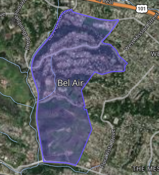
Boundary map of Bel Air.
Crime Index for 93101
135
The crime index in 93101 is 135, which is 1.4 times higher than national average.
Market Trends
Historical market data near 1228 Manitou Rd over selected time period.
Nearby Properties on Manitou Rd
- 1315 Manitou Rd, Santa Barbara, CA 93101 (West Side) is a 1,378 square foot, 3 bedroom, 2 bathroom, 0.16 acre property. It was built in 1962 and has an estimate of $1,464,810 with a price per ft² of $1,063.
- 1132 Manitou Rd, Santa Barbara, CA 93101 (Bel Air) is a 2,510 square foot, 3 bedroom, 3.25 bathroom, 0.34 acre property. It was built in 1979 and has an estimate of $2,418,648 with a price per ft² of $964.
- 1220 Manitou Rd, Santa Barbara, CA 93101 (Bel Air) is a 2,105 square foot, 3 bedroom, 2 bathroom, 0.41 acre property. It was built in 1980 and has an estimate of $2,111,613 with a price per ft² of $1,003.
- 1304 Manitou Rd, Santa Barbara, CA 93101 (Bel Air) is a 2,082 square foot, 3 bedroom, 2 bathroom, 0.54 acre property. It was built in 1980 and has an estimate of $2,006,332 with a price per ft² of $964.
- 1328 Manitou Rd, Santa Barbara, CA 93101 (Bel Air) is a 2,205 square foot, 3 bedroom, 3.25 bathroom, 0.38 acre property. It was built in 1979 and has an estimate of $2,386,424 with a price per ft² of $1,082.
- 1100 Manitou Rd, Santa Barbara, CA 93101 (Bel Air) is a 1,552 square foot, 4 bedroom, 2 bathroom, 0.14 acre property. It was built in 1959 and has an estimate of $1,508,658 with a price per ft² of $972.
- 1106 Manitou Rd, Santa Barbara, CA 93101 (Bel Air) is a 1,099 square foot, 2 bedroom, 1 bathroom, 0.15 acre property. It was built in 1958 and has an estimate of $1,429,623 with a price per ft² of $1,301.
- 1112 Manitou Rd, Santa Barbara, CA 93101 (Bel Air) is a 2,092 square foot, 3 bedroom, 2 bathroom, 0.35 acre property. It was built in 1980 and has an estimate of $2,181,613 with a price per ft² of $1,043.
- 1118 Manitou Rd, Santa Barbara, CA 93101 (Bel Air) is a 2,118 square foot, 3 bedroom, 2 bathroom, 0.34 acre property. It was built in 1974 and has an estimate of $2,209,830 with a price per ft² of $1,043.
- 1124 Manitou Rd, Santa Barbara, CA 93101 (Bel Air) is a 2,792 square foot, 3 bedroom, 3 bathroom, 0.35 acre property. It was built in 1979 and has an estimate of $1,920,792 with a price per ft² of $688.
- 1057 Manitou Rd, Santa Barbara, CA 93101 (West Side) is a 720 square foot, 2 bedroom, 1 bathroom, 0.17 acre property. It was built in 1948 and has an estimate of $1,196,919 with a price per ft² of $1,662.
- 1237 Manitou Rd, Santa Barbara, CA 93101 (West Side) is a 944 square foot, 2 bedroom, 1 bathroom, 0.12 acre property. It was built in 1952 and has an estimate of $1,361,061 with a price per ft² of $1,442.
- 1229 Manitou Rd, Santa Barbara, CA 93101 (West Side) is a 1,625 square foot, 4 bedroom, 3.25 bathroom, 0.16 acre property. It was built in 1958 and has an estimate of $1,541,824 with a price per ft² of $949.
- 1101 Manitou Rd, Santa Barbara, CA 93101 (West Side) is a 1,439 square foot, 3 bedroom, 3.25 bathroom, 0.28 acre property. It was built in 1947 and has an estimate of $1,563,568 with a price per ft² of $1,087.
- 1241 Manitou Rd, Santa Barbara, CA 93101 (West Side) is a 1,312 square foot, 3 bedroom, 3.25 bathroom, 0.21 acre property. It was built in 1963 and has an estimate of $1,638,650 with a price per ft² of $1,249.
- 1121 Manitou Rd, Santa Barbara, CA 93101 (West Side) is a 1,386 square foot, 2 bedroom, 1 bathroom, 0.15 acre property. It was built in 1946 and has an estimate of $1,357,850 with a price per ft² of $980.
- 1508 Manitou Rd, Santa Barbara, CA 93105 (Bel Air) is a 2,235 square foot, 3 bedroom, 2.5 bathroom, 0.53 acre property. It was built in 1978 and has an estimate of $2,309,818 with a price per ft² of $1,033.
- 1502 Manitou Rd, Santa Barbara, CA 93105 (Bel Air) is a 2,700 square foot, 4 bedroom, 3 bathroom, 0.44 acre property. It was built in 1977 and has an estimate of $2,645,487 with a price per ft² of $980.
- 1507 Manitou Rd, Santa Barbara, CA 93105 (Bel Air) is a 2,283 square foot, 4 bedroom, 3.25 bathroom, 0.55 acre property. It was built in 1979 and has an estimate of $2,467,602 with a price per ft² of $1,081.
- 1527 Manitou Rd, Santa Barbara, CA 93105 (Bel Air) is a 2,426 square foot, 3 bedroom, 2 bathroom, 0.36 acre property. It was built in 1978 and has an estimate of $2,115,995 with a price per ft² of $872.
- 1533 Manitou Rd, Santa Barbara, CA 93105 (Bel Air) is a 2,035 square foot, 4 bedroom, 2.5 bathroom, 0.49 acre property. It was built in 1978 and has an estimate of $2,343,680 with a price per ft² of $1,152.
- 1549 Manitou Rd, Santa Barbara, CA 93105 (Bel Air) is a 1,812 square foot, 3 bedroom, 2.5 bathroom, 0.66 acre property. It was built in 1978 and has an estimate of $2,330,521 with a price per ft² of $1,286.
- 1553 Manitou Rd, Santa Barbara, CA 93105 (Bel Air) is a 2,437 square foot, 3 bedroom, 3.25 bathroom, 0.67 acre property. It was built in 1978 and has an estimate of $2,591,545 with a price per ft² of $1,063.
- View more properties on Manitou Rd