132 Pearl St
Santa Cruz, CA 95060
- 3Beds
- 1Bath
- 1,174ft²Living Area
- 3,703ft²Lot Size
- -Pool
- 2Car
- 1948Year Built
- -DOM
- 2Permits
Property Valuations
Latest estimates for 132 Pearl St based on TopHap automated valuation model (AVM).
TopHap Estimate
$1,052,500
$896/ft²
+$328K above Sold Price
Updated 3 months ago
Last Sold Price
$725,000
$618/ft²
4 years ago
132 Pearl St is valued at $1,052,500 by TopHap AVM 3 months ago.
132 Pearl St was last sold in 2019 for $725,000.
Permits
132 Pearl St has 2 permit records.
Current Ownership
Information about the current owner(s).
Taxes Billed
Taxes billed in 2023$8,797.98From latest Total Assessed Value1.15%Total Assessed Value$762,104=Land+
Assessed Value$604,428Additions
Assessed Value$157,676
In 2023, taxes billed for 132 Pearl St were $8,797.98, which is 1.15% from latest Total Assessed Value of $762,104.
Property History
132 Pearl St has undefined property events records (listings, deeds, permits, tax, foreclosure, loan).
Environment
Environmental factors around 132 Pearl St
Hazard Risks
Earthquake359Nat'l Avg100Particulates98Air Pollution80Ozone78Carb Mono61Lead43Tornado6Weather1Hail0Hurricane0Wind0
9 hazards (Carbon Monoxide, Earthquake Risk, Tornado Index, Air Pollution Index, Ozone Index, Weather Risk, Lead Index, Particulate Matter, National Average) are above the national average around 132 Pearl St.
Walkability Index
16 /20
Most Walkable
20-18
Very Walkable
17-15
Somewhat Walkable
14-10
Car Dependent
9-0
132 Pearl St has a walkability score of 16 out of 20, which means that it is in a very walkable area.
Noise Level
38 dB
Quiet Suburban Residential 0-49
Suburban Residential 50-54
Urban Residential 55-59
Noisy Urban Residential 60-64
Very Noisy Urban Residential 65+
Noise at 132 Pearl St is around 38dBs, which is comparable to a Quiet Suburban Residential area.
Temperature
Seasonal temperature sampled over multiple years
Winter
Average
Low
41°F
High
60°F
Summer
Average
Low
52°F
High
75°F
In the winter at 132 Pearl St, temperatures range from 41.25°F to 59.72°F with an average of 50.49°F. In the summer, the temperature ranges from 52.28°F to 75.09°F with and average of 63.69°F.
School Information
Public/private schools serving 132 Pearl St
Public Schools
Nearby public schools serving 132 Pearl St have ratings undefined, undefined, and undefined.
Neighborhood
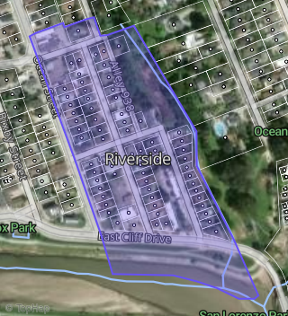
This property is located in Lower Ocean, Santa Cruz, CA 95060.
Seasonal Housing units 95060
28%of housing is for seasonal rent.
Daytime Population for 95060
+12%of people during work hours.
Boundary map of Lower Ocean.
Crime Index for 95060
121
The crime index in 95060 is 121, which is 1.2 times higher than national average.
Market Trends
Historical market data near 132 Pearl St over selected time period.
Nearby Properties on Pearl St
- 123 Pearl St #Apt 1, Santa Cruz, CA 95060 (Riverside) is a 5,152 square foot, 9 bedroom, 0.2 acre property. It was built in 1959 and has an estimate of $2,321,106 with a price per ft² of $451.
- 210 Pearl St, Santa Cruz, CA 95060 (Riverside) is a 2,832 square foot, 6 bedroom, 4 bathroom, 0.07 acre property. It was built in 1962 and has an estimate of $1,585,124 with a price per ft² of $560.
- 127 Pearl St, Santa Cruz, CA 95060 (Riverside) is a 2,587 square foot, 6 bedroom, 3 bathroom, 0.08 acre property. It was built in 1962 and has an estimate of $1,574,381 with a price per ft² of $609.
- 224 Pearl St, Santa Cruz, CA 95060 (Riverside) is a 1,536 square foot, 3 bedroom, 3 bathroom, 0.15 acre property. It was built in 1952 and has an estimate of $1,321,806 with a price per ft² of $861.
- 214 Pearl St, Santa Cruz, CA 95060 (Riverside) is a 0.07 acre property.
- View more properties on Pearl St