143 Merriam Ave
Newton, NJ 07860
- -Bed
- -Bath
- 2,096ft²Living Area
- 0.3acLot Size
- -Pool
- -Car
- 1996Year Built
- -DOM
- 2Permits
Property Valuations
Latest estimates for 143 Merriam Ave based on TopHap automated valuation model (AVM).
TopHap Estimate
$456,700
$217/ft²
+$120K above Sold Price
Updated 3 months ago
Last Sold Price
$336,995
$161/ft²
15 years ago
143 Merriam Ave is valued at $456,700 by TopHap AVM 3 months ago.
143 Merriam Ave was last sold in 2008 for $336,995.
Permits
143 Merriam Ave has 2 permit records of total value of $3,985.
Current Ownership
Information about the current owner(s).
Taxes Billed
Taxes billed in 2021$10,416.95From latest Total Assessed Value4.49%Total Assessed Value$231,900=Land+
Assessed Value$62,900Additions
Assessed Value$169,000
In 2021, taxes billed for 143 Merriam Ave were $10,416.95, which is 4.49% from latest Total Assessed Value of $231,900.
Property History
143 Merriam Ave has undefined property events records (listings, deeds, permits, tax, foreclosure, loan).
Environment
Environmental factors around 143 Merriam Ave
Hazard Risks
Carb Mono110Nat'l Avg100Ozone93Air Pollution89Particulates85Hurricane84Earthquake82Lead78Wind75Weather65Hail58Tornado36
12 hazards (Carbon Monoxide, Earthquake Risk, Hail Index, Tornado Index, Hurricane Index, Air Pollution Index, Ozone Index, Wind Index, Weather Risk, Lead Index, Particulate Matter, National Average) are above the national average around 143 Merriam Ave.
Walkability Index
7 /20
Most Walkable
20-18
Very Walkable
17-15
Somewhat Walkable
14-10
Car Dependent
9-0
143 Merriam Ave has a walkability score of 7 out of 20, which means that it is in a car dependent area.
Temperature
Seasonal temperature sampled over multiple years
Winter
Average
Low
18°F
High
37°F
Summer
Average
Low
57°F
High
81°F
In the winter at 143 Merriam Ave, temperatures range from 18.33°F to 36.59°F with an average of 27.46°F. In the summer, the temperature ranges from 56.95°F to 80.76°F with and average of 68.86°F.
School Information
Public/private schools serving 143 Merriam Ave
Public Schools
Nearby public schools serving 143 Merriam Ave have ratings undefined, undefined, and undefined.
Neighborhood
This property is located in Newton.
Seasonal Housing units 07860
37%of housing is for seasonal rent.
Daytime Population for 07860
-6%of people during work hours.
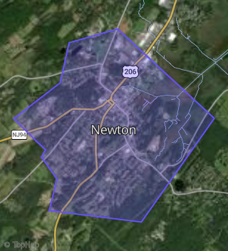
Boundary map of Newton.
Crime Index for 07860
108
The crime index in 07860 is 108, which is 1.1 times higher than national average.
Market Trends
Historical market data near 143 Merriam Ave over selected time period.
Nearby Properties on Merriam Ave
- 135 Merriam Ave, Newton, NJ 07860 is a 2,410 square foot and 0.33 acre property. It was built in 1994 and has an estimate of $470,092 with a price per ft² of $195.
- 100-104 Merriam Ave, Newton, NJ 07860 is a 2,000 square foot and 0.45 acre property. It was built in 1954 and has an estimate of $412,600 with a price per ft² of $206.
- 62 Merriam Ave, Newton, NJ 07860 is a 1,152 square foot and 0.25 acre property. It was built in 1986 and has an estimate of $382,692 with a price per ft² of $332.
- 60 Merriam Ave, Newton, NJ 07860 is a 1,152 square foot and 0.26 acre property. It was built in 1986 and has an estimate of $283,152 with a price per ft² of $246.
- 81 Merriam Ave, Newton, NJ 07860 is a 8.54 acre property.
- 36 Merriam Ave, Newton, NJ 07860 is a 1,326 square foot and 0.51 acre property. It was built in 1900 and has an estimate of $348,995 with a price per ft² of $263.
- 39 Merriam Ave, Newton, NJ 07860 is a 763 square foot and 0.34 acre property. It was built in 1910 and has an estimate of $238,548 with a price per ft² of $313.
- 94 Merriam Ave, Newton, NJ 07860 is a 1,050 square foot and 0.17 acre property. It was built in 1950 and has an estimate of $214,000 with a price per ft² of $204.
- 35 Merriam Ave, Newton, NJ 07860 is a 2,182 square foot and 0.26 acre property. It was built in 1940 and has an estimate of $346,503 with a price per ft² of $159.
- 77 Merriam Ave, Newton, NJ 07860 is a 0.17 acre property.
- 136 Merriam Ave, Newton, NJ 07860 is a 1,848 square foot and 0.35 acre property. It was built in 1988 and has an estimate of $385,561 with a price per ft² of $209.
- 23 Merriam Ave, Newton, NJ 07860 is a 2,392 square foot and 0.17 acre property. It was built in 1920 and has an estimate of $348,819 with a price per ft² of $146.
- 142 Merriam Ave, Newton, NJ 07860 is a 2,492 square foot and 0.35 acre property. It was built in 1989 and has an estimate of $475,000 with a price per ft² of $191.
- 149 Merriam Ave, Newton, NJ 07860 is a 2,156 square foot and 0.43 acre property. It was built in 1989 and has an estimate of $411,316 with a price per ft² of $191.
- 45 Merriam Ave, Newton, NJ 07860 is a 1,500 square foot and 0.34 acre property. It was built in 2011 and has an estimate of $390,333 with a price per ft² of $260.
- View more properties on Merriam Ave