149 San Antonio Rd
Santa Barbara, CA 93110
- -Bed
- -Bath
- -Living Area
- 8.5acLot Size
- -Pool
- -Car
- -Year Built
- -DOM
- 3Permits
Permits
149 San Antonio Rd has 3 permit records of total value of $5,000.
Current Ownership
Information about the current owner(s).
Property History
149 San Antonio Rd has undefined property events records (listings, deeds, permits, tax, foreclosure, loan).
Environment
Environmental factors around 149 San Antonio Rd
Hazard Risks
Earthquake450Lead101Particulates101Nat'l Avg100Ozone98Air Pollution96Carb Mono85Tornado5Weather3Hurricane2Wind1Hail0
11 hazards (Carbon Monoxide, Earthquake Risk, Tornado Index, Hurricane Index, Air Pollution Index, Ozone Index, Wind Index, Weather Risk, Lead Index, Particulate Matter, National Average) are above the national average around 149 San Antonio Rd.
Walkability Index
11 /20
Most Walkable
20-18
Very Walkable
17-15
Somewhat Walkable
14-10
Car Dependent
9-0
149 San Antonio Rd has a walkability score of 11 out of 20, which means that it is in a somewhat walkable area.
Temperature
Seasonal temperature sampled over multiple years
Winter
Average
Low
39°F
High
58°F
Summer
Average
Low
55°F
High
81°F
In the winter at 149 San Antonio Rd, temperatures range from 39.08°F to 58.42°F with an average of 48.75°F. In the summer, the temperature ranges from 54.73°F to 80.82°F with and average of 67.78°F.
School Information
Public/private schools serving 149 San Antonio Rd
Public Schools
Nearby public schools serving 149 San Antonio Rd have ratings undefined, undefined, and undefined.
Neighborhood
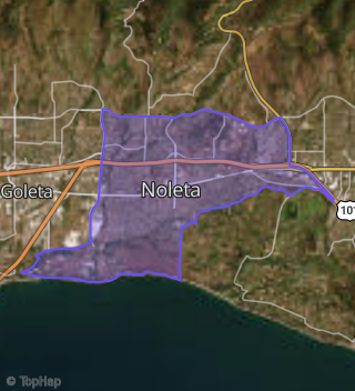
This property is located in Noleta, Santa Barbara, CA 93110.
Seasonal Housing units 93110
32%of housing is for seasonal rent.
Daytime Population for 93110
+1%of people during work hours.
Boundary map of Noleta.
Crime Index for 93110
104
The crime index in 93110 is 104, which is 1.0 times higher than national average.
Market Trends
Historical market data near 149 San Antonio Rd over selected time period.
Nearby Properties on San Antonio Rd
- 111 S San Antonio Rd, Santa Barbara, CA 93110 (Noleta) is a 1,224 square foot, 3 bedroom, 2 bathroom, 0.16 acre property. It was built in 1961 and has an estimate of $1,252,639 with a price per ft² of $1,023.
- 155 S San Antonio Rd, Santa Barbara, CA 93110 (Noleta) is a 1,846 square foot, 4 bedroom, 2 bathroom, 0.15 acre property. It was built in 1960 and has an estimate of $1,328,120 with a price per ft² of $719.
- 147 S San Antonio Rd, Santa Barbara, CA 93110 (Noleta) is a 1,402 square foot, 4 bedroom, 2 bathroom, 0.15 acre property. It was built in 1961 and has an estimate of $1,297,718 with a price per ft² of $926.
- 137 S San Antonio Rd, Santa Barbara, CA 93110 (Noleta) is a 1,686 square foot, 3 bedroom, 2 bathroom, 0.15 acre property. It was built in 1961 and has an estimate of $1,308,918 with a price per ft² of $776.
- 61 S San Antonio Rd, Santa Barbara, CA 93110 (Noleta) is a 618 square foot, 1 bedroom, 1 bathroom, 0.19 acre property. It was built in 1925 and has an estimate of $1,649,507 with a price per ft² of $2,669.
- 65 S San Antonio Rd, Santa Barbara, CA 93110 (Noleta) is a 1,303 square foot, 2 bedroom, 1 bathroom, 0.29 acre property. It was built in 1952 and has an estimate of $1,299,396 with a price per ft² of $997.
- 119 S San Antonio Rd, Santa Barbara, CA 93110 (Noleta) is a 1,846 square foot, 4 bedroom, 3 bathroom, 0.15 acre property. It was built in 1960 and has an estimate of $1,398,667 with a price per ft² of $758.
- 129 S San Antonio Rd, Santa Barbara, CA 93110 (Noleta) is a 1,402 square foot, 4 bedroom, 2 bathroom, 0.15 acre property. It was built in 1961 and has an estimate of $1,289,495 with a price per ft² of $920.
- 44 S San Antonio Rd, Santa Barbara, CA 93110 (Noleta) is a 2.5 acre property.
- 149 N San Antonio Rd, Santa Barbara, CA 93110 (Noleta) is a 8.5 acre property.
- 260 N San Antonio Rd, Santa Barbara, CA 93110 (Noleta) is a 61.86 acre property.
- 44 S San Antonio Rd, Santa Barbara, CA 93110 (Noleta) is a 5.34 acre property.
- 66 S San Antonio Rd, Santa Barbara, CA 93110 (Noleta) is a 0.28 acre property.
- 44 S San Antonio Rd, Santa Barbara, CA 93110 (Noleta) is a 8.15 acre property.
- 44 S San Antonio Rd, Santa Barbara, CA 93110 (Noleta) is a 1 acre property.
- 44 S San Antonio Rd, Santa Barbara, CA 93110 (Noleta) is a 1 acre property.