2033 Fairmont Dr
Hanford, CA 93230
- 3Beds
- 2Baths
- 1,345ft²Living Area
- 9,600ft²Lot Size
- -Pool
- 2Car
- 1961Year Built
- -DOM
- 1Permit
Property Valuations
Latest estimates for 2033 Fairmont Dr based on TopHap automated valuation model (AVM).
TopHap Estimate
$333,000
$247/ft²
+$217K above Sold Price
Updated 3 months ago
Last Sold Price
$116,000
$86/ft²
11 years ago
2033 Fairmont Dr is valued at $333,000 by TopHap AVM 3 months ago.
2033 Fairmont Dr was last sold in 2013 for $116,000.
Permits
2033 Fairmont Dr has 1 permit records.
Current Ownership
Information about the current owner(s).
Taxes Billed
Taxes billed in 2023$1,482.48From latest Total Assessed Value1.08%Total Assessed Value$137,178=Land+
Assessed Value$59,179Additions
Assessed Value$77,999
In 2023, taxes billed for 2033 Fairmont Dr were $1,482.48, which is 1.08% from latest Total Assessed Value of $137,178.
Property History
2033 Fairmont Dr has undefined property events records (listings, deeds, permits, tax, foreclosure, loan).
Environment
Environmental factors around 2033 Fairmont Dr
Hazard Risks
Earthquake121Particulates119Nat'l Avg100Carb Mono97Air Pollution93Ozone92Lead53Tornado27Weather13Hail0Hurricane0Wind0
9 hazards (Carbon Monoxide, Earthquake Risk, Tornado Index, Air Pollution Index, Ozone Index, Weather Risk, Lead Index, Particulate Matter, National Average) are above the national average around 2033 Fairmont Dr.
Walkability Index
15 /20
Most Walkable
20-18
Very Walkable
17-15
Somewhat Walkable
14-10
Car Dependent
9-0
2033 Fairmont Dr has a walkability score of 15 out of 20, which means that it is in a very walkable area.
Temperature
Seasonal temperature sampled over multiple years
Winter
Average
Low
37°F
High
57°F
Summer
Average
Low
61°F
High
96°F
In the winter at 2033 Fairmont Dr, temperatures range from 36.76°F to 57.29°F with an average of 47.03°F. In the summer, the temperature ranges from 61.35°F to 95.6°F with and average of 78.48°F.
School Information
Public/private schools serving 2033 Fairmont Dr
Public Schools
Nearby public schools serving 2033 Fairmont Dr have ratings undefined, undefined, and undefined.
Neighborhood
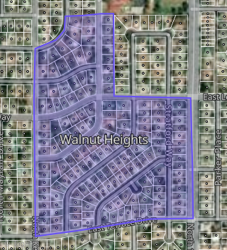
This property is located in Walnut Heights, Hanford, CA 93230.
Seasonal Housing units 93230
7%of housing is for seasonal rent.
Daytime Population for 93230
-12%of people during work hours.
Boundary map of Walnut Heights.
Crime Index for 93230
109
The crime index in 93230 is 109, which is 1.1 times higher than national average.
Market Trends
Historical market data near 2033 Fairmont Dr over selected time period.
Nearby Properties on Fairmont Dr
- 2012 Fairmont Dr, Hanford, CA 93230 (Walnut Heights) is a 1,356 square foot, 3 bedroom, 2 bathroom, 0.19 acre property. It was built in 1961 and has an estimate of $292,751 with a price per ft² of $216.
- 2036 Fairmont Dr, Hanford, CA 93230 (Walnut Heights) is a 1,378 square foot, 3 bedroom, 2 bathroom, 0.17 acre property. It was built in 1963 and has an estimate of $277,315 with a price per ft² of $201.
- 2013 Fairmont Dr, Hanford, CA 93230 (Walnut Heights) is a 1,140 square foot, 2 bedroom, 2 bathroom, 0.16 acre property. It was built in 1964 and has an estimate of $265,820 with a price per ft² of $233.
- 2017 Fairmont Dr, Hanford, CA 93230 (Walnut Heights) is a 1,345 square foot, 3 bedroom, 2 bathroom, 0.16 acre property. It was built in 1966 and has an estimate of $302,018 with a price per ft² of $225.
- 2021 Fairmont Dr, Hanford, CA 93230 (Walnut Heights) is a 1,345 square foot, 3 bedroom, 2 bathroom, 0.16 acre property. It was built in 1962 and has an estimate of $292,984 with a price per ft² of $218.
- 3027 Fairmont Dr, Hanford, CA 93230 (Gateway Estates) is a 1,543 square foot, 4 bedroom, 2 bathroom, 0.18 acre property. It was built in 1995 and has an estimate of $357,188 with a price per ft² of $231.
- 3063 Fairmont Dr, Hanford, CA 93230 (Gateway Estates) is a 1,541 square foot, 3 bedroom, 2 bathroom, 0.19 acre property. It was built in 1995 and has an estimate of $352,059 with a price per ft² of $228.
- 2787 Fairmont Dr, Hanford, CA 93230 (Northgate Estates) is a 1,919 square foot, 3 bedroom, 2 bathroom, 0.19 acre property. It was built in 1991 and has an estimate of $376,106 with a price per ft² of $196.
- 2773 Fairmont Dr, Hanford, CA 93230 (Northgate Estates) is a 1,716 square foot, 3 bedroom, 2 bathroom, 0.21 acre property. It was built in 1991 and has an estimate of $373,478 with a price per ft² of $218.
- 2759 Fairmont Dr, Hanford, CA 93230 (Northgate Estates) is a 1,804 square foot, 3 bedroom, 2 bathroom, 0.18 acre property. It was built in 1991 and has an estimate of $361,490 with a price per ft² of $200.
- 2574 Fairmont Dr, Hanford, CA 93230 (Harvest View Estates) is a 2,092 square foot, 3 bedroom, 2 bathroom, 0.22 acre property. It was built in 1991 and has an estimate of $424,884 with a price per ft² of $203.
- 2589 Fairmont Dr, Hanford, CA 93230 (Harvest View Estates) is a 2,378 square foot, 3 bedroom, 3 bathroom, 0.29 acre property. It was built in 1992 and has an estimate of $513,730 with a price per ft² of $216.
- 2234 Fairmont Dr, Hanford, CA 93230 (Kings Manor) is a 1,646 square foot, 4 bedroom, 2 bathroom, 0.16 acre property. It was built in 1964 and has an estimate of $249,395 with a price per ft² of $152.
- 3003 Fairmont Dr, Hanford, CA 93230 (Gateway Estates) is a 1,145 square foot, 3 bedroom, 2 bathroom, 0.19 acre property. It was built in 1995 and has an estimate of $274,407 with a price per ft² of $240.
- 2896 Fairmont Dr, Hanford, CA 93230 (Morningside Estates) is a 2,328 square foot, 3 bedroom, 3 bathroom, 0.23 acre property. It was built in 1994 and has an estimate of $495,670 with a price per ft² of $213.
- 2808 Fairmont Dr, Hanford, CA 93230 (Morningside Estates) is a 2,342 square foot, 3 bedroom, 2 bathroom, 0.19 acre property. It was built in 1992 and has an estimate of $390,850 with a price per ft² of $167.
- View more properties on Fairmont Dr