213 Birchwood Rd 50 213
Medford, NY 11763
- 1Bed
- 1Bath
- 1,008ft²Living Area
- -Lot Size
- -Pool
- -Car
- 1973Year Built
- -DOM
- -Permit
Property Valuations
Latest estimates for 213 Birchwood Rd 50 213 based on TopHap automated valuation model (AVM).
TopHap Estimate
$332,500
$329/ft²
+$119K above Sold Price
Updated 3 months ago
Last Sold Price
$214,000
$212/ft²
20 years ago
213 Birchwood Rd 50 213 is valued at $332,500 by TopHap AVM 3 months ago.
213 Birchwood Rd 50 213 was last sold in 2003 for $214,000.
Current Ownership
Information about the current owner(s).
Taxes Billed
Total Assessed Value$1,010=Land+
Assessed Value$300Additions
Assessed Value$710
In 2022, taxes billed for 213 Birchwood Rd 50 213 were $0, which is 0.00% from latest Total Assessed Value of $1,010.
Property History
213 Birchwood Rd 50 213 has undefined property events records (listings, deeds, permits, tax, foreclosure, loan).
Environment
Environmental factors around 213 Birchwood Rd 50 213
Hazard Risks
Hurricane141Lead115Air Pollution105Ozone103Nat'l Avg100Carb Mono97Weather81Particulates80Earthquake58Wind52Hail32Tornado14
12 hazards (Carbon Monoxide, Earthquake Risk, Hail Index, Tornado Index, Hurricane Index, Air Pollution Index, Ozone Index, Wind Index, Weather Risk, Lead Index, Particulate Matter, National Average) are above the national average around 213 Birchwood Rd 50 213.
Walkability Index
9 /20
Most Walkable
20-18
Very Walkable
17-15
Somewhat Walkable
14-10
Car Dependent
9-0
213 Birchwood Rd 50 213 has a walkability score of 9 out of 20, which means that it is in a car dependent area.
Temperature
Seasonal temperature sampled over multiple years
Winter
Average
Low
25°F
High
40°F
Summer
Average
Low
62°F
High
80°F
In the winter at 213 Birchwood Rd 50 213, temperatures range from 24.93°F to 40.19°F with an average of 32.56°F. In the summer, the temperature ranges from 62.35°F to 80°F with and average of 71.18°F.
School Information
Public/private schools serving 213 Birchwood Rd 50 213
Public Schools
Nearby public schools serving 213 Birchwood Rd 50 213 have ratings undefined, undefined, and undefined.
Neighborhood
This property is located in Medford, Medford, NY 11763.
Seasonal Housing units 11763
11%of housing is for seasonal rent.
Daytime Population for 11763
-12%of people during work hours.
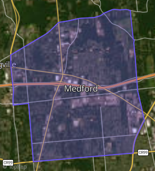
Boundary map of Medford.
Crime Index for 11763
91
The crime index in 11763 is 91, which is 0.9 times lower than national average.
Market Trends
Historical market data near 213 Birchwood Rd 50 213 over selected time period.
Nearby Properties on Birchwood Rd
- 126 Birchwood Rd # 29-126, Medford, NY 11763 (Medford) is a 808 square foot, 1 bedroom, 1 bathroom, 0.02 acre property. It was built in 1973 and has an estimate of $309,069 with a price per ft² of $383.
- 124 Birchwood Rd # 28-124, Medford, NY 11763 (Medford) is a 1,100 square foot, 2 bedroom, 1 bathroom, 0.01 acre property. It was built in 1973 and has an estimate of $327,648 with a price per ft² of $298.
- 128 Birchwood Rd # 29-128, Medford, NY 11763 (Medford) is a 808 square foot, 1 bedroom, 1 bathroom, 0.02 acre property. It was built in 1973 and has an estimate of $309,069 with a price per ft² of $383.
- 12 Birchwood Rd # 3-12, Medford, NY 11763 (Medford) is a 1,008 square foot, 1 bedroom, 1 bathroom, 0.02 acre property. It was built in 1973 and has an estimate of $324,783 with a price per ft² of $322.
- 8 Birchwood Rd # 2-8, Medford, NY 11763 (Medford) is a 1,100 square foot, 2 bedroom, 1 bathroom, 0.01 acre property. It was built in 1973 and has an estimate of $327,997 with a price per ft² of $298.
- 16 Birchwood Rd # 4-16, Medford, NY 11763 (Medford) is a 1,296 square foot, 3 bedroom, 1 bathroom, 0.02 acre property. It was built in 1973 and has an estimate of $375,370 with a price per ft² of $290.
- 6 Birchwood Rd # 2-6, Medford, NY 11763 (Medford) is a 1,100 square foot, 2 bedroom, 1 bathroom, 0.02 acre property. It was built in 1973 and has an estimate of $327,997 with a price per ft² of $298.
- 18 Birchwood Rd # 5-18, Medford, NY 11763 (Medford) is a 1,008 square foot, 1 bedroom, 1 bathroom, 0.02 acre property. It was built in 1973 and has an estimate of $324,783 with a price per ft² of $322.
- 4 Birchwood Rd # 1-4, Medford, NY 11763 (Medford) is a 1,008 square foot, 2 bedroom, 2 bathroom, 0.02 acre property. It was built in 1973 and has an estimate of $324,783 with a price per ft² of $322.
- 2 Birchwood Rd # 1-2, Medford, NY 11763 (Medford) is a 1,008 square foot, 1 bedroom, 1 bathroom, 0.02 acre property. It was built in 1973 and has an estimate of $324,783 with a price per ft² of $322.
- 22 Birchwood Rd # 6-22, Medford, NY 11763 (Medford) is a 1,100 square foot, 2 bedroom, 1 bathroom, 0.01 acre property. It was built in 1973 and has an estimate of $327,997 with a price per ft² of $298.
- 319 Birchwood Rd, Medford, NY 11763 (Medford) is a 1,296 square foot, 3 bedroom, 1 bathroom, 0.02 acre property. It was built in 1973 and has an estimate of $363,462 with a price per ft² of $280.
- 317 Birchwood Rd, Medford, NY 11763 (Medford) is a 1,296 square foot, 3 bedroom, 1 bathroom, 0.02 acre property. It was built in 1973 and has an estimate of $363,462 with a price per ft² of $280.
- 316 Birchwood Rd, Medford, NY 11763 (Medford) is a 1,516 square foot, 3 bedroom, 1 bathroom, 0.02 acre property. It was built in 1973 and has an estimate of $379,895 with a price per ft² of $251.
- 320 Birchwood Rd, Medford, NY 11763 (Medford) is a 1,296 square foot, 3 bedroom, 1 bathroom, 0.02 acre property. It was built in 1973 and has an estimate of $363,462 with a price per ft² of $280.
- 321 Birchwood Rd, Medford, NY 11763 (Medford) is a 1,008 square foot, 1 bedroom, 1 bathroom, 0.02 acre property. It was built in 1973 and has an estimate of $321,827 with a price per ft² of $319.
- 315 Birchwood Rd, Medford, NY 11763 (Medford) is a 1,516 square foot, 3 bedroom, 1 bathroom, 0.02 acre property. It was built in 1973 and has an estimate of $379,895 with a price per ft² of $251.
- 322 Birchwood Rd, Medford, NY 11763 (Medford) is a 1,008 square foot, 1 bedroom, 1 bathroom, 0.02 acre property. It was built in 1973 and has an estimate of $311,734 with a price per ft² of $309.
- 314 Birchwood Rd, Medford, NY 11763 (Medford) is a 1,296 square foot, 3 bedroom, 1 bathroom, 0.02 acre property. It was built in 1973 and has an estimate of $363,462 with a price per ft² of $280.
- 323 Birchwood Rd, Medford, NY 11763 (Medford) is a 1,008 square foot, 1 bedroom, 1 bathroom, 0.02 acre property. It was built in 1973 and has an estimate of $315,526 with a price per ft² of $313.
- 313 Birchwood Rd, Medford, NY 11763 (Medford) is a 1,296 square foot, 3 bedroom, 1 bathroom, 0.02 acre property. It was built in 1973 and has an estimate of $363,462 with a price per ft² of $280.
- 859 Birchwood Rd, Medford, NY 11763 (Medford) is a 1,100 square foot, 2 bedroom, 1 bathroom, 0.01 acre property. It was built in 1973 and has an estimate of $327,648 with a price per ft² of $298.
- 425 Birchwood Rd, Medford, NY 11763 (Medford) is a 1,296 square foot, 3 bedroom, 2 bathroom, 0.01 acre property. It was built in 1973 and has an estimate of $363,462 with a price per ft² of $280.
- 217 Birchwood Rd # 51-217, Medford, NY 11763 (Medford) is a 1,100 square foot, 2 bedroom, 1 bathroom, 0.01 acre property. It was built in 1973 and has an estimate of $340,069 with a price per ft² of $309.
- 326 Birchwood Rd, Medford, NY 11763 (Medford) is a 1,100 square foot, 2 bedroom, 1 bathroom, 0.01 acre property. It was built in 1973 and has an estimate of $318,649 with a price per ft² of $290.
- View more properties on Birchwood Rd