213 215 Kenwood Way
San Francisco, CA 94127
- 3Beds
- 2Baths
- 2,973ft²Living Area
- 3,336ft²Lot Size
- -Pool
- -Car
- 1926Year Built
- -DOM
- 22Permits
Permits
213 215 Kenwood Way has 22 permit records of total value of $170,150.
Current Ownership
Information about the current owner(s).
Taxes Billed
Taxes billed in 2023$17,296.60From latest Total Assessed Value1.23%Total Assessed Value$1,405,554=Land+
Assessed Value$820,237Additions
Assessed Value$585,317
In 2023, taxes billed for 213 215 Kenwood Way were $17,296.6, which is 1.23% from latest Total Assessed Value of $1,405,554.
Property History
213 215 Kenwood Way has undefined property events records (listings, deeds, permits, tax, foreclosure, loan).
Environment
Environmental factors around 213 215 Kenwood Way
Hazard Risks
Earthquake483Particulates103Nat'l Avg100Carb Mono92Air Pollution87Ozone83Lead40Tornado6Weather1Hail0Hurricane0Wind0
9 hazards (Carbon Monoxide, Earthquake Risk, Tornado Index, Air Pollution Index, Ozone Index, Weather Risk, Lead Index, Particulate Matter, National Average) are above the national average around 213 215 Kenwood Way.
Walkability Index
17 /20
Most Walkable
20-18
Very Walkable
17-15
Somewhat Walkable
14-10
Car Dependent
9-0
213 215 Kenwood Way has a walkability score of 17 out of 20, which means that it is in a very walkable area.
Noise Level
42 dB
Quiet Suburban Residential 0-49
Suburban Residential 50-54
Urban Residential 55-59
Noisy Urban Residential 60-64
Very Noisy Urban Residential 65+
Noise at 213 215 Kenwood Way is around 42dBs, which is comparable to a Quiet Suburban Residential area.
Temperature
Seasonal temperature sampled over multiple years
Winter
Average
Low
43°F
High
57°F
Summer
Average
Low
52°F
High
68°F
In the winter at 213 215 Kenwood Way, temperatures range from 43.17°F to 57.49°F with an average of 50.33°F. In the summer, the temperature ranges from 52.48°F to 67.74°F with and average of 60.11°F.
School Information
Public/private schools serving 213 215 Kenwood Way
Public Schools
Nearby public schools serving 213 215 Kenwood Way have ratings undefined, undefined, undefined, undefined, undefined, undefined, undefined, undefined, undefined, undefined, undefined, undefined, undefined, undefined, undefined, and undefined.
Neighborhood
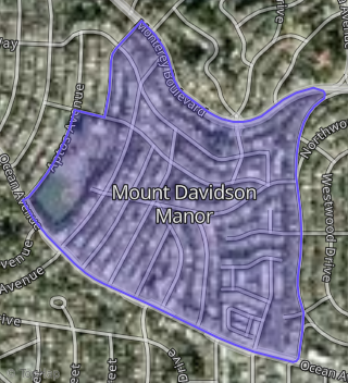
This property is located in West Of Twin Peaks, San Francisco, CA 94127.
Seasonal Housing units 94127
14%of housing is for seasonal rent.
Daytime Population for 94127
-5%of people during work hours.
Boundary map of West of Twin Peaks.
Crime Index for 94127
37
The crime index in 94127 is 37, which is 0.4 times lower than national average.
Market Trends
Historical market data near 213 215 Kenwood Way over selected time period.
Nearby Properties on Kenwood Way
- 19 Kenwood Way, San Francisco, CA 94127 (Mount Davidson Manor) is a 2,064 square foot, 3 bedroom, 3 bathroom, 0.08 acre property. It was built in 1955 and has an estimate of $1,866,864 with a price per ft² of $1,436.
- 15 Kenwood Way, San Francisco, CA 94127 (Mount Davidson Manor) is a 1,732 square foot, 2 bathroom, 0.08 acre property. It was built in 1955 and has an estimate of $1,455,157 with a price per ft² of $840.
- 300 Kenwood Way, San Francisco, CA 94127 (Mount Davidson Manor) is a 1,960 square foot, 4 bedroom, 3 bathroom, 0.07 acre property. It was built in 1977 and has an estimate of $1,736,647 with a price per ft² of $886.
- 130 Kenwood Way, San Francisco, CA 94127 (Mount Davidson Manor) is a 1,154 square foot, 2 bedroom, 3 bathroom, 0.06 acre property. It was built in 1950 and has an estimate of $1,405,762 with a price per ft² of $1,218.
- 140 Kenwood Way, San Francisco, CA 94127 (Mount Davidson Manor) is a 1,013 square foot, 2 bathroom, 0.07 acre property. It was built in 1950 and has an estimate of $1,156,414 with a price per ft² of $1,142.
- 156 Kenwood Way, San Francisco, CA 94127 (Mount Davidson Manor) is a 2,245 square foot, 3 bedroom, 2 bathroom, 0.07 acre property. It was built in 1929 and has an estimate of $1,899,571 with a price per ft² of $846.
- 160 Kenwood Way, San Francisco, CA 94127 (Mount Davidson Manor) is a 2,470 square foot, 3 bedroom, 2 bathroom, 0.08 acre property. It was built in 1929 and has an estimate of $1,773,749 with a price per ft² of $718.
- 196 Kenwood Way, San Francisco, CA 94127 (Mount Davidson Manor) is a 2,415 square foot, 2 bathroom, 0.1 acre property. It was built in 1929 and has an estimate of $1,848,650 with a price per ft² of $765.
- 216 Kenwood Way, San Francisco, CA 94127 (Mount Davidson Manor) is a 1,468 square foot, 1 bathroom, 0.09 acre property. It was built in 1929 and has an estimate of $1,245,906 with a price per ft² of $849.
- 224 Kenwood Way, San Francisco, CA 94127 (Mount Davidson Manor) is a 2,257 square foot, 4 bedroom, 3 bathroom, 0.1 acre property. It was built in 1929 and has an estimate of $1,926,093 with a price per ft² of $853.
- 240 Kenwood Way, San Francisco, CA 94127 (Mount Davidson Manor) is a 2,104 square foot, 3 bedroom, 2 bathroom, 0.11 acre property. It was built in 1929 and has an estimate of $1,797,681 with a price per ft² of $854.
- 111 Kenwood Way, San Francisco, CA 94127 (Mount Davidson Manor) is a 1,888 square foot, 3 bedroom, 3 bathroom, 0.1 acre property. It was built in 1955 and has an estimate of $1,810,115 with a price per ft² of $959.
- 125 Kenwood Way, San Francisco, CA 94127 (Mount Davidson Manor) is a 2,072 square foot, 4 bedroom, 2 bathroom, 0.08 acre property. It was built in 1928 and has an estimate of $1,843,427 with a price per ft² of $890.
- 129 Kenwood Way, San Francisco, CA 94127 (Mount Davidson Manor) is a 2,413 square foot, 6 bedroom, 2 bathroom, 0.08 acre property. It was built in 1928 and has an estimate of $1,789,305 with a price per ft² of $742.
- 141 Kenwood Way, San Francisco, CA 94127 (Mount Davidson Manor) is a 1,894 square foot, 3 bedroom, 1 bathroom, 0.07 acre property. It was built in 1935 and has an estimate of $1,302,635 with a price per ft² of $688.
- 145 Kenwood Way, San Francisco, CA 94127 (Mount Davidson Manor) is a 2,513 square foot, 6 bedroom, 3 bathroom, 0.07 acre property. It was built in 1935 and has an estimate of $1,634,765 with a price per ft² of $651.
- View more properties on Kenwood Way