21836 Parrotts Ferry Rd
Columbia, CA 95310
- 2Beds
- 1Bath
- 904ft²Living Area
- 2acLot Size
- -Pool
- 6Car
- 1953Year Built
- -DOM
- -Permit
Property Valuations
Latest estimates for 21836 Parrotts Ferry Rd based on TopHap automated valuation model (AVM).
TopHap Estimate
$331,100
$366/ft²
+$189K above Sold Price
Updated 3 months ago
Last Sold Price
$142,500
$158/ft²
23 years ago
21836 Parrotts Ferry Rd is valued at $331,100 by TopHap AVM 3 months ago.
21836 Parrotts Ferry Rd was last sold in 2001 for $142,500.
Current Ownership
Information about the current owner(s).
Taxes Billed
Taxes billed in 2023$2,819.26From latest Total Assessed Value1.08%Total Assessed Value$261,161=Land+
Assessed Value$86,890Additions
Assessed Value$174,271
In 2023, taxes billed for 21836 Parrotts Ferry Rd were $2,819.26, which is 1.08% from latest Total Assessed Value of $261,161.
Property History
21836 Parrotts Ferry Rd has undefined property events records (listings, deeds, permits, tax, foreclosure, loan).
Environment
Environmental factors around 21836 Parrotts Ferry Rd
Hazard Risks
Nat'l Avg100Particulates100Ozone87Earthquake83Air Pollution80Carb Mono75Lead43Hail1Hurricane0Tornado0Weather0Wind0
8 hazards (Carbon Monoxide, Earthquake Risk, Hail Index, Air Pollution Index, Ozone Index, Lead Index, Particulate Matter, National Average) are above the national average around 21836 Parrotts Ferry Rd.
Walkability Index
7 /20
Most Walkable
20-18
Very Walkable
17-15
Somewhat Walkable
14-10
Car Dependent
9-0
21836 Parrotts Ferry Rd has a walkability score of 7 out of 20, which means that it is in a car dependent area.
Temperature
Seasonal temperature sampled over multiple years
Winter
Average
Low
30°F
High
50°F
Summer
Average
Low
53°F
High
83°F
In the winter at 21836 Parrotts Ferry Rd, temperatures range from 30.16°F to 49.66°F with an average of 39.91°F. In the summer, the temperature ranges from 52.83°F to 83.11°F with and average of 67.97°F.
School Information
Public/private schools serving 21836 Parrotts Ferry Rd
Public Schools
Nearby public schools serving 21836 Parrotts Ferry Rd have ratings undefined, and undefined.
Neighborhood
This property is located in Columbia.
Seasonal Housing units 95310
40%of housing is for seasonal rent.
Daytime Population for 95310
-19%of people during work hours.
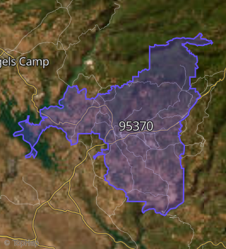
Boundary map of Columbia.
Crime Index for 95310
100
The crime index in 95310 is 100, which is 1.0 times lower than national average.
Market Trends
Historical market data near 21836 Parrotts Ferry Rd over selected time period.
Nearby Properties on Parrotts Ferry Rd
- 23732 Parrotts Ferry Rd #Spc 37, Columbia, CA 95310 is a 1,079 square foot, 3 bedroom, 2 bathroom property. It was built in 2001 and has an estimate of $282,835 with a price per ft² of $262.
- 23732 Parrotts Ferry Rd #Spc 27, Columbia, CA 95310 is a 1,079 square foot, 2 bedroom, 2 bathroom property. It was built in 1991 and has an estimate of $287,788 with a price per ft² of $267.
- 23097 Parrotts Ferry Rd, Columbia, CA 95310 is a 13.41 acre property.
- 22900 Parrotts Ferry Rd, Columbia, CA 95310 is a 1,296 square foot, 2 bedroom, 1 bathroom, 0.36 acre property. It was built in 1910 and has an estimate of $297,405 with a price per ft² of $229.
- 23732 Parrotts Ferry Rd #Spc 16, Columbia, CA 95310 is a 1,689 square foot, 2 bedroom, 2 bathroom property. It was built in 1999 and has an estimate of $473,044 with a price per ft² of $280.
- 23300 Parrotts Ferry Rd, Columbia, CA 95310 is a 1,496 square foot, 3 bedroom, 3 bathroom, 1.14 acre property. It was built in 1980 and has an estimate of $395,816 with a price per ft² of $265.
- 23546 Parrotts Ferry Rd, Columbia, CA 95310 is a 1,914 square foot, 3 bedroom, 2 bathroom, 1.01 acre property. It was built in 1974 and has an estimate of $654,756 with a price per ft² of $342.
- 23732 Parrotts Ferry Rd #Spc 55, Columbia, CA 95310 is a 1,079 square foot, 3 bedroom, 2 bathroom property. It was built in 1990 and has an estimate of $230,597 with a price per ft² of $214.
- 22221 Parrotts Ferry Rd, Columbia, CA 95310 is a 6,876 square foot and 6.46 acre property.
- 21770 Parrotts Ferry Rd, Columbia, CA 95310 is a 2,896 square foot and 1.56 acre property.
- 23460 Parrotts Ferry Rd, Columbia, CA 95310 is a 1,492 square foot, 3 bedroom, 3 bathroom, 1.12 acre property. It was built in 1982 and has an estimate of $430,316 with a price per ft² of $288.
- 22267 Parrotts Ferry Rd, Columbia, CA 95310 is a 2,911 square foot and 1.41 acre property.
- 23572 Parrotts Ferry Rd, Columbia, CA 95310 is a 1,400 square foot, 3 bedroom, 2 bathroom, 1.5 acre property. It was built in 1978 and has an estimate of $401,157 with a price per ft² of $287.
- 23732 Parrotts Ferry Rd #Spc 58, Columbia, CA 95310 is a 1,079 square foot, 2 bedroom, 2 bathroom property. It was built in 2005 and has an estimate of $341,481 with a price per ft² of $316.
- 23732 Parrotts Ferry Rd #Spc 24, Columbia, CA 95310 is a 1,079 square foot, 3 bedroom, 2 bathroom, 42.05 acre property. It was built in 1991 and has an estimate of $629,639 with a price per ft² of $584.
- 23490 Parrotts Ferry Rd, Columbia, CA 95310 is a 1,414 square foot, 3 bedroom, 2 bathroom, 1.09 acre property. It was built in 1977 and has an estimate of $402,526 with a price per ft² of $285.
- 22176 Parrotts Ferry Rd, Columbia, CA 95310 is a 296 square foot and 0.68 acre property.
- 22131 Parrotts Ferry Rd, Columbia, CA 95310 is a 3,068 square foot and 1.09 acre property.
- 23732 Parrotts Ferry Rd, Columbia, CA 95310 is a 1,079 square foot and 42.05 acre property.
- 23384 Parrotts Ferry Rd, Columbia, CA 95310 is a 2,172 square foot, 3 bedroom, 2.5 bathroom, 1.08 acre property. It was built in 1978 and has an estimate of $517,620 with a price per ft² of $238.
- 23400 Parrotts Ferry Rd, Columbia, CA 95310 is a 1,732 square foot, 3 bedroom, 3.25 bathroom, 1.06 acre property. It was built in 1978 and has an estimate of $395,883 with a price per ft² of $229.
- 23732 Parrotts Ferry Rd #Spc 6, Columbia, CA 95310 is a 1,079 square foot, 3 bedroom, 2 bathroom property. It was built in 1990 and has an estimate of $238,365 with a price per ft² of $221.
- 22261 Parrotts Ferry Rd, Columbia, CA 95310 is a 4,756 square foot and 0.65 acre property.
- 23732 Parrotts Ferry Rd #Spc 44, Columbia, CA 95310 is a 1,079 square foot, 2 bedroom, 2 bathroom property. It was built in 1990 and has an estimate of $281,711 with a price per ft² of $261.
- 23732 Parrotts Ferry Rd #Spc 30, Columbia, CA 95310 is a 1,222 square foot, 3 bedroom, 2 bathroom property. It was built in 2001 and has an estimate of $286,045 with a price per ft² of $234.
- View more properties on Parrotts Ferry-Rd