222 Meigs Rd 6
Santa Barbara, CA 93109
- 3Beds
- 3Baths
- 1,918ft²Living Area
- 923ft²Lot Size
- -Pool
- -Car
- 1994Year Built
- -DOM
- -Permit
Property Valuations
Latest estimates for 222 Meigs Rd 6 based on TopHap automated valuation model (AVM).
TopHap Estimate
$1,655,000
$862/ft²
+$706K above Sold Price
Updated 4 months ago
Last Sold Price
$949,000
$495/ft²
10 years ago
222 Meigs Rd 6 is valued at $1,655,000 by TopHap AVM 4 months ago.
222 Meigs Rd 6 was last sold in 2014 for $949,000.
Current Ownership
Information about the current owner(s).
Taxes Billed
Taxes billed in 2023$11,804.92From latest Total Assessed Value1.06%Total Assessed Value$1,118,160=Land+
Assessed Value$506,648Additions
Assessed Value$611,512
In 2023, taxes billed for 222 Meigs Rd 6 were $11,804.92, which is 1.06% from latest Total Assessed Value of $1,118,160.
Property History
222 Meigs Rd 6 has undefined property events records (listings, deeds, permits, tax, foreclosure, loan).
Environment
Environmental factors around 222 Meigs Rd 6
Hazard Risks
Earthquake413Nat'l Avg100Ozone100Particulates100Lead99Carb Mono95Air Pollution93Tornado8Weather5Hurricane2Wind1Hail0
11 hazards (Carbon Monoxide, Earthquake Risk, Tornado Index, Hurricane Index, Air Pollution Index, Ozone Index, Wind Index, Weather Risk, Lead Index, Particulate Matter, National Average) are above the national average around 222 Meigs Rd 6.
Walkability Index
12 /20
Most Walkable
20-18
Very Walkable
17-15
Somewhat Walkable
14-10
Car Dependent
9-0
222 Meigs Rd 6 has a walkability score of 12 out of 20, which means that it is in a somewhat walkable area.
Noise Level
43 dB
Quiet Suburban Residential 0-49
Suburban Residential 50-54
Urban Residential 55-59
Noisy Urban Residential 60-64
Very Noisy Urban Residential 65+
Noise at 222 Meigs Rd 6 is around 43dBs, which is comparable to a Quiet Suburban Residential area.
Temperature
Seasonal temperature sampled over multiple years
Winter
Average
Low
43°F
High
65°F
Summer
Average
Low
56°F
High
74°F
In the winter at 222 Meigs Rd 6, temperatures range from 43.35°F to 64.7°F with an average of 54.03°F. In the summer, the temperature ranges from 55.85°F to 73.72°F with and average of 64.79°F.
School Information
Public/private schools serving 222 Meigs Rd 6
Public Schools
Nearby public schools serving 222 Meigs Rd 6 have ratings undefined, undefined, and undefined.
Neighborhood
This property is located in Mesa, Santa Barbara, CA 93109.
Seasonal Housing units 93109
46%of housing is for seasonal rent.
Daytime Population for 93109
-1%of people during work hours.
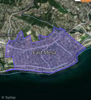
Boundary map of Mesa.
Crime Index for 93109
116
The crime index in 93109 is 116, which is 1.2 times higher than national average.
Market Trends
Historical market data near 222 Meigs Rd 6 over selected time period.
Nearby Properties on Meigs Rd
- 220 Meigs Rd # 20, Santa Barbara, CA 93109 (East Mesa) is a 848 square foot, 2 bedroom, 1 bathroom, 0.02 acre property. It was built in 1994 and has an estimate of $868,534 with a price per ft² of $1,024.
- 222 Meigs Rd #Apt 2, Santa Barbara, CA 93109 (East Mesa) is a 1,972 square foot, 3 bedroom, 3.25 bathroom, 0.02 acre property. It was built in 1992 and has an estimate of $1,795,971 with a price per ft² of $911.
- 222 Meigs Rd #Apt 3, Santa Barbara, CA 93109 (East Mesa) is a 1,907 square foot, 3 bedroom, 4.25 bathroom, 0.02 acre property. It was built in 1994 and has an estimate of $1,900,728 with a price per ft² of $997.
- 222 Meigs Rd #Apt 7, Santa Barbara, CA 93109 (East Mesa) is a 1,907 square foot, 3 bedroom, 4.25 bathroom, 0.02 acre property. It was built in 1994 and has an estimate of $1,794,717 with a price per ft² of $941.
- 222 Meigs Rd #Apt 11, Santa Barbara, CA 93109 (East Mesa) is a 1,903 square foot, 3 bedroom, 3.25 bathroom, 0.02 acre property. It was built in 1994 and has an estimate of $1,710,625 with a price per ft² of $899.
- 222 Meigs Rd #Apt 10, Santa Barbara, CA 93109 (East Mesa) is a 1,923 square foot, 3 bedroom, 3.25 bathroom, 0.02 acre property. It was built in 1992 and has an estimate of $1,582,233 with a price per ft² of $823.
- 222 Meigs Rd #Apt 9, Santa Barbara, CA 93109 (East Mesa) is a 1,917 square foot, 3 bedroom, 3.25 bathroom, 0.02 acre property. It was built in 1994 and has an estimate of $1,712,438 with a price per ft² of $893.
- 222 Meigs Rd #Apt 14, Santa Barbara, CA 93109 (East Mesa) is a 1,917 square foot, 3 bedroom, 3.25 bathroom, 0.02 acre property. It was built in 1994 and has an estimate of $1,739,727 with a price per ft² of $908.
- 222 Meigs Rd #Apt 16, Santa Barbara, CA 93109 (East Mesa) is a 2,020 square foot, 3 bedroom, 3.25 bathroom, 0.01 acre property. It was built in 1994 and has an estimate of $2,293,000 with a price per ft² of $1,135.
- 222 Meigs Rd #Apt 12, Santa Barbara, CA 93109 (East Mesa) is a 1,902 square foot, 3 bedroom, 3.25 bathroom, 0.02 acre property. It was built in 1994 and has an estimate of $1,779,052 with a price per ft² of $935.
- 222 Meigs Rd #Apt 18, Santa Barbara, CA 93109 (East Mesa) is a 2,858 square foot, 3 bedroom, 3.25 bathroom, 0.04 acre property. It was built in 1994 and has an estimate of $2,301,410 with a price per ft² of $805.
- 222 Meigs Rd # 17, Santa Barbara, CA 93109 (East Mesa) is a 852 square foot, 2 bedroom, 1 bathroom, 0.02 acre property. It was built in 1994 and has an estimate of $856,932 with a price per ft² of $1,006.
- 222 Meigs Rd #Apt 19, Santa Barbara, CA 93109 (East Mesa) is a 2,823 square foot, 4 bedroom, 3.25 bathroom, 0.03 acre property. It was built in 1994 and has an estimate of $2,043,899 with a price per ft² of $724.
- 722 Meigs Rd, Santa Barbara, CA 93109 (Alta Mesa) is a 1,410 square foot, 4 bedroom, 3.25 bathroom, 0.24 acre property. It was built in 1957 and has an estimate of $1,803,231 with a price per ft² of $1,279.
- 730 Meigs Rd, Santa Barbara, CA 93109 (Alta Mesa) is a 2,006 square foot, 5 bedroom, 2 bathroom, 0.27 acre property. It was built in 1958 and has an estimate of $2,360,819 with a price per ft² of $1,177.
- 736 Meigs Rd, Santa Barbara, CA 93109 (Alta Mesa) is a 1,248 square foot, 3 bedroom, 3.25 bathroom, 0.24 acre property. It was built in 1957 and has an estimate of $1,897,769 with a price per ft² of $1,521.
- 740 Meigs Rd, Santa Barbara, CA 93109 (Alta Mesa) is a 1,247 square foot, 3 bedroom, 2 bathroom, 0.22 acre property. It was built in 1957 and has an estimate of $1,660,886 with a price per ft² of $1,332.
- 748 Meigs Rd, Santa Barbara, CA 93109 (Alta Mesa) is a 1,251 square foot, 3 bedroom, 2 bathroom, 0.28 acre property. It was built in 1958 and has an estimate of $1,624,774 with a price per ft² of $1,299.
- 510 Meigs Rd, Santa Barbara, CA 93109 (Alta Mesa) is a 1,452 square foot, 4 bedroom, 3.25 bathroom, 0.27 acre property. It was built in 1957 and has an estimate of $1,691,740 with a price per ft² of $1,165.
- 520 Meigs Rd, Santa Barbara, CA 93109 (Alta Mesa) is a 1,170 square foot, 3 bedroom, 2 bathroom, 0.49 acre property. It was built in 1958 and has an estimate of $2,076,866 with a price per ft² of $1,775.
- View more properties on Meigs Rd