275 Cairo Rd
Oakland, CA 94603
- 3Beds
- 1Bath
- 1,026ft²Living Area
- 4,125ft²Lot Size
- -Pool
- -Car
- 1943Year Built
- -DOM
- -Permit
Property Valuations
Latest estimates for 275 Cairo Rd based on TopHap automated valuation model (AVM).
TopHap Estimate
$528,500
$515/ft²
+$163K above Sold Price
Updated 3 months ago
Last Sold Price
$365,454
$356/ft²
16 years ago
275 Cairo Rd is valued at $528,500 by TopHap AVM 3 months ago.
275 Cairo Rd was last sold in 2007 for $365,454.
Current Ownership
Information about the current owner(s).
Taxes Billed
Taxes billed in 2023$8,024.52From latest Total Assessed Value1.74%Total Assessed Value$460,790=Land+
Assessed Value$138,237Additions
Assessed Value$322,553
In 2023, taxes billed for 275 Cairo Rd were $8,024.52, which is 1.74% from latest Total Assessed Value of $460,790.
Property History
275 Cairo Rd has undefined property events records (listings, deeds, permits, tax, foreclosure, loan).
Environment
Environmental factors around 275 Cairo Rd
Hazard Risks
Earthquake614Carb Mono102Nat'l Avg100Particulates97Ozone86Air Pollution86Lead38Tornado16Weather8Wind1Hail0Hurricane0
10 hazards (Carbon Monoxide, Earthquake Risk, Tornado Index, Air Pollution Index, Ozone Index, Wind Index, Weather Risk, Lead Index, Particulate Matter, National Average) are above the national average around 275 Cairo Rd.
Walkability Index
15 /20
Most Walkable
20-18
Very Walkable
17-15
Somewhat Walkable
14-10
Car Dependent
9-0
275 Cairo Rd has a walkability score of 15 out of 20, which means that it is in a very walkable area.
Noise Level
49 dB
Quiet Suburban Residential 0-49
Suburban Residential 50-54
Urban Residential 55-59
Noisy Urban Residential 60-64
Very Noisy Urban Residential 65+
Noise at 275 Cairo Rd is around 49dBs, which is comparable to a Quiet Suburban Residential area.
Temperature
Seasonal temperature sampled over multiple years
Winter
Average
Low
43°F
High
58°F
Summer
Average
Low
55°F
High
72°F
In the winter at 275 Cairo Rd, temperatures range from 43.44°F to 58.34°F with an average of 50.89°F. In the summer, the temperature ranges from 54.93°F to 72.45°F with and average of 63.69°F.
School Information
Public/private schools serving 275 Cairo Rd
Public Schools
Nearby public schools serving 275 Cairo Rd have ratings undefined, undefined, and undefined.
Neighborhood
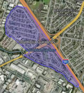
This property is located in Columbia Gardens, Oakland, CA 94603.
Seasonal Housing units 94603
3%of housing is for seasonal rent.
Daytime Population for 94603
-29%of people during work hours.
Boundary map of Columbia Gardens.
Crime Index for 94603
129
The crime index in 94603 is 129, which is 1.3 times higher than national average.
Market Trends
Historical market data near 275 Cairo Rd over selected time period.
Nearby Properties on Cairo Rd
- 260 Cairo Rd, Oakland, CA 94603 (Columbia Gardens) is a 988 square foot, 3 bedroom, 1 bathroom, 0.1 acre property. It was built in 1943 and has an estimate of $543,446 with a price per ft² of $550.
- 269 Cairo Rd, Oakland, CA 94603 (Columbia Gardens) is a 1,273 square foot, 3 bedroom, 2 bathroom, 0.09 acre property. It was built in 1943 and has an estimate of $567,888 with a price per ft² of $446.
- 263 Cairo Rd, Oakland, CA 94603 (Columbia Gardens) is a 988 square foot, 3 bedroom, 1 bathroom, 0.09 acre property. It was built in 1943 and has an estimate of $494,274 with a price per ft² of $500.
- 227 Cairo Rd, Oakland, CA 94603 (Columbia Gardens) is a 1,456 square foot, 4 bedroom, 2 bathroom, 0.11 acre property. It was built in 1944 and has an estimate of $544,562 with a price per ft² of $374.
- 294 Cairo Rd, Oakland, CA 94603 (Columbia Gardens) is a 1,013 square foot, 3 bedroom, 1 bathroom, 0.21 acre property. It was built in 1943 and has an estimate of $482,864 with a price per ft² of $477.
- View more properties on Cairo Rd