330 Broad St
Paulsboro, NJ 08066
- -Bed
- -Bath
- 2,124ft²Living Area
- 7,200ft²Lot Size
- -Pool
- 3Car
- 1920Year Built
- -DOM
- -Permit
Property Valuations
Latest estimates for 330 Broad St based on TopHap automated valuation model (AVM).
TopHap Estimate
$198,900
$93/ft²
+$89K above Sold Price
Updated 3 months ago
Last Sold Price
$110,000
$52/ft²
3 years ago
330 Broad St is valued at $198,900 by TopHap AVM 3 months ago.
330 Broad St was last sold in 2021 for $110,000.
Current Ownership
Information about the current owner(s).
Taxes Billed
Taxes billed in 2021$5,442.35From latest Total Assessed Value4.45%Total Assessed Value$122,200=Land+
Assessed Value$14,700Additions
Assessed Value$107,500
In 2021, taxes billed for 330 Broad St were $5,442.35, which is 4.45% from latest Total Assessed Value of $122,200.
Property History
330 Broad St has undefined property events records (listings, deeds, permits, tax, foreclosure, loan).
Environment
Environmental factors around 330 Broad St
Hazard Risks
Wind194Weather119Hurricane113Tornado110Particulates102Nat'l Avg100Ozone96Air Pollution93Carb Mono84Earthquake80Hail77Lead58
12 hazards (Carbon Monoxide, Earthquake Risk, Hail Index, Tornado Index, Hurricane Index, Air Pollution Index, Ozone Index, Wind Index, Weather Risk, Lead Index, Particulate Matter, National Average) are above the national average around 330 Broad St.
Walkability Index
15 /20
Most Walkable
20-18
Very Walkable
17-15
Somewhat Walkable
14-10
Car Dependent
9-0
330 Broad St has a walkability score of 15 out of 20, which means that it is in a very walkable area.
Temperature
Seasonal temperature sampled over multiple years
Winter
Average
Low
28°F
High
42°F
Summer
Average
Low
66°F
High
85°F
In the winter at 330 Broad St, temperatures range from 27.62°F to 42.44°F with an average of 35.03°F. In the summer, the temperature ranges from 65.86°F to 84.79°F with and average of 75.33°F.
School Information
Public/private schools serving 330 Broad St
Public Schools
Nearby public schools serving 330 Broad St have ratings undefined, undefined, and undefined.
Neighborhood
This property is located in Paulsboro.
Seasonal Housing units 08066
4%of housing is for seasonal rent.
Daytime Population for 08066
+25%of people during work hours.
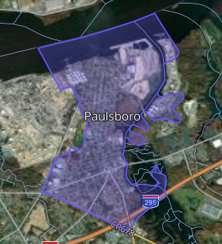
Boundary map of Paulsboro.
Crime Index for 08066
162
The crime index in 08066 is 162, which is 1.6 times higher than national average.
Market Trends
Historical market data near 330 Broad St over selected time period.
Nearby Properties on Broad St
- 128 W Broad St, Paulsboro, NJ 08066 is a 1,926 square foot and 0.17 acre property. It was built in 1900 and has an estimate of $226,860 with a price per ft² of $118.
- 416 W Broad St, Paulsboro, NJ 08066 is a 0.42 acre property.
- 215 E Broad St, Paulsboro, NJ 08066 is a 2.32 acre property.
- 441 W Broad St, Paulsboro, NJ 08066 is a 1,696 square foot and 0.43 acre property. It was built in 1920 and has an estimate of $408,700 with a price per ft² of $241.
- 428 W Broad St, Paulsboro, NJ 08066 is a 0.17 acre property.
- 32 E Broad St, Paulsboro, NJ 08066 is a 0.26 acre property.
- 529 W Broad St, Paulsboro, NJ 08066 is a 0.27 acre property.
- 110 W Broad St, Paulsboro, NJ 08066 is a 1,257 square foot and 0.17 acre property. It was built in 1900 and has an estimate of $135,901 with a price per ft² of $108.
- 212 E Broad St, Paulsboro, NJ 08066 is a 2,096 square foot and 0.19 acre property. It was built in 1810 and has an estimate of $158,321 with a price per ft² of $76.
- 500 W Broad St, Paulsboro, NJ 08066 is a 1.51 acre property.
- 300 W Broad St, Paulsboro, NJ 08066 is a 0.17 acre property.
- 250 W Broad St, Paulsboro, NJ 08066 is a 1,748 square foot and 0.17 acre property. It was built in 1950 and has an estimate of $199,517 with a price per ft² of $114.
- 246 W Broad St, Paulsboro, NJ 08066 is a 1,972 square foot and 0.17 acre property.
- 232 W Broad St, Paulsboro, NJ 08066 is a 2,238 square foot and 0.17 acre property. It was built in 1920 and has an estimate of $229,500 with a price per ft² of $103.
- 79 W Broad St, Paulsboro, NJ 08066 is a 2,960 square foot and 0.19 acre property.
- 322 W Broad St, Paulsboro, NJ 08066 is a 1,512 square foot and 0.17 acre property. It was built in 1920 and has an estimate of $25,604 with a price per ft² of $17.
- 104-106 E Broad St, Paulsboro, NJ 08066 is a 0.3 acre property.
- 120 E Broad St, Paulsboro, NJ 08066 is a 3,244 square foot and 0.29 acre property. It was built in 1910 and has an estimate of $152,040 with a price per ft² of $47.
- 525 W Broad St, Paulsboro, NJ 08066 is a 0.24 acre property.
- 449 W Broad St, Paulsboro, NJ 08066 is a 1,200 square foot and 0.21 acre property. It was built in 1920 and has an estimate of $128,051 with a price per ft² of $107.
- 225 W Broad St, Paulsboro, NJ 08066 is a 2,508 square foot and 0.25 acre property. It was built in 1920 and has an estimate of $192,941 with a price per ft² of $77.
- 29 W Broad St, Paulsboro, NJ 08066 is a 0.35 acre property.
- 37 W Broad St, Paulsboro, NJ 08066 is a 0.28 acre property.
- 24-26 W Broad St, Paulsboro, NJ 08066 is a 2,526 square foot and 0.06 acre property.
- 24 E Broad St, Paulsboro, NJ 08066 is a 0.19 acre property.
- View more properties on Broad St