344 Stevens St
Philadelphia, PA 19111
- 3Beds
- 1Bath
- 1,050ft²Living Area
- 1,571ft²Lot Size
- -Pool
- -Car
- 1950Year Built
- -DOM
- -Permit
Property Valuations
Latest estimates for 344 Stevens St based on TopHap automated valuation model (AVM).
TopHap Estimate
$203,873
$194/ft²
-$51K below Sold Price
Updated 3 months ago
Last Sold Price
$255,000
$243/ft²
23 months ago
344 Stevens St is valued at $203,873 by TopHap AVM 3 months ago.
344 Stevens St was last sold in 2022 for $255,000.
Current Ownership
Information about the current owner(s).
Taxes Billed
Taxes billed in 2023$1,949.92From latest Total Assessed Value1.4%Total Assessed Value$139,300=Land+
Assessed Value$27,860Additions
Assessed Value$111,440
In 2023, taxes billed for 344 Stevens St were $1,949.92, which is 1.40% from latest Total Assessed Value of $139,300.
Property History
344 Stevens St has undefined property events records (listings, deeds, permits, tax, foreclosure, loan).
Environment
Environmental factors around 344 Stevens St
Hazard Risks
Wind362Hail138Particulates123Weather122Hurricane101Nat'l Avg100Tornado99Ozone96Air Pollution95Carb Mono92Earthquake81Lead55
12 hazards (Carbon Monoxide, Earthquake Risk, Hail Index, Tornado Index, Hurricane Index, Air Pollution Index, Ozone Index, Wind Index, Weather Risk, Lead Index, Particulate Matter, National Average) are above the national average around 344 Stevens St.
Walkability Index
15 /20
Most Walkable
20-18
Very Walkable
17-15
Somewhat Walkable
14-10
Car Dependent
9-0
344 Stevens St has a walkability score of 15 out of 20, which means that it is in a very walkable area.
Temperature
Seasonal temperature sampled over multiple years
Winter
Average
Low
27°F
High
42°F
Summer
Average
Low
65°F
High
84°F
In the winter at 344 Stevens St, temperatures range from 26.56°F to 41.93°F with an average of 34.25°F. In the summer, the temperature ranges from 64.74°F to 84.32°F with and average of 74.53°F.
School Information
Public/private schools serving 344 Stevens St
Public Schools
Nearby public schools serving 344 Stevens St have ratings undefined, and undefined.
Neighborhood
This property is located in Near Northeast Philadelphia, Philadelphia, PA 19111.
Seasonal Housing units 19111
12%of housing is for seasonal rent.
Daytime Population for 19111
-20%of people during work hours.
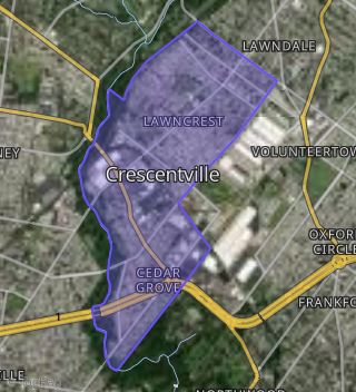
Boundary map of Near Northeast Philadelphia.
Crime Index for 19111
59
The crime index in 19111 is 59, which is 0.6 times lower than national average.
Market Trends
Historical market data near 344 Stevens St over selected time period.
Nearby Properties on Stevens St
- 1539 Stevens St, Philadelphia, PA 19149 (Oxford Circle) is a 1,126 square foot, 3 bedroom, 1 bathroom, 0.03 acre property. It was built in 1950 and has an estimate of $192,936 with a price per ft² of $171.
- 1511 Stevens St, Philadelphia, PA 19149 (Oxford Circle) is a 1,126 square foot, 3 bedroom, 1 bathroom, 0.03 acre property. It was built in 1950 and has an estimate of $193,500 with a price per ft² of $172.
- 1475 Stevens St, Philadelphia, PA 19149 (Oxford Circle) is a 970 square foot, 3 bedroom, 1 bathroom, 0.02 acre property. It was built in 1950 and has an estimate of $156,500 with a price per ft² of $161.
- 1478 Stevens St, Philadelphia, PA 19149 (Oxford Circle) is a 990 square foot, 3 bedroom, 1 bathroom, 0.02 acre property. It was built in 1950 and has an estimate of $168,047 with a price per ft² of $170.
- 1546 Stevens St, Philadelphia, PA 19149 (Oxford Circle) is a 1,126 square foot, 3 bedroom, 1 bathroom, 0.02 acre property. It was built in 1950 and has an estimate of $182,000 with a price per ft² of $162.
- 1468 Stevens St, Philadelphia, PA 19149 (Oxford Circle) is a 970 square foot, 3 bedroom, 1 bathroom, 0.02 acre property. It was built in 1950 and has an estimate of $173,033 with a price per ft² of $178.
- 1414 Stevens St, Philadelphia, PA 19149 (Oxford Circle) is a 970 square foot, 3 bedroom, 1 bathroom, 0.04 acre property. It was built in 1950 and has an estimate of $172,728 with a price per ft² of $178.
- 203 Stevens St, Philadelphia, PA 19111 (Crescentville) is a 1,224 square foot, 3 bedroom, 1 bathroom, 0.03 acre property. It was built in 1950 and has an estimate of $229,782 with a price per ft² of $188.
- 1446 Stevens St, Philadelphia, PA 19149 (Oxford Circle) is a 970 square foot, 3 bedroom, 1 bathroom, 0.02 acre property. It was built in 1950 and has an estimate of $166,179 with a price per ft² of $171.
- 215 Stevens St, Philadelphia, PA 19111 (Crescentville) is a 1,224 square foot, 3 bedroom, 1 bathroom, 0.03 acre property. It was built in 1950 and has an estimate of $235,979 with a price per ft² of $193.
- 1544 Stevens St, Philadelphia, PA 19149 (Oxford Circle) is a 1,126 square foot, 3 bedroom, 1 bathroom, 0.03 acre property. It was built in 1950 and has an estimate of $209,749 with a price per ft² of $186.
- 1548 Stevens St, Philadelphia, PA 19149 (Oxford Circle) is a 1,126 square foot, 3 bedroom, 1 bathroom, 0.02 acre property. It was built in 1950 and has an estimate of $192,000 with a price per ft² of $171.
- 1550 Stevens St, Philadelphia, PA 19149 (Oxford Circle) is a 1,126 square foot, 3 bedroom, 1 bathroom, 0.03 acre property. It was built in 1950 and has an estimate of $209,749 with a price per ft² of $186.
- 1542 Stevens St, Philadelphia, PA 19149 (Oxford Circle) is a 1,126 square foot, 3 bedroom, 1 bathroom, 0.04 acre property. It was built in 1950 and has an estimate of $225,402 with a price per ft² of $200.
- 1540 Stevens St, Philadelphia, PA 19149 (Oxford Circle) is a 1,126 square foot, 3 bedroom, 1 bathroom, 0.04 acre property. It was built in 1950 and has an estimate of $181,500 with a price per ft² of $161.
- 1552 Stevens St, Philadelphia, PA 19149 (Oxford Circle) is a 1,126 square foot, 3 bedroom, 1 bathroom, 0.02 acre property. It was built in 1950 and has an estimate of $209,749 with a price per ft² of $186.
- 1538 Stevens St, Philadelphia, PA 19149 (Oxford Circle) is a 1,126 square foot, 3 bedroom, 1 bathroom, 0.03 acre property. It was built in 1950 and has an estimate of $188,919 with a price per ft² of $168.
- 1554 Stevens St, Philadelphia, PA 19149 (Oxford Circle) is a 1,126 square foot, 3 bedroom, 1 bathroom, 0.03 acre property. It was built in 1950 and has an estimate of $176,420 with a price per ft² of $157.
- 2748 Stevens St, Philadelphia, PA 19149 (Mayfair) is a 928 square foot, 3 bedroom, 1 bathroom, 0.02 acre property. It was built in 1950 and has an estimate of $203,312 with a price per ft² of $219.
- 1465 Stevens St, Philadelphia, PA 19149 (Oxford Circle) is a 970 square foot, 3 bedroom, 1 bathroom, 0.02 acre property. It was built in 1950 and has an estimate of $166,926 with a price per ft² of $172.
- 364 Stevens St, Philadelphia, PA 19111 (Crescentville) is a 1,050 square foot, 3 bedroom, 1 bathroom, 0.04 acre property. It was built in 1950 and has an estimate of $214,817 with a price per ft² of $205.
- 1439 Stevens St, Philadelphia, PA 19149 (Oxford Circle) is a 970 square foot, 3 bedroom, 1 bathroom, 0.02 acre property. It was built in 1950 and has an estimate of $166,926 with a price per ft² of $172.
- 1509 Stevens St, Philadelphia, PA 19149 (Oxford Circle) is a 1,126 square foot, 3 bedroom, 1 bathroom, 0.03 acre property. It was built in 1950 and has an estimate of $145,000 with a price per ft² of $129.
- 2821 Stevens St, Philadelphia, PA 19149 (Mayfair) is a 1,068 square foot, 3 bedroom, 1 bathroom, 0.02 acre property. It was built in 1950 and has an estimate of $189,508 with a price per ft² of $177.
- 1516 Stevens St, Philadelphia, PA 19149 (Oxford Circle) is a 1,126 square foot, 3 bedroom, 1 bathroom, 0.02 acre property. It was built in 1950 and has an estimate of $209,401 with a price per ft² of $186.
- View more properties on Stevens St