35 Nash Rd
New Bedford, MA 02746
- 1Bed
- 1Bath
- 800ft²Living Area
- 8,146ft²Lot Size
- -Pool
- -Car
- 1968Year Built
- -DOM
- -Permit
Property Valuations
Latest estimates for 35 Nash Rd based on TopHap automated valuation model (AVM).
TopHap Estimate
$345,500
$431/ft²
+$161K above Sold Price
Updated 3 months ago
Last Sold Price
$185,000
$231/ft²
19 years ago
35 Nash Rd is valued at $345,500 by TopHap AVM 3 months ago.
35 Nash Rd was last sold in 2004 for $185,000.
Current Ownership
Information about the current owner(s).
Taxes Billed
Taxes billed in 2023$2,974.00From latest Total Assessed Value1.43%Total Assessed Value$208,100=Land+
Assessed Value$77,300Additions
Assessed Value$130,800
In 2023, taxes billed for 35 Nash Rd were $2,974, which is 1.43% from latest Total Assessed Value of $208,100.
Property History
35 Nash Rd has undefined property events records (listings, deeds, permits, tax, foreclosure, loan).
Environment
Environmental factors around 35 Nash Rd
Hazard Risks
Hurricane155Lead109Nat'l Avg100Particulates100Weather93Air Pollution91Ozone89Carb Mono81Wind73Earthquake60Hail22Tornado16
12 hazards (Carbon Monoxide, Earthquake Risk, Hail Index, Tornado Index, Hurricane Index, Air Pollution Index, Ozone Index, Wind Index, Weather Risk, Lead Index, Particulate Matter, National Average) are above the national average around 35 Nash Rd.
Walkability Index
17 /20
Most Walkable
20-18
Very Walkable
17-15
Somewhat Walkable
14-10
Car Dependent
9-0
35 Nash Rd has a walkability score of 17 out of 20, which means that it is in a very walkable area.
Temperature
Seasonal temperature sampled over multiple years
Winter
Average
Low
23°F
High
39°F
Summer
Average
Low
61°F
High
78°F
In the winter at 35 Nash Rd, temperatures range from 23.33°F to 38.97°F with an average of 31.15°F. In the summer, the temperature ranges from 60.82°F to 77.76°F with and average of 69.29°F.
School Information
Public/private schools serving 35 Nash Rd
Public Schools
Nearby public schools serving 35 Nash Rd have ratings undefined, undefined, undefined, undefined, and undefined.
Neighborhood
This property is located in New Bedford.
Seasonal Housing units 02746
7%of housing is for seasonal rent.
Daytime Population for 02746
-26%of people during work hours.
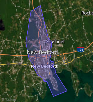
Boundary map of New Bedford.
Crime Index for 02746
165
The crime index in 02746 is 165, which is 1.6 times higher than national average.
Market Trends
Historical market data near 35 Nash Rd over selected time period.
Nearby Properties on Nash Rd
- 128 Nash Rd, New Bedford, MA 02746 is a 2,268 square foot, 6 bedroom, 3 bathroom, 0.1 acre property.
- 119 Nash Rd, New Bedford, MA 02746 is a 2,144 square foot, 6 bedroom, 2 bathroom, 0.1 acre property. It was built in 1907 and has an estimate of $346,600 with a price per ft² of $162.
- 105 Nash Rd, New Bedford, MA 02746 is a 1,901 square foot, 3 bedroom, 3.5 bathroom, 0.1 acre property.
- 533-535 Nash Rd, New Bedford, MA 02746 is a 2,504 square foot, 6 bedroom, 2 bathroom, 0.18 acre property. It was built in 1923 and has an estimate of $400,100 with a price per ft² of $160.
- 513-515 Nash Rd, New Bedford, MA 02746 is a 2,658 square foot, 6 bedroom, 3.25 bathroom, 0.19 acre property. It was built in 1924 and has an estimate of $421,800 with a price per ft² of $159.
- 209-211 Nash Rd, New Bedford, MA 02746 is a 5,100 square foot, 12 bedroom, 4 bathroom, 0.11 acre property.
- 404 Nash Rd, New Bedford, MA 02746 is a 3.62 acre property.
- 306 Nash Rd, New Bedford, MA 02746 is a 4,362 square foot, 9 bedroom, 3 bathroom, 0.2 acre property.
- 282 Nash Rd, New Bedford, MA 02746 is a 6,206 square foot, 3 bathroom, 0.39 acre property.
- 272 Nash Rd, New Bedford, MA 02746 is a 3,090 square foot, 9 bedroom, 3 bathroom, 0.1 acre property.
- 266 Nash Rd, New Bedford, MA 02746 is a 3,525 square foot, 9 bedroom, 3 bathroom, 0.1 acre property.
- 258-260 Nash Rd, New Bedford, MA 02746 is a 5,152 square foot, 6 bedroom, 2 bathroom, 0.1 acre property. It was built in 1923 and has an estimate of $625,200 with a price per ft² of $121.
- 190 Nash Rd, New Bedford, MA 02746 is a 4,344 square foot, 6 bedroom, 6 bathroom, 0.09 acre property.
- 358 Nash Rd, New Bedford, MA 02746 is a 320 square foot, 1 bathroom, 0.1 acre property.
- 80 Nash Rd, New Bedford, MA 02746 is a 2,208 square foot, 6 bedroom, 2 bathroom, 0.08 acre property. It was built in 1922 and has an estimate of $306,100 with a price per ft² of $139.
- 503 Nash Rd, New Bedford, MA 02746 is a 1,669 square foot, 4 bedroom, 2 bathroom, 0.18 acre property. It was built in 1890 and has an estimate of $308,300 with a price per ft² of $185.
- 265-267 Nash Rd, New Bedford, MA 02746 is a 3,247 square foot, 6 bedroom, 3 bathroom, 0.09 acre property.
- 257-259 Nash Rd, New Bedford, MA 02746 is a 2,324 square foot, 6 bedroom, 2 bathroom, 0.08 acre property. It was built in 1919 and has an estimate of $374,200 with a price per ft² of $161.
- 499-501 Nash Rd, New Bedford, MA 02746 is a 2,616 square foot, 6 bedroom, 3 bathroom, 0.18 acre property. It was built in 1924 and has an estimate of $423,500 with a price per ft² of $162.
- 248 Nash Rd, New Bedford, MA 02746 is a 3,526 square foot, 9 bedroom, 3 bathroom, 0.1 acre property.
- 212 Nash Rd, New Bedford, MA 02746 is a 4,355 square foot, 9 bedroom, 3 bathroom, 0.1 acre property.
- 198 Nash Rd, New Bedford, MA 02746 is a 3,477 square foot, 6 bedroom, 3 bathroom, 0.1 acre property.
- 355 Nash Rd, New Bedford, MA 02746 is a 5,076 square foot, 12 bedroom, 6 bathroom, 0.12 acre property.
- 161 Nash Rd, New Bedford, MA 02746 is a 3,618 square foot, 9 bedroom, 3 bathroom, 0.17 acre property.
- 482 Nash Rd, New Bedford, MA 02746 is a 720 square foot, 2 bedroom, 1 bathroom, 0.11 acre property. It was built in 1956 and has an estimate of $260,465 with a price per ft² of $362.
- View more properties on Nash Rd