3815 Mourfield Ave
Stockton, CA 95206
- 2Beds
- 1Bath
- 672ft²Living Area
- 10,000ft²Lot Size
- -Pool
- -Car
- 1953Year Built
- -DOM
- 3Permits
Property Valuations
Latest estimates for 3815 Mourfield Ave based on TopHap automated valuation model (AVM).
TopHap Estimate
$220,800
$328/ft²
Updated 3 months ago
3815 Mourfield Ave is valued at $220,800 by TopHap AVM 3 months ago.
Permits
3815 Mourfield Ave has 3 permit records.
Current Ownership
Information about the current owner(s).
Taxes Billed
Taxes billed in 2023$602.90From latest Total Assessed Value1.72%Total Assessed Value$35,102=Land+
Assessed Value$15,968Additions
Assessed Value$19,134
In 2023, taxes billed for 3815 Mourfield Ave were $602.9, which is 1.72% from latest Total Assessed Value of $35,102.
Property History
3815 Mourfield Ave has undefined property events records (listings, deeds, permits, tax, foreclosure, loan).
Environment
Environmental factors around 3815 Mourfield Ave
Hazard Risks
Earthquake156Nat'l Avg100Particulates95Ozone84Air Pollution84Carb Mono83Lead44Tornado29Weather10Wind3Hail0Hurricane0
10 hazards (Carbon Monoxide, Earthquake Risk, Tornado Index, Air Pollution Index, Ozone Index, Wind Index, Weather Risk, Lead Index, Particulate Matter, National Average) are above the national average around 3815 Mourfield Ave.
Walkability Index
12 /20
Most Walkable
20-18
Very Walkable
17-15
Somewhat Walkable
14-10
Car Dependent
9-0
3815 Mourfield Ave has a walkability score of 12 out of 20, which means that it is in a somewhat walkable area.
Noise Level
37 dB
Quiet Suburban Residential 0-49
Suburban Residential 50-54
Urban Residential 55-59
Noisy Urban Residential 60-64
Very Noisy Urban Residential 65+
Noise at 3815 Mourfield Ave is around 37dBs, which is comparable to a Quiet Suburban Residential area.
Temperature
Seasonal temperature sampled over multiple years
Winter
Average
Low
38°F
High
57°F
Summer
Average
Low
57°F
High
91°F
In the winter at 3815 Mourfield Ave, temperatures range from 38.2°F to 56.52°F with an average of 47.36°F. In the summer, the temperature ranges from 56.88°F to 90.65°F with and average of 73.77°F.
School Information
Public/private schools serving 3815 Mourfield Ave
Public Schools
Nearby public schools serving 3815 Mourfield Ave have ratings undefined, undefined, undefined, undefined, undefined, and undefined.
Neighborhood
This property is located in Taft Mosswood, Stockton, CA 95206.
Seasonal Housing units 95206
6%of housing is for seasonal rent.
Daytime Population for 95206
-18%of people during work hours.
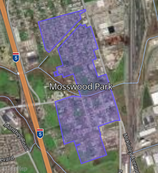
Boundary map of Taft Mosswood.
Crime Index for 95206
84
The crime index in 95206 is 84, which is 0.8 times lower than national average.
Market Trends
Historical market data near 3815 Mourfield Ave over selected time period.
Nearby Properties on Mourfield Ave
- 3558 Mourfield Ave, Stockton, CA 95206 (Mosswood Park) is a 1,064 square foot, 3 bedroom, 1 bathroom, 0.37 acre property. It was built in 1999 and has an estimate of $322,593 with a price per ft² of $303.
- 3457 Mourfield Ave, Stockton, CA 95206 (Mosswood Park) is a 1,008 square foot, 3 bedroom, 1 bathroom, 0.2 acre property. It was built in 1991 and has an estimate of $325,781 with a price per ft² of $323.
- 3425 Mourfield Ave, Stockton, CA 95206 (Mosswood Park) is a 568 square foot, 1 bedroom, 1 bathroom, 0.06 acre property. It was built in 1967 and has an estimate of $142,680 with a price per ft² of $251.
- 3747 Mourfield Ave, Stockton, CA 95206 (Taft Mosswood) is a 2.3 acre property.
- 3417 Mourfield Ave, Stockton, CA 95206 (Mosswood Park) is a 1,363 square foot, 3 bedroom, 2 bathroom, 0.19 acre property. It was built in 2003 and has an estimate of $326,353 with a price per ft² of $239.
- 3407 Mourfield Ave, Stockton, CA 95206 (Mosswood Park) is a 1,921 square foot, 3 bedroom, 2 bathroom, 0.58 acre property. It was built in 2005 and has an estimate of $461,051 with a price per ft² of $240.
- 3739 Mourfield Ave, Stockton, CA 95206 (Mosswood Park) is a 3,231 square foot, 8 bedroom, 5 bathroom, 0.98 acre property. It was built in 1944 and has an estimate of $494,445 with a price per ft² of $153.
- 3411 Mourfield Ave, Stockton, CA 95206 (Mosswood Park) is a 1,271 square foot, 3 bedroom, 1 bathroom, 0.27 acre property. It was built in 1916 and has an estimate of $286,115 with a price per ft² of $225.
- 3445 Mourfield Ave, Stockton, CA 95206 (Mosswood Park) is a 5,436 square foot, 4 bedroom, 5 bathroom, 2.31 acre property. It was built in 2020 and has an estimate of $1,581,970 with a price per ft² of $291.
- 3864 Mourfield Ave, Stockton, CA 95206 (Mosswood Park) is a 1,220 square foot, 2 bedroom, 1 bathroom, 0.94 acre property.
- 3914 Mourfield Ave, Stockton, CA 95206 (Mosswood Park) is a 0.94 acre property.
- 3936 Mourfield Ave, Stockton, CA 95206 (Mosswood Park) is a 1,893 square foot, 2 bedroom, 2 bathroom, 0.58 acre property. It was built in 1994 and has an estimate of $340,467 with a price per ft² of $180.
- 3523 Mourfield Ave, Stockton, CA 95206 (Mosswood Park) is a 1,316 square foot, 3 bedroom, 2 bathroom, 0.18 acre property. It was built in 2018 and has an estimate of $346,861 with a price per ft² of $264.
- 3525 Mourfield Ave, Stockton, CA 95206 (Mosswood Park) is a 0.12 acre property.
- 3847 Mourfield Ave, Stockton, CA 95206 (Mosswood Park) is a 1.21 acre property.
- 3855 Mourfield Ave, Stockton, CA 95206 (Taft Mosswood) is a 3.15 acre property.
- 3803 Mourfield Ave, Stockton, CA 95206 (Taft Mosswood) is a 3.61 acre property.
- 3922 Mourfield Ave, Stockton, CA 95206 (Mosswood Park) is a 1,077 square foot, 3 bedroom, 1 bathroom, 0.36 acre property. It was built in 1965 and has an estimate of $308,352 with a price per ft² of $286.
- 3652 Mourfield Ave, Stockton, CA 95206 (Mosswood Park) is a 0.35 acre property.
- 3444 Mourfield Ave, Stockton, CA 95206 (Mosswood Park) is a 1,064 square foot, 3 bedroom, 2 bathroom, 0.36 acre property. It was built in 1986 and has an estimate of $360,767 with a price per ft² of $339.
- 3432 Mourfield Ave, Stockton, CA 95206 (Mosswood Park) is a 0.36 acre property.
- 3428 Mourfield Ave, Stockton, CA 95206 (Mosswood Park) is a 1,256 square foot, 3 bedroom, 2 bathroom, 0.36 acre property. It was built in 1993 and has an estimate of $384,099 with a price per ft² of $306.
- 3421 Mourfield Ave, Stockton, CA 95206 (Mosswood Park) is a 1,375 square foot, 3 bedroom, 1 bathroom, 0.23 acre property. It was built in 1952 and has an estimate of $236,064 with a price per ft² of $172.
- 3619 Mourfield Ave, Stockton, CA 95206 (Mosswood Park) is a 1,415 square foot, 4 bedroom, 2 bathroom, 0.25 acre property. It was built in 2018 and has an estimate of $373,828 with a price per ft² of $264.
- 3569 Mourfield Ave, Stockton, CA 95206 (Mosswood Park) is a 0.58 acre property.
- View more properties on Mourfield Ave