439 Bundy Dr
Los Angeles, CA 90049
- 2Beds
- 1Bath
- 1,720ft²Living Area
- 6,998ft²Lot Size
- 1Pool
- -Car
- 1925Year Built
- -DOM
- 10Permits
Property Valuations
Latest estimates for 439 Bundy Dr based on TopHap automated valuation model (AVM).
TopHap Estimate
$2,668,973
$1,551/ft²
-$161K below Sold Price
Updated 4 months ago
Last Sold Price
$2,830,000
$1,645/ft²
8 months ago
439 Bundy Dr is valued at $2,668,973 by TopHap AVM 4 months ago.
439 Bundy Dr was last sold in 2023 for $2,830,000.
Permits
439 Bundy Dr has 10 permit records.
Current Ownership
Information about the current owner(s).
Taxes Billed
Taxes billed in 2023$26,951.32From latest Total Assessed Value1.21%Total Assessed Value$2,219,900=Land+
Assessed Value$1,775,922Additions
Assessed Value$443,978
In 2023, taxes billed for 439 Bundy Dr were $26,951.32, which is 1.21% from latest Total Assessed Value of $2,219,900.
Property History
439 Bundy Dr has undefined property events records (listings, deeds, permits, tax, foreclosure, loan).
Environment
Environmental factors around 439 Bundy Dr
Hazard Risks
Earthquake440Carb Mono163Ozone112Air Pollution110Particulates106Lead105Nat'l Avg100Tornado61Weather24Hurricane8Hail0Wind0
10 hazards (Carbon Monoxide, Earthquake Risk, Tornado Index, Hurricane Index, Air Pollution Index, Ozone Index, Weather Risk, Lead Index, Particulate Matter, National Average) are above the national average around 439 Bundy Dr.
Walkability Index
15 /20
Most Walkable
20-18
Very Walkable
17-15
Somewhat Walkable
14-10
Car Dependent
9-0
439 Bundy Dr has a walkability score of 15 out of 20, which means that it is in a very walkable area.
Noise Level
48 dB
Quiet Suburban Residential 0-49
Suburban Residential 50-54
Urban Residential 55-59
Noisy Urban Residential 60-64
Very Noisy Urban Residential 65+
Noise at 439 Bundy Dr is around 48dBs, which is comparable to a Quiet Suburban Residential area.
Temperature
Seasonal temperature sampled over multiple years
Winter
Average
Low
48°F
High
66°F
Summer
Average
Low
59°F
High
81°F
In the winter at 439 Bundy Dr, temperatures range from 47.56°F to 66.16°F with an average of 56.86°F. In the summer, the temperature ranges from 59.32°F to 81.14°F with and average of 70.23°F.
School Information
Public/private schools serving 439 Bundy Dr
Public Schools
Nearby public schools serving 439 Bundy Dr have ratings undefined, undefined, and undefined.
Neighborhood
This property is located in Brentwood, Los Angeles, CA 90049.
Seasonal Housing units 90049
14%of housing is for seasonal rent.
Daytime Population for 90049
+30%of people during work hours.
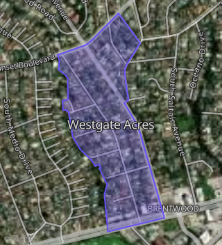
Boundary map of Brentwood.
Crime Index for 90049
117
The crime index in 90049 is 117, which is 1.2 times higher than national average.
Market Trends
Historical market data near 439 Bundy Dr over selected time period.
Nearby Properties on Bundy Dr
- 874 S Bundy Dr, Los Angeles, CA 90049 (Brentwood) is a 3,977 square foot, 4 bedroom, 5 bathroom, 0.18 acre property. It was built in 2007 and has an estimate of $3,453,151 with a price per ft² of $868.
- 1254 N Bundy Dr, Los Angeles, CA 90049 (Brentwood) is a 6,595 square foot, 5 bedroom, 6 bathroom, 0.61 acre property. It was built in 2005 and has an estimate of $5,821,230 with a price per ft² of $883.
- 1901 S Bundy Dr, Los Angeles, CA 90025 (Sawtelle) is a 30,000 square foot and 1.5 acre property.
- 230 N Bundy Dr, Los Angeles, CA 90049 (Brentwood) is a 2,141 square foot, 3 bedroom, 2 bathroom, 0.14 acre property. It was built in 1957 and has an estimate of $2,893,371 with a price per ft² of $1,351.
- 224 N Bundy Dr, Los Angeles, CA 90049 (Brentwood) is a 2,159 square foot, 3 bedroom, 2 bathroom, 0.13 acre property. It was built in 1959 and has an estimate of $2,768,169 with a price per ft² of $1,282.
- 250 N Bundy Dr, Los Angeles, CA 90049 (Brentwood) is a 2,166 square foot, 3 bedroom, 3 bathroom, 0.16 acre property. It was built in 1957 and has an estimate of $2,684,602 with a price per ft² of $1,239.
- 237 N Bundy Dr, Los Angeles, CA 90049 (Brentwood) is a 3,762 square foot, 4 bedroom, 4 bathroom, 0.14 acre property. It was built in 2003 and has an estimate of $4,616,820 with a price per ft² of $1,227.
- 231 N Bundy Dr, Los Angeles, CA 90049 (Brentwood) is a 3,766 square foot, 4 bedroom, 3 bathroom, 0.14 acre property. It was built in 1955 and has an estimate of $3,802,970 with a price per ft² of $1,010.
- 245 N Bundy Dr, Los Angeles, CA 90049 (Brentwood) is a 4,432 square foot, 5 bedroom, 5 bathroom, 0.15 acre property. It was built in 2013 and has an estimate of $6,175,148 with a price per ft² of $1,393.
- 218 N Bundy Dr, Los Angeles, CA 90049 (Brentwood) is a 2,022 square foot, 4 bedroom, 3 bathroom, 0.13 acre property. It was built in 1956 and has an estimate of $2,563,953 with a price per ft² of $1,268.
- 225 N Bundy Dr, Los Angeles, CA 90049 (Brentwood) is a 1,724 square foot, 3 bedroom, 2 bathroom, 0.17 acre property. It was built in 1948 and has an estimate of $3,160,416 with a price per ft² of $1,833.
- 251 N Bundy Dr, Los Angeles, CA 90049 (Brentwood) is a 1,886 square foot, 3 bedroom, 2 bathroom, 0.15 acre property. It was built in 1940 and has an estimate of $2,847,798 with a price per ft² of $1,510.
- 221 N Bundy Dr, Los Angeles, CA 90049 (Brentwood) is a 3,047 square foot, 5 bedroom, 5 bathroom, 0.14 acre property. It was built in 1985 and has an estimate of $3,220,466 with a price per ft² of $1,057.
- 1002 N Bundy Dr, Los Angeles, CA 90049 (Brentwood) is a 2,225 square foot, 3 bedroom, 2 bathroom, 0.65 acre property. It was built in 1964 and has an estimate of $3,030,528 with a price per ft² of $1,362.
- 1301 N Bundy Dr, Los Angeles, CA 90049 (Brentwood) is a 1,450 square foot, 2 bedroom, 2 bathroom, 0.13 acre property. It was built in 1953 and has an estimate of $2,195,958 with a price per ft² of $1,514.
- 750 S Bundy Dr #Apt 101, Los Angeles, CA 90049 (750 S Bundy Drive) is a 1,614 square foot, 2 bedroom, 3 bathroom, 0.04 acre property. It was built in 1983 and has an estimate of $1,855,989 with a price per ft² of $1,150.
- 750 S Bundy Dr #Apt 308, Los Angeles, CA 90049 (750 S Bundy Drive) is a 2,281 square foot, 2 bedroom, 3 bathroom, 0.05 acre property. It was built in 1989 and has an estimate of $1,915,630 with a price per ft² of $840.
- 1355 N Bundy Dr, Los Angeles, CA 90049 (Brentwood) is a 2,048 square foot, 3 bedroom, 2.25 bathroom, 0.42 acre property. It was built in 1962 and has an estimate of $3,641,777 with a price per ft² of $1,778.
- 415 S Bundy Dr, Los Angeles, CA 90049 (Westgate Acres) is a 1,704 square foot, 2 bedroom, 1 bathroom, 0.16 acre property. It was built in 1929 and has an estimate of $2,623,532 with a price per ft² of $1,540.
- 809 S Bundy Dr #Apt 106, Los Angeles, CA 90049 (809 S Bundy Drive) is a 1,427 square foot, 2 bedroom, 2 bathroom, 0.03 acre property. It was built in 1973 and has an estimate of $1,803,513 with a price per ft² of $1,264.
- 809 S Bundy Dr #Apt 112, Los Angeles, CA 90049 (809 S Bundy Drive) is a 1,488 square foot, 2 bedroom, 1.75 bathroom, 0.03 acre property. It was built in 1970 and has an estimate of $1,999,556 with a price per ft² of $1,344.
- 809 S Bundy Dr #Apt 116, Los Angeles, CA 90049 (809 S Bundy Drive) is a 1,300 square foot, 2 bedroom, 2 bathroom, 0.03 acre property. It was built in 1973 and has an estimate of $1,758,137 with a price per ft² of $1,352.
- 809 S Bundy Dr #Apt 204, Los Angeles, CA 90049 (809 S Bundy Drive) is a 1,030 square foot, 1 bedroom, 1 bathroom, 0.02 acre property. It was built in 1970 and has an estimate of $1,532,012 with a price per ft² of $1,487.
- 809 S Bundy Dr #Apt 207, Los Angeles, CA 90049 (809 S Bundy Drive) is a 1,642 square foot, 3 bedroom, 3 bathroom, 0.04 acre property. It was built in 1970 and has an estimate of $2,014,246 with a price per ft² of $1,227.
- 809 S Bundy Dr #Apt 209, Los Angeles, CA 90049 (809 S Bundy Drive) is a 1,350 square foot, 1 bedroom, 1 bathroom, 0.03 acre property. It was built in 1970 and has an estimate of $1,903,312 with a price per ft² of $1,410.
- View more properties on Bundy Dr