448 Alan Rd
Santa Barbara, CA 93109
- 3Beds
- 3Baths
- 1,747ft²Living Area
- 10,018ft²Lot Size
- -Pool
- -Car
- 2014Year Built
- -DOM
- 7Permits
Property Valuations
Latest estimates for 448 Alan Rd based on TopHap automated valuation model (AVM).
TopHap Estimate
$2,168,250
$1,241/ft²
-$724K below Sold Price
Updated 3 months ago
Last Sold Price
$2,892,500
$1,656/ft²
2 years ago
448 Alan Rd is valued at $2,168,250 by TopHap AVM 3 months ago.
448 Alan Rd was last sold in 2021 for $2,892,500.
Permits
448 Alan Rd has 7 permit records.
Current Ownership
Information about the current owner(s).
Taxes Billed
Taxes billed in 2023$31,895.62From latest Total Assessed Value1.06%Total Assessed Value$3,009,357=Land+
Assessed Value$1,352,520Additions
Assessed Value$1,656,837
In 2023, taxes billed for 448 Alan Rd were $31,895.62, which is 1.06% from latest Total Assessed Value of $3,009,357.
Property History
448 Alan Rd has undefined property events records (listings, deeds, permits, tax, foreclosure, loan).
Environment
Environmental factors around 448 Alan Rd
Hazard Risks
Earthquake413Nat'l Avg100Ozone100Particulates100Lead99Carb Mono95Air Pollution93Tornado8Weather5Hurricane2Wind1Hail0
11 hazards (Carbon Monoxide, Earthquake Risk, Tornado Index, Hurricane Index, Air Pollution Index, Ozone Index, Wind Index, Weather Risk, Lead Index, Particulate Matter, National Average) are above the national average around 448 Alan Rd.
Walkability Index
6 /20
Most Walkable
20-18
Very Walkable
17-15
Somewhat Walkable
14-10
Car Dependent
9-0
448 Alan Rd has a walkability score of 6 out of 20, which means that it is in a car dependent area.
Noise Level
37 dB
Quiet Suburban Residential 0-49
Suburban Residential 50-54
Urban Residential 55-59
Noisy Urban Residential 60-64
Very Noisy Urban Residential 65+
Noise at 448 Alan Rd is around 37dBs, which is comparable to a Quiet Suburban Residential area.
Temperature
Seasonal temperature sampled over multiple years
Winter
Average
Low
43°F
High
65°F
Summer
Average
Low
56°F
High
74°F
In the winter at 448 Alan Rd, temperatures range from 43.35°F to 64.7°F with an average of 54.03°F. In the summer, the temperature ranges from 55.85°F to 73.72°F with and average of 64.79°F.
School Information
Public/private schools serving 448 Alan Rd
Public Schools
Nearby public schools serving 448 Alan Rd have ratings undefined, undefined, and undefined.
Neighborhood
This property is located in Las Positas, Santa Barbara, CA 93109.
Seasonal Housing units 93109
46%of housing is for seasonal rent.
Daytime Population for 93109
-1%of people during work hours.
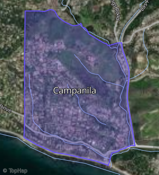
Boundary map of Las Positas.
Crime Index for 93109
116
The crime index in 93109 is 116, which is 1.2 times higher than national average.
Market Trends
Historical market data near 448 Alan Rd over selected time period.
Nearby Properties on Alan Rd
- 548 Alan Rd, Santa Barbara, CA 93109 (Campanila) is a 1,308 square foot, 4 bedroom, 3.25 bathroom, 0.24 acre property. It was built in 1956 and has an estimate of $1,624,512 with a price per ft² of $1,242.
- 542 Alan Rd, Santa Barbara, CA 93109 (Campanila) is a 1,344 square foot, 4 bedroom, 2 bathroom, 0.25 acre property. It was built in 1957 and has an estimate of $1,404,671 with a price per ft² of $1,045.
- 536 Alan Rd, Santa Barbara, CA 93109 (Campanila) is a 1,340 square foot, 4 bedroom, 2 bathroom, 0.27 acre property. It was built in 1958 and has an estimate of $1,402,292 with a price per ft² of $1,046.
- 530 Alan Rd, Santa Barbara, CA 93109 (Campanila) is a 1,826 square foot, 4 bedroom, 2 bathroom, 0.34 acre property. It was built in 1956 and has an estimate of $1,930,497 with a price per ft² of $1,057.
- 526 Alan Rd, Santa Barbara, CA 93109 (Campanila) is a 1,308 square foot, 4 bedroom, 3.25 bathroom, 0.31 acre property. It was built in 1956 and has an estimate of $1,363,686 with a price per ft² of $1,043.
- 479 Alan Rd, Santa Barbara, CA 93109 (Campanila) is a 1,177 square foot, 3 bedroom, 3.25 bathroom, 0.21 acre property. It was built in 1956 and has an estimate of $1,629,386 with a price per ft² of $1,384.
- 486 Alan Rd, Santa Barbara, CA 93109 (Campanila) is a 2,894 square foot, 5 bedroom, 3.25 bathroom, 0.17 acre property. It was built in 1956 and has an estimate of $2,150,813 with a price per ft² of $743.
- 478 Alan Rd, Santa Barbara, CA 93109 (Campanila) is a 1,700 square foot, 4 bedroom, 2 bathroom, 0.18 acre property. It was built in 1957 and has an estimate of $1,681,605 with a price per ft² of $989.
- 474 Alan Rd, Santa Barbara, CA 93109 (Campanila) is a 1,344 square foot, 4 bedroom, 2 bathroom, 0.2 acre property. It was built in 1957 and has an estimate of $1,287,751 with a price per ft² of $958.
- 470 Alan Rd, Santa Barbara, CA 93109 (Campanila) is a 1,293 square foot, 4 bedroom, 2 bathroom, 0.23 acre property. It was built in 1956 and has an estimate of $1,344,364 with a price per ft² of $1,040.
- 464 Alan Rd, Santa Barbara, CA 93109 (Campanila) is a 1,300 square foot, 3 bedroom, 2 bathroom, 0.19 acre property. It was built in 1956 and has an estimate of $985,573 with a price per ft² of $758.
- 458 Alan Rd, Santa Barbara, CA 93109 (Campanila) is a 1,336 square foot, 3 bedroom, 2 bathroom, 0.18 acre property. It was built in 1958 and has an estimate of $1,250,372 with a price per ft² of $936.
- 444 Alan Rd, Santa Barbara, CA 93109 (Campanila) is a 1,369 square foot, 3 bedroom, 3.25 bathroom, 0.25 acre property. It was built in 1957 and has an estimate of $1,640,954 with a price per ft² of $1,199.
- 440 Alan Rd, Santa Barbara, CA 93109 (Campanila) is a 2,254 square foot, 5 bedroom, 4.25 bathroom, 0.24 acre property. It was built in 1956 and has an estimate of $2,200,107 with a price per ft² of $976.
- 436 Alan Rd, Santa Barbara, CA 93109 (Campanila) is a 1,326 square foot, 4 bedroom, 2 bathroom, 0.24 acre property. It was built in 1956 and has an estimate of $1,471,496 with a price per ft² of $1,110.
- 422 Alan Rd, Santa Barbara, CA 93109 (Campanila) is a 2,558 square foot, 3 bedroom, 3.25 bathroom, 0.42 acre property. It was built in 1980 and has an estimate of $2,633,245 with a price per ft² of $1,029.
- 406 Alan Rd, Santa Barbara, CA 93109 (Campanila) is a 2,580 square foot, 4 bedroom, 3.25 bathroom, 0.42 acre property. It was built in 1980 and has an estimate of $3,013,819 with a price per ft² of $1,168.
- 415 Alan Rd, Santa Barbara, CA 93109 (Campanila) is a 3,375 square foot, 4 bedroom, 5 bathroom, 1.03 acre property. It was built in 1977 and has an estimate of $4,947,263 with a price per ft² of $1,466.
- 425 Alan Rd, Santa Barbara, CA 93109 (Campanila) is a 2,217 square foot, 3 bedroom, 4.25 bathroom, 0.33 acre property. It was built in 2019 and has an estimate of $2,432,000 with a price per ft² of $1,097.
- View more properties on Alan Rd