4663 Tajo Dr
Santa Barbara, CA 93110
- 4Beds
- 2Baths
- 1,402ft²Living Area
- 6,969ft²Lot Size
- -Pool
- -Car
- 1961Year Built
- -DOM
- -Permit
Property Valuations
Latest estimates for 4663 Tajo Dr based on TopHap automated valuation model (AVM).
TopHap Estimate
$1,576,000
$1,124/ft²
+$897K above Sold Price
Updated 3 months ago
Last Sold Price
$679,000
$484/ft²
9 years ago
4663 Tajo Dr is valued at $1,576,000 by TopHap AVM 3 months ago.
4663 Tajo Dr was last sold in 2015 for $679,000.
Current Ownership
Information about the current owner(s).
Taxes Billed
Taxes billed in 2023$8,804.54From latest Total Assessed Value1.12%Total Assessed Value$784,361=Land+
Assessed Value$462,070Additions
Assessed Value$322,291
In 2023, taxes billed for 4663 Tajo Dr were $8,804.54, which is 1.12% from latest Total Assessed Value of $784,361.
Property History
4663 Tajo Dr has undefined property events records (listings, deeds, permits, tax, foreclosure, loan).
Environment
Environmental factors around 4663 Tajo Dr
Hazard Risks
Earthquake450Lead101Particulates101Nat'l Avg100Ozone98Air Pollution96Carb Mono85Tornado5Weather3Hurricane2Wind1Hail0
11 hazards (Carbon Monoxide, Earthquake Risk, Tornado Index, Hurricane Index, Air Pollution Index, Ozone Index, Wind Index, Weather Risk, Lead Index, Particulate Matter, National Average) are above the national average around 4663 Tajo Dr.
Walkability Index
9 /20
Most Walkable
20-18
Very Walkable
17-15
Somewhat Walkable
14-10
Car Dependent
9-0
4663 Tajo Dr has a walkability score of 9 out of 20, which means that it is in a car dependent area.
Noise Level
45 dB
Quiet Suburban Residential 0-49
Suburban Residential 50-54
Urban Residential 55-59
Noisy Urban Residential 60-64
Very Noisy Urban Residential 65+
Noise at 4663 Tajo Dr is around 45dBs, which is comparable to a Quiet Suburban Residential area.
Temperature
Seasonal temperature sampled over multiple years
Winter
Average
Low
39°F
High
58°F
Summer
Average
Low
55°F
High
81°F
In the winter at 4663 Tajo Dr, temperatures range from 39.08°F to 58.42°F with an average of 48.75°F. In the summer, the temperature ranges from 54.73°F to 80.82°F with and average of 67.78°F.
School Information
Public/private schools serving 4663 Tajo Dr
Public Schools
Nearby public schools serving 4663 Tajo Dr have ratings undefined, undefined, and undefined.
Neighborhood
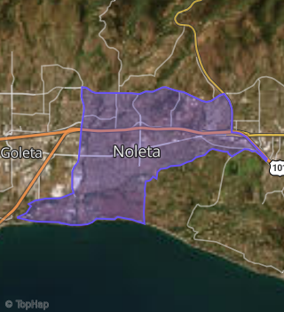
This property is located in Noleta, Santa Barbara, CA 93110.
Seasonal Housing units 93110
32%of housing is for seasonal rent.
Daytime Population for 93110
+1%of people during work hours.
Boundary map of Noleta.
Crime Index for 93110
104
The crime index in 93110 is 104, which is 1.0 times higher than national average.
Market Trends
Historical market data near 4663 Tajo Dr over selected time period.
Nearby Properties on Tajo Dr
- 4689 Tajo Dr, Santa Barbara, CA 93110 (Noleta) is a 1,402 square foot, 4 bedroom, 2 bathroom, 0.22 acre property. It was built in 1960 and has an estimate of $1,175,524 with a price per ft² of $838.
- 4680 Tajo Dr, Santa Barbara, CA 93110 (Noleta) is a 1,400 square foot, 4 bedroom, 2 bathroom, 0.15 acre property. It was built in 1961 and has an estimate of $1,289,817 with a price per ft² of $921.
- 4676 Tajo Dr, Santa Barbara, CA 93110 (Noleta) is a 1,862 square foot, 4 bedroom, 2 bathroom, 0.16 acre property. It was built in 1961 and has an estimate of $1,187,175 with a price per ft² of $638.
- 4670 Tajo Dr, Santa Barbara, CA 93110 (Noleta) is a 1,686 square foot, 3 bedroom, 2 bathroom, 0.16 acre property. It was built in 1961 and has an estimate of $1,241,512 with a price per ft² of $736.
- 4626 Tajo Dr, Santa Barbara, CA 93110 (Noleta) is a 1,224 square foot, 3 bedroom, 2 bathroom, 0.16 acre property. It was built in 1961 and has an estimate of $1,227,135 with a price per ft² of $1,003.
- View more properties on Tajo Dr