483 Lori Dr
Benicia, CA 94510
- 3Beds
- 2Baths
- 1,579ft²Living Area
- 7,405ft²Lot Size
- -Pool
- 2Car
- 1978Year Built
- -DOM
- -Permit
Property Valuations
Latest estimates for 483 Lori Dr based on TopHap automated valuation model (AVM).
TopHap Estimate
$837,250
$530/ft²
+$637K above Sold Price
Updated 3 months ago
Last Sold Price
$200,000
$127/ft²
25 years ago
483 Lori Dr is valued at $837,250 by TopHap AVM 3 months ago.
483 Lori Dr was last sold in 1998 for $200,000.
Current Ownership
Information about the current owner(s).
Taxes Billed
Taxes billed in 2022$3,443.04From latest Total Assessed Value1.14%Total Assessed Value$301,362=Land+
Assessed Value$97,942Additions
Assessed Value$203,420
In 2022, taxes billed for 483 Lori Dr were $3,443.04, which is 1.14% from latest Total Assessed Value of $301,362.
Property History
483 Lori Dr has undefined property events records (listings, deeds, permits, tax, foreclosure, loan).
Environment
Environmental factors around 483 Lori Dr
Hazard Risks
Earthquake475Nat'l Avg100Particulates92Carb Mono90Air Pollution85Ozone84Lead42Tornado6Hail2Weather1Hurricane0Wind0
10 hazards (Carbon Monoxide, Earthquake Risk, Hail Index, Tornado Index, Air Pollution Index, Ozone Index, Weather Risk, Lead Index, Particulate Matter, National Average) are above the national average around 483 Lori Dr.
Walkability Index
12 /20
Most Walkable
20-18
Very Walkable
17-15
Somewhat Walkable
14-10
Car Dependent
9-0
483 Lori Dr has a walkability score of 12 out of 20, which means that it is in a somewhat walkable area.
Noise Level
53 dB
Quiet Suburban Residential 0-49
Suburban Residential 50-54
Urban Residential 55-59
Noisy Urban Residential 60-64
Very Noisy Urban Residential 65+
Noise at 483 Lori Dr is around 53dBs, which is comparable to a Suburban Residential area.
Temperature
Seasonal temperature sampled over multiple years
Winter
Average
Low
39°F
High
57°F
Summer
Average
Low
54°F
High
83°F
In the winter at 483 Lori Dr, temperatures range from 39.4°F to 56.97°F with an average of 48.19°F. In the summer, the temperature ranges from 54.32°F to 83.43°F with and average of 68.88°F.
School Information
Public/private schools serving 483 Lori Dr
Public Schools
Nearby public schools serving 483 Lori Dr have ratings undefined, undefined, and undefined.
Neighborhood
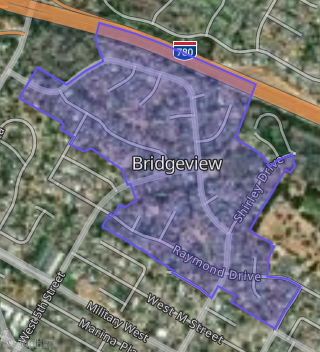
This property is located in Bridgeview, Benicia, CA 94510.
Seasonal Housing units 94510
14%of housing is for seasonal rent.
Daytime Population for 94510
+3%of people during work hours.
Boundary map of Bridgeview.
Crime Index for 94510
74
The crime index in 94510 is 74, which is 0.7 times lower than national average.
Market Trends
Historical market data near 483 Lori Dr over selected time period.
Nearby Properties on Lori Dr
- 529 Lori Dr, Benicia, CA 94510 (Bridgeview) is a 1,531 square foot, 4 bedroom, 3 bathroom, 0.15 acre property. It was built in 1980 and has an estimate of $1,079,514 with a price per ft² of $705.
- 531 Lori Dr, Benicia, CA 94510 (Bridgeview) is a 1,835 square foot, 4 bedroom, 3 bathroom, 0.15 acre property. It was built in 1978 and has an estimate of $1,066,147 with a price per ft² of $581.
- 537 Lori Dr, Benicia, CA 94510 (Bridgeview) is a 1,835 square foot, 4 bedroom, 3 bathroom, 0.18 acre property. It was built in 1978 and has an estimate of $1,021,287 with a price per ft² of $557.
- 545 Lori Dr, Benicia, CA 94510 (Bridgeview) is a 2,014 square foot, 4 bedroom, 3 bathroom, 0.21 acre property. It was built in 1978 and has an estimate of $1,092,244 with a price per ft² of $542.
- 570 Lori Dr, Benicia, CA 94510 (Bridgeview) is a 1,312 square foot, 3 bedroom, 2 bathroom, 0.29 acre property. It was built in 1978 and has an estimate of $955,323 with a price per ft² of $728.
- 566 Lori Dr, Benicia, CA 94510 (Bridgeview) is a 2,497 square foot, 4 bedroom, 3 bathroom, 0.2 acre property. It was built in 1978 and has an estimate of $1,304,592 with a price per ft² of $522.
- 562 Lori Dr, Benicia, CA 94510 (Bridgeview) is a 1,531 square foot, 4 bedroom, 3 bathroom, 0.16 acre property. It was built in 1978 and has an estimate of $902,996 with a price per ft² of $590.
- 554 Lori Dr, Benicia, CA 94510 (Bridgeview) is a 1,531 square foot, 4 bedroom, 3 bathroom, 0.16 acre property. It was built in 1978 and has an estimate of $899,919 with a price per ft² of $588.
- 550 Lori Dr, Benicia, CA 94510 (Bridgeview) is a 2,014 square foot, 4 bedroom, 3 bathroom, 0.16 acre property. It was built in 1978 and has an estimate of $1,082,238 with a price per ft² of $537.
- 565 Lori Dr #Apt 50, Benicia, CA 94510 (Bridgeview Heights) is a 873 square foot, 2 bedroom, 2 bathroom, 0.02 acre property. It was built in 1983 and has an estimate of $509,587 with a price per ft² of $584.
- 565 Lori Dr #Apt 62, Benicia, CA 94510 (Bridgeview Heights) is a 873 square foot, 2 bedroom, 2 bathroom, 0.02 acre property. It was built in 1983 and has an estimate of $500,938 with a price per ft² of $574.
- 565 Lori Dr #Apt 66, Benicia, CA 94510 (Bridgeview Heights) is a 939 square foot, 2 bedroom, 2 bathroom, 0.02 acre property. It was built in 1984 and has an estimate of $523,110 with a price per ft² of $557.
- 565 Lori Dr #Apt 72, Benicia, CA 94510 (Bridgeview Heights) is a 873 square foot, 2 bedroom, 2 bathroom, 0.02 acre property. It was built in 1983 and has an estimate of $530,842 with a price per ft² of $608.
- 565 Lori Dr #Apt 45, Benicia, CA 94510 (Bridgeview Heights) is a 873 square foot, 2 bedroom, 2 bathroom, 0.02 acre property. It was built in 1983 and has an estimate of $502,416 with a price per ft² of $576.
- 565 Lori Dr #Apt 49, Benicia, CA 94510 (Bridgeview Heights) is a 873 square foot, 2 bedroom, 2 bathroom, 0.02 acre property. It was built in 1983 and has an estimate of $512,356 with a price per ft² of $587.
- 565 Lori Dr #Apt 51, Benicia, CA 94510 (Bridgeview Heights) is a 939 square foot, 2 bedroom, 2 bathroom, 0.02 acre property. It was built in 1983 and has an estimate of $543,579 with a price per ft² of $579.
- 565 Lori Dr #Apt 55, Benicia, CA 94510 (Bridgeview Heights) is a 873 square foot, 2 bedroom, 2 bathroom, 0.02 acre property. It was built in 1983 and has an estimate of $510,878 with a price per ft² of $585.
- 565 Lori Dr #Apt 63, Benicia, CA 94510 (Bridgeview Heights) is a 641 square foot, 1 bedroom, 1 bathroom, 0.01 acre property. It was built in 1982 and has an estimate of $365,423 with a price per ft² of $570.
- 565 Lori Dr #Apt 67, Benicia, CA 94510 (Bridgeview Heights) is a 873 square foot, 2 bedroom, 2 bathroom, 0.02 acre property. It was built in 1984 and has an estimate of $493,301 with a price per ft² of $565.
- 565 Lori Dr #Apt 69, Benicia, CA 94510 (Bridgeview Heights) is a 873 square foot, 2 bedroom, 2 bathroom, 0.02 acre property. It was built in 1983 and has an estimate of $501,502 with a price per ft² of $574.
- 565 Lori Dr #Apt 73, Benicia, CA 94510 (Bridgeview Heights) is a 873 square foot, 2 bedroom, 2 bathroom, 0.02 acre property. It was built in 1983 and has an estimate of $508,889 with a price per ft² of $583.
- 565 Lori Dr #Apt 75, Benicia, CA 94510 (Bridgeview Heights) is a 939 square foot, 2 bedroom, 2 bathroom, 0.02 acre property. It was built in 1983 and has an estimate of $537,214 with a price per ft² of $572.
- 565 Lori Dr #Apt 79, Benicia, CA 94510 (Bridgeview Heights) is a 873 square foot, 2 bedroom, 2 bathroom, 0.02 acre property. It was built in 1983 and has an estimate of $521,547 with a price per ft² of $597.
- 565 Lori Dr #Apt 4, Benicia, CA 94510 (Bridgeview Heights) is a 939 square foot, 2 bedroom, 2 bathroom, 0.02 acre property. It was built in 1983 and has an estimate of $548,302 with a price per ft² of $584.
- 565 Lori Dr #Apt 6, Benicia, CA 94510 (Bridgeview Heights) is a 641 square foot, 1 bedroom, 1 bathroom, 0.01 acre property. It was built in 1982 and has an estimate of $377,616 with a price per ft² of $589.
- View more properties on Lori Dr