5303 Olive Dr
Bakersfield, CA 93308
- -Bed
- -Bath
- -Living Area
- 0.9acLot Size
- -Pool
- -Car
- -Year Built
- -DOM
- 11Permits
Permits
5303 Olive Dr has 11 permit records of total value of $3,000.
Current Ownership
Information about the current owner(s).
Taxes Billed
Taxes billed in 2023$9,529.04From latest Total Assessed Value1.47%Total Assessed Value$649,808=Land+
Assessed Value$340,375Additions
Assessed Value$309,433
In 2023, taxes billed for 5303 Olive Dr were $9,529.04, which is 1.47% from latest Total Assessed Value of $649,808.
Property History
5303 Olive Dr has undefined property events records (listings, deeds, permits, tax, foreclosure, loan).
Environment
Environmental factors around 5303 Olive Dr
Hazard Risks
Earthquake206Particulates110Nat'l Avg100Air Pollution99Ozone97Carb Mono90Lead82Wind3Hurricane2Weather2Hail1Tornado1
12 hazards (Carbon Monoxide, Earthquake Risk, Hail Index, Tornado Index, Hurricane Index, Air Pollution Index, Ozone Index, Wind Index, Weather Risk, Lead Index, Particulate Matter, National Average) are above the national average around 5303 Olive Dr.
Walkability Index
8 /20
Most Walkable
20-18
Very Walkable
17-15
Somewhat Walkable
14-10
Car Dependent
9-0
5303 Olive Dr has a walkability score of 8 out of 20, which means that it is in a car dependent area.
Temperature
Seasonal temperature sampled over multiple years
Winter
Average
Low
38°F
High
59°F
Summer
Average
Low
63°F
High
94°F
In the winter at 5303 Olive Dr, temperatures range from 37.96°F to 58.7°F with an average of 48.33°F. In the summer, the temperature ranges from 62.99°F to 93.54°F with and average of 78.27°F.
School Information
Public/private schools serving 5303 Olive Dr
Public Schools
Nearby public schools serving 5303 Olive Dr have ratings undefined, undefined, and undefined.
Neighborhood
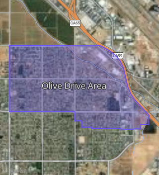
This property is located in Olive Drive Area, Bakersfield, CA 93308.
Seasonal Housing units 93308
33%of housing is for seasonal rent.
Daytime Population for 93308
+13%of people during work hours.
Boundary map of Olive Drive Area.
Crime Index for 93308
127
The crime index in 93308 is 127, which is 1.3 times higher than national average.
Market Trends
Historical market data near 5303 Olive Dr over selected time period.
Nearby Properties on Olive Dr
- 7313 Olive Dr, Bakersfield, CA 93308 (Fruitvale) is a 1,620 square foot, 3 bedroom, 1.75 bathroom, 0.35 acre property. It was built in 1971 and has an estimate of $402,073 with a price per ft² of $248.
- 7307 Olive Dr, Bakersfield, CA 93308 (Fruitvale) is a 2,151 square foot, 3 bedroom, 1.75 bathroom, 0.35 acre property. It was built in 1968 and has an estimate of $430,330 with a price per ft² of $200.
- 7009 Olive Dr, Bakersfield, CA 93308 (Fruitvale) is a 2,057 square foot, 3 bedroom, 2.5 bathroom, 0.26 acre property. It was built in 1974 and has an estimate of $419,783 with a price per ft² of $217.
- 930 Olive Dr #Apt 10, Bakersfield, CA 93308 (Oildale) is a 1,276 square foot, 3 bedroom, 2.25 bathroom, 0.04 acre property. It was built in 1976 and has an estimate of $158,744 with a price per ft² of $124.
- 930 Olive Dr #Apt 11, Bakersfield, CA 93308 (Oildale) is a 960 square foot, 2 bedroom, 1 bathroom, 0.04 acre property. It was built in 1976 and has an estimate of $151,671 with a price per ft² of $158.
- 930 Olive Dr #Apt 13, Bakersfield, CA 93308 (Oildale) is a 1,544 square foot, 3 bedroom, 1 bathroom, 0.04 acre property. It was built in 1977 and has an estimate of $196,562 with a price per ft² of $127.
- 930 Olive Dr #Apt 21, Bakersfield, CA 93308 (Oildale) is a 1,544 square foot, 4 bedroom, 2 bathroom, 0.04 acre property. It was built in 1976 and has an estimate of $177,497 with a price per ft² of $115.
- 930 Olive Dr #Apt 27, Bakersfield, CA 93308 (Oildale) is a 960 square foot, 2 bedroom, 1 bathroom, 0.04 acre property. It was built in 1976 and has an estimate of $145,086 with a price per ft² of $151.
- 930 Olive Dr #Apt 29, Bakersfield, CA 93308 (Oildale) is a 1,276 square foot, 3 bedroom, 2.5 bathroom, 0.03 acre property. It was built in 1977 and has an estimate of $165,919 with a price per ft² of $130.
- 930 Olive Dr #Apt 33, Bakersfield, CA 93308 (Oildale) is a 1,276 square foot, 3 bedroom, 2 bathroom, 0.04 acre property. It was built in 1977 and has an estimate of $170,072 with a price per ft² of $133.
- 930 Olive Dr #Apt 36, Bakersfield, CA 93308 (Oildale) is a 1,276 square foot, 3 bedroom, 2.5 bathroom, 0.03 acre property. It was built in 1977 and has an estimate of $174,304 with a price per ft² of $137.
- 930 Olive Dr #Apt 40, Bakersfield, CA 93308 (Oildale) is a 960 square foot, 2 bedroom, 1 bathroom, 0.04 acre property. It was built in 1977 and has an estimate of $146,805 with a price per ft² of $153.
- 930 Olive Dr #Apt 45, Bakersfield, CA 93308 (Oildale) is a 1,276 square foot, 3 bedroom, 2.5 bathroom, 0.04 acre property. It was built in 1977 and has an estimate of $174,318 with a price per ft² of $137.
- 930 Olive Dr #Apt 50, Bakersfield, CA 93308 (Oildale) is a 1,276 square foot, 3 bedroom, 2.5 bathroom, 0.04 acre property. It was built in 1977 and has an estimate of $167,234 with a price per ft² of $131.
- 1000 Olive Dr #Apt 1, Bakersfield, CA 93308 (Oildale) is a 1,234 square foot, 2 bedroom, 1.75 bathroom, 0.06 acre property. It was built in 1981 and has an estimate of $177,630 with a price per ft² of $144.
- 1000 Olive Dr #Apt 7, Bakersfield, CA 93308 (Oildale) is a 1,234 square foot, 2 bedroom, 1.75 bathroom, 0.06 acre property. It was built in 1981 and has an estimate of $177,755 with a price per ft² of $144.
- 1000 Olive Dr #Apt 5, Bakersfield, CA 93308 (Oildale) is a 1,234 square foot, 2 bedroom, 2 bathroom, 0.04 acre property. It was built in 1981 and has an estimate of $183,521 with a price per ft² of $149.
- 1000 Olive Dr #Apt 9, Bakersfield, CA 93308 (Oildale) is a 1,234 square foot, 2 bedroom, 1.75 bathroom, 0.06 acre property. It was built in 1981 and has an estimate of $179,196 with a price per ft² of $145.
- 1129 Olive Dr, Bakersfield, CA 93308 (Oildale) is a 23,600 square foot and 1.83 acre property.
- 1115 Olive Dr, Bakersfield, CA 93308 (Oildale) is a 12,680 square foot and 1.38 acre property.
- 1211 Olive Dr, Bakersfield, CA 93308 (Oildale) is a 0.94 acre property.
- 1223 Olive Dr, Bakersfield, CA 93308 (Oildale) is a 1,942 square foot and 0.2 acre property.
- 1215 Olive Dr, Bakersfield, CA 93308 (Oildale) is a 8,378 square foot and 0.65 acre property.
- 1107 Olive Dr, Bakersfield, CA 93308 (Oildale) is a 8,250 square foot and 0.53 acre property.
- 1211 Olive Dr, Bakersfield, CA 93308 (Oildale) is a 29,565 square foot and 1.29 acre property.
- View more properties on Olive Dr