533 Oxford St
Philadelphia, PA 19122
- 5Beds
- 1Bath
- 2,117ft²Living Area
- 1,196ft²Lot Size
- -Pool
- -Car
- 1920Year Built
- -DOM
- 1Permit
Property Valuations
Latest estimates for 533 Oxford St based on TopHap automated valuation model (AVM).
TopHap Estimate
$414,878
$195/ft²
+$165K above Sold Price
Updated 3 months ago
Last Sold Price
$250,000
$118/ft²
6 years ago
533 Oxford St is valued at $414,878 by TopHap AVM 3 months ago.
533 Oxford St was last sold in 2017 for $250,000.
Permits
533 Oxford St has 1 permit records.
Current Ownership
Information about the current owner(s).
Taxes Billed
Taxes billed in 2023$2,904.59From latest Total Assessed Value1.01%Total Assessed Value$287,500=Land+
Assessed Value$0Additions
Assessed Value$0
In 2023, taxes billed for 533 Oxford St were $2,904.59, which is 1.01% from latest Total Assessed Value of $287,500.
Property History
533 Oxford St has undefined property events records (listings, deeds, permits, tax, foreclosure, loan).
Environment
Environmental factors around 533 Oxford St
Hazard Risks
Wind259Hail113Weather112Particulates108Hurricane104Nat'l Avg100Tornado98Ozone97Air Pollution95Carb Mono80Earthquake72Lead55
12 hazards (Carbon Monoxide, Earthquake Risk, Hail Index, Tornado Index, Hurricane Index, Air Pollution Index, Ozone Index, Wind Index, Weather Risk, Lead Index, Particulate Matter, National Average) are above the national average around 533 Oxford St.
Walkability Index
17 /20
Most Walkable
20-18
Very Walkable
17-15
Somewhat Walkable
14-10
Car Dependent
9-0
533 Oxford St has a walkability score of 17 out of 20, which means that it is in a very walkable area.
Temperature
Seasonal temperature sampled over multiple years
Winter
Average
Low
27°F
High
42°F
Summer
Average
Low
66°F
High
85°F
In the winter at 533 Oxford St, temperatures range from 27.36°F to 42.43°F with an average of 34.9°F. In the summer, the temperature ranges from 65.61°F to 84.8°F with and average of 75.21°F.
School Information
Public/private schools serving 533 Oxford St
Public Schools
Nearby public schools serving 533 Oxford St have ratings undefined, and undefined.
Neighborhood
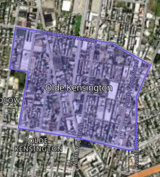
This property is located in Olde Kensington, Philadelphia, PA 19122.
Seasonal Housing units 19122
6%of housing is for seasonal rent.
Daytime Population for 19122
-8%of people during work hours.
Boundary map of Olde Kensington.
Crime Index for 19122
135
The crime index in 19122 is 135, which is 1.4 times higher than national average.
Market Trends
Historical market data near 533 Oxford St over selected time period.
Nearby Properties on Oxford St
- 170 W Oxford St, Philadelphia, PA 19122 (Olde Kensington) is a 1,287 square foot, 3 bedroom, 2 bathroom, 0.01 acre property. It was built in 1925 and has an estimate of $357,000 with a price per ft² of $277.
- 158 W Oxford St, Philadelphia, PA 19122 (Olde Kensington) is a 1,230 square foot, 3 bedroom, 1 bathroom, 0.02 acre property. It was built in 1925 and has an estimate of $374,250 with a price per ft² of $304.
- 172 W Oxford St, Philadelphia, PA 19122 (Olde Kensington) is a 1,176 square foot, 3 bedroom, 1 bathroom, 0.02 acre property. It was built in 1925 and has an estimate of $330,250 with a price per ft² of $281.
- 156 W Oxford St, Philadelphia, PA 19122 (Olde Kensington) is a 1,276 square foot, 3 bedroom, 1 bathroom, 0.02 acre property. It was built in 1920 and has an estimate of $345,750 with a price per ft² of $271.
- 2049 W Oxford St, Philadelphia, PA 19121 (Stanton) is a 1,230 square foot, 6 bedroom, 1 bathroom, 0.03 acre property. It was built in 1915 and has an estimate of $205,095 with a price per ft² of $167.
- 2043 W Oxford St, Philadelphia, PA 19121 (Stanton) is a 1,231 square foot, 3 bedroom, 1 bathroom, 0.03 acre property. It was built in 1915 and has an estimate of $125,235 with a price per ft² of $102.
- 2037 W Oxford St, Philadelphia, PA 19121 (Stanton) is a 2,384 square foot, 5 bedroom, 5 bathroom, 0.02 acre property.
- 6115 W Oxford St, Philadelphia, PA 19151 (Overbrook) is a 2,256 square foot and 0.09 acre property. It was built in 1925 and has an estimate of $365,769 with a price per ft² of $162.
- 6117 W Oxford St, Philadelphia, PA 19151 (Overbrook) is a 2,256 square foot and 0.09 acre property. It was built in 1925 and has an estimate of $288,819 with a price per ft² of $128.
- 223 W Oxford St, Philadelphia, PA 19122 (Olde Kensington) is a 900 square foot, 3 bedroom, 2 bathroom, 0.01 acre property. It was built in 1920 and has an estimate of $312,250 with a price per ft² of $347.
- 5352 W Oxford St, Philadelphia, PA 19131 (Wynnefield) is a 1,152 square foot, 3 bedroom, 1 bathroom, 0.03 acre property. It was built in 1925 and has an estimate of $172,678 with a price per ft² of $150.
- 2700 W Oxford St, Philadelphia, PA 19121 (Brewerytown) is a 1,692 square foot, 7 bedroom, 3 bathroom, 0.02 acre property. It was built in 1920 and has an estimate of $357,250 with a price per ft² of $211.
- 5550 W Oxford St, Philadelphia, PA 19131 (Overbrook) is a 1,230 square foot, 3 bedroom, 1 bathroom, 0.06 acre property. It was built in 1910 and has an estimate of $132,301 with a price per ft² of $108.
- 6146 W Oxford St, Philadelphia, PA 19151 (Overbrook) is a 2,256 square foot and 0.05 acre property. It was built in 1925 and has an estimate of $439,900 with a price per ft² of $195.
- 6148 W Oxford St, Philadelphia, PA 19151 (Overbrook) is a 2,256 square foot and 0.05 acre property.
- 6144 W Oxford St, Philadelphia, PA 19151 (Overbrook) is a 2,256 square foot and 0.05 acre property.
- 6138 W Oxford St, Philadelphia, PA 19151 (Overbrook) is a 2,256 square foot and 0.05 acre property.
- 6134 W Oxford St, Philadelphia, PA 19151 (Overbrook) is a 2,256 square foot and 0.05 acre property.
- 6132 W Oxford St, Philadelphia, PA 19151 (Overbrook) is a 2,256 square foot and 0.05 acre property.
- 6123 W Oxford St, Philadelphia, PA 19151 (Overbrook) is a 2,782 square foot and 0.09 acre property.
- 6124 W Oxford St, Philadelphia, PA 19151 (Overbrook) is a 2,256 square foot and 0.05 acre property.
- 1124 W Oxford St, Philadelphia, PA 19122 (Templetown) is a 1,350 square foot, 1 bathroom, 0.04 acre property. It was built in 1920 and has an estimate of $206,195 with a price per ft² of $153.
- 1126 W Oxford St, Philadelphia, PA 19122 (Templetown) is a 1,350 square foot, 1 bathroom, 0.04 acre property. It was built in 1920 and has an estimate of $206,195 with a price per ft² of $153.
- 1122 W Oxford St, Philadelphia, PA 19122 (Templetown) is a 1,350 square foot, 1 bathroom, 0.04 acre property. It was built in 1920 and has an estimate of $289,628 with a price per ft² of $215.
- 1128 W Oxford St, Philadelphia, PA 19122 (Templetown) is a 1,350 square foot, 1 bathroom, 0.04 acre property. It was built in 1920 and has an estimate of $206,195 with a price per ft² of $153.
- View more properties on Oxford St