542 Cooper Dr
Benicia, CA 94510
- 4Beds
- 3Baths
- 2,714ft²Living Area
- 10,890ft²Lot Size
- -Pool
- 2Car
- 1980Year Built
- -DOM
- -Permit
Property Valuations
Latest estimates for 542 Cooper Dr based on TopHap automated valuation model (AVM).
TopHap Estimate
$961,250
$354/ft²
+$727K above Sold Price
Updated 3 months ago
Last Sold Price
$234,000
$86/ft²
31 years ago
542 Cooper Dr is valued at $961,250 by TopHap AVM 3 months ago.
542 Cooper Dr was last sold in 1992 for $234,000.
Current Ownership
Information about the current owner(s).
Taxes Billed
Taxes billed in 2022$4,475.86From latest Total Assessed Value1.15%Total Assessed Value$389,927=Land+
Assessed Value$108,310Additions
Assessed Value$281,617
In 2022, taxes billed for 542 Cooper Dr were $4,475.86, which is 1.15% from latest Total Assessed Value of $389,927.
Property History
542 Cooper Dr has undefined property events records (listings, deeds, permits, tax, foreclosure, loan).
Environment
Environmental factors around 542 Cooper Dr
Hazard Risks
Earthquake475Nat'l Avg100Particulates92Carb Mono90Air Pollution85Ozone84Lead42Tornado6Hail2Weather1Hurricane0Wind0
10 hazards (Carbon Monoxide, Earthquake Risk, Hail Index, Tornado Index, Air Pollution Index, Ozone Index, Weather Risk, Lead Index, Particulate Matter, National Average) are above the national average around 542 Cooper Dr.
Walkability Index
11 /20
Most Walkable
20-18
Very Walkable
17-15
Somewhat Walkable
14-10
Car Dependent
9-0
542 Cooper Dr has a walkability score of 11 out of 20, which means that it is in a somewhat walkable area.
Noise Level
40 dB
Quiet Suburban Residential 0-49
Suburban Residential 50-54
Urban Residential 55-59
Noisy Urban Residential 60-64
Very Noisy Urban Residential 65+
Noise at 542 Cooper Dr is around 40dBs, which is comparable to a Quiet Suburban Residential area.
Temperature
Seasonal temperature sampled over multiple years
Winter
Average
Low
39°F
High
57°F
Summer
Average
Low
54°F
High
83°F
In the winter at 542 Cooper Dr, temperatures range from 39.4°F to 56.97°F with an average of 48.19°F. In the summer, the temperature ranges from 54.32°F to 83.43°F with and average of 68.88°F.
School Information
Public/private schools serving 542 Cooper Dr
Public Schools
Nearby public schools serving 542 Cooper Dr have ratings undefined, undefined, and undefined.
Neighborhood
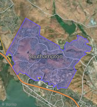
This property is located in Southampton, Benicia, CA 94510.
Seasonal Housing units 94510
14%of housing is for seasonal rent.
Daytime Population for 94510
+3%of people during work hours.
Boundary map of Southampton.
Crime Index for 94510
74
The crime index in 94510 is 74, which is 0.7 times lower than national average.
Market Trends
Historical market data near 542 Cooper Dr over selected time period.
Nearby Properties on Cooper Dr
- 558 Cooper Dr, Benicia, CA 94510 (Southampton) is a 2,089 square foot, 4 bedroom, 3 bathroom, 0.23 acre property. It was built in 1980 and has an estimate of $826,900 with a price per ft² of $396.
- 573 Cooper Dr, Benicia, CA 94510 (Southampton) is a 2,948 square foot, 4 bedroom, 2.5 bathroom, 0.2 acre property. It was built in 1980 and has an estimate of $1,016,766 with a price per ft² of $345.
- 510 Cooper Dr, Benicia, CA 94510 (Southampton) is a 2,714 square foot, 4 bedroom, 3 bathroom, 0.24 acre property. It was built in 1980 and has an estimate of $1,070,159 with a price per ft² of $394.
- 565 Cooper Dr, Benicia, CA 94510 (Southampton) is a 2,178 square foot, 4 bedroom, 3 bathroom, 0.17 acre property. It was built in 1981 and has an estimate of $759,353 with a price per ft² of $253.
- 544 Cooper Dr, Benicia, CA 94510 (Southampton) is a 1,919 square foot, 4 bedroom, 2 bathroom, 0.2 acre property. It was built in 1980 and has an estimate of $760,520 with a price per ft² of $396.
- 579 Cooper Dr, Benicia, CA 94510 (Southampton) is a 2,713 square foot, 3 bedroom, 3 bathroom, 0.24 acre property. It was built in 1980 and has an estimate of $919,471 with a price per ft² of $345.
- 545 Cooper Dr, Benicia, CA 94510 (Southampton) is a 2,714 square foot, 4 bedroom, 3 bathroom, 0.21 acre property. It was built in 1980 and has an estimate of $954,541 with a price per ft² of $352.
- 518 Cooper Dr, Benicia, CA 94510 (Southampton) is a 2,039 square foot, 3 bedroom, 3.25 bathroom, 0.24 acre property. It was built in 1980 and has an estimate of $955,216 with a price per ft² of $468.
- 553 Cooper Dr, Benicia, CA 94510 (Southampton) is a 2,039 square foot, 3 bedroom, 2.5 bathroom, 0.2 acre property. It was built in 1980 and has an estimate of $786,065 with a price per ft² of $386.
- 522 Cooper Dr, Benicia, CA 94510 (Southampton) is a 2,164 square foot, 4 bedroom, 3.25 bathroom, 0.3 acre property. It was built in 1980 and has an estimate of $1,063,020 with a price per ft² of $491.
- 524 Cooper Dr, Benicia, CA 94510 (Southampton) is a 1,836 square foot, 4 bedroom, 3 bathroom, 0.29 acre property. It was built in 1980 and has an estimate of $1,058,039 with a price per ft² of $576.
- 532 Cooper Dr, Benicia, CA 94510 (Southampton) is a 1,919 square foot, 4 bedroom, 2 bathroom, 0.27 acre property. It was built in 1980 and has an estimate of $914,963 with a price per ft² of $477.
- 504 Cooper Dr, Benicia, CA 94510 (Southampton) is a 2,164 square foot, 4 bedroom, 3.25 bathroom, 0.23 acre property. It was built in 1980 and has an estimate of $865,963 with a price per ft² of $400.
- 502 Cooper Dr, Benicia, CA 94510 (Southampton) is a 1,745 square foot, 3 bedroom, 2 bathroom, 0.22 acre property. It was built in 1980 and has an estimate of $928,254 with a price per ft² of $532.
- 506 Cooper Dr, Benicia, CA 94510 (Southampton) is a 1,603 square foot, 3 bedroom, 2 bathroom, 0.22 acre property. It was built in 1980 and has an estimate of $992,440 with a price per ft² of $619.
- 561 Cooper Dr, Benicia, CA 94510 (Southampton) is a 1,836 square foot, 4 bedroom, 3.25 bathroom, 0.21 acre property. It was built in 1981 and has an estimate of $919,884 with a price per ft² of $501.
- 566 Cooper Dr, Benicia, CA 94510 (Southampton) is a 1,919 square foot, 4 bedroom, 2 bathroom, 0.25 acre property. It was built in 1981 and has an estimate of $717,254 with a price per ft² of $374.
- 549 Cooper Dr, Benicia, CA 94510 (Southampton) is a 1,836 square foot, 4 bedroom, 3 bathroom, 0.2 acre property. It was built in 1982 and has an estimate of $824,079 with a price per ft² of $449.
- 568 Cooper Dr, Benicia, CA 94510 (Southampton) is a 1,745 square foot, 3 bedroom, 2 bathroom, 0.19 acre property. It was built in 1980 and has an estimate of $933,437 with a price per ft² of $535.
- 508 Cooper Dr, Benicia, CA 94510 (Southampton) is a 1,919 square foot, 4 bedroom, 2 bathroom, 0.27 acre property. It was built in 1980 and has an estimate of $799,560 with a price per ft² of $417.
- 546 Cooper Dr, Benicia, CA 94510 (Southampton) is a 1,745 square foot, 3 bedroom, 2 bathroom, 0.22 acre property. It was built in 1980 and has an estimate of $897,141 with a price per ft² of $514.
- 554 Cooper Dr, Benicia, CA 94510 (Southampton) is a 2,478 square foot, 4 bedroom, 3 bathroom, 0.22 acre property. It was built in 1980 and has an estimate of $978,888 with a price per ft² of $395.
- 577 Cooper Dr, Benicia, CA 94510 (Southampton) is a 1,919 square foot, 4 bedroom, 2 bathroom, 0.22 acre property. It was built in 1980 and has an estimate of $784,241 with a price per ft² of $409.
- 575 Cooper Dr, Benicia, CA 94510 (Southampton) is a 2,714 square foot, 4 bedroom, 3 bathroom, 0.23 acre property. It was built in 1980 and has an estimate of $865,395 with a price per ft² of $319.
- 581 Cooper Dr, Benicia, CA 94510 (Southampton) is a 2,164 square foot, 4 bedroom, 3.25 bathroom, 0.25 acre property. It was built in 1980 and has an estimate of $890,896 with a price per ft² of $412.
- View more properties on Cooper Dr