569 Seamans Neck Rd
Seaford, NY 11783
- -Bed
- 2Baths
- 1,260ft²Living Area
- 6,600ft²Lot Size
- 1Pool
- -Car
- 1954Year Built
- -DOM
- 1Permit
Property Valuations
Latest estimates for 569 Seamans Neck Rd based on TopHap automated valuation model (AVM).
TopHap Estimate
$648,492
$514/ft²
Updated 3 months ago
569 Seamans Neck Rd is valued at $648,492 by TopHap AVM 3 months ago.
Permits
569 Seamans Neck Rd has 1 permit records of total value of $17,800.
Current Ownership
Information about the current owner(s).
Taxes Billed
Taxes billed in 2023$8,718.96From latest Total Assessed Value2,080.9%Total Assessed Value$419=Land+
Assessed Value$180Additions
Assessed Value$239
In 2023, taxes billed for 569 Seamans Neck Rd were $8,718.96, which is 2080.90% from latest Total Assessed Value of $419.
Property History
569 Seamans Neck Rd has undefined property events records (listings, deeds, permits, tax, foreclosure, loan).
Environment
Environmental factors around 569 Seamans Neck Rd
Hazard Risks
Wind216Hurricane144Lead121Ozone111Air Pollution108Particulates104Nat'l Avg100Carb Mono97Weather93Earthquake82Hail60Tornado23
12 hazards (Carbon Monoxide, Earthquake Risk, Hail Index, Tornado Index, Hurricane Index, Air Pollution Index, Ozone Index, Wind Index, Weather Risk, Lead Index, Particulate Matter, National Average) are above the national average around 569 Seamans Neck Rd.
Walkability Index
13 /20
Most Walkable
20-18
Very Walkable
17-15
Somewhat Walkable
14-10
Car Dependent
9-0
569 Seamans Neck Rd has a walkability score of 13 out of 20, which means that it is in a somewhat walkable area.
Temperature
Seasonal temperature sampled over multiple years
Winter
Average
Low
27°F
High
41°F
Summer
Average
Low
64°F
High
80°F
In the winter at 569 Seamans Neck Rd, temperatures range from 26.96°F to 40.57°F with an average of 33.77°F. In the summer, the temperature ranges from 64.38°F to 80.29°F with and average of 72.34°F.
School Information
Public/private schools serving 569 Seamans Neck Rd
Public Schools
Nearby public schools serving 569 Seamans Neck Rd have ratings undefined, undefined, undefined, and undefined.
Neighborhood
This property is located in Levittown, Seaford, NY 11783.
Seasonal Housing units 11783
7%of housing is for seasonal rent.
Daytime Population for 11783
-21%of people during work hours.
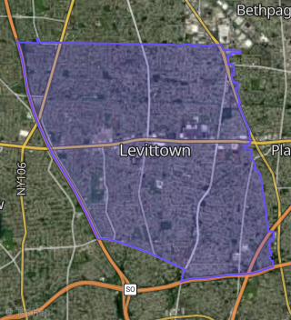
Boundary map of Levittown.
Crime Index for 11783
67
The crime index in 11783 is 67, which is 0.7 times lower than national average.
Market Trends
Historical market data near 569 Seamans Neck Rd over selected time period.
Nearby Properties on Seamans Neck Rd
- 2605 S Seamans Neck Rd, Seaford, NY 11783 (Seaford) is a 2,209 square foot, 3.25 bathroom, 0.16 acre property. It was built in 1967 and has an estimate of $765,761 with a price per ft² of $347.
- 1838 W Seamans Neck Rd, Seaford, NY 11783 (Wantagh) is a 2,225 square foot, 3 bathroom, 0.23 acre property. It was built in 1954 and has an estimate of $728,800 with a price per ft² of $328.
- 1804 W Seamans Neck Rd, Seaford, NY 11783 (Wantagh) is a 1,231 square foot, 2.25 bathroom, 0.16 acre property. It was built in 1972 and has an estimate of $618,878 with a price per ft² of $503.
- 1830 W Seamans Neck Rd, Seaford, NY 11783 (Wantagh) is a 1,473 square foot, 2.25 bathroom, 0.22 acre property. It was built in 1954 and has an estimate of $658,004 with a price per ft² of $447.
- 2212 Seamans Neck Rd, Seaford, NY 11783 (Seaford) is a 1,092 square foot, 1 bathroom, 0.14 acre property. It was built in 1963 and has an estimate of $533,122 with a price per ft² of $488.
- 2230 Seamans Neck Rd, Seaford, NY 11783 (Seaford) is a 1,973 square foot, 4 bedroom, 2 bathroom, 0.09 acre property. It was built in 1985 and has an estimate of $635,290 with a price per ft² of $322.
- 1994 Seamans Neck Rd, Seaford, NY 11783 (Seaford) is a 1,892 square foot, 3.25 bathroom, 0.13 acre property. It was built in 1975 and has an estimate of $691,954 with a price per ft² of $366.
- 2187 Seamans Neck Rd, Seaford, NY 11783 (Seaford) is a 1,128 square foot, 2.25 bathroom, 0.14 acre property. It was built in 1929 and has an estimate of $535,585 with a price per ft² of $475.
- 2195 Seamans Neck Rd, Seaford, NY 11783 (Seaford) is a 1,976 square foot, 3 bathroom, 0.23 acre property.
- 2171 Seamans Neck Rd, Seaford, NY 11783 (Seaford) is a 1,764 square foot, 2 bathroom, 0.17 acre property. It was built in 1898 and has an estimate of $536,816 with a price per ft² of $304.
- 2177 Seamans Neck Rd, Seaford, NY 11783 (Seaford) is a 1,037 square foot, 2 bathroom, 0.18 acre property. It was built in 1950 and has an estimate of $550,999 with a price per ft² of $531.
- 2423 S Seamans Neck Rd, Seaford, NY 11783 (Seaford) is a 1,723 square foot, 1 bathroom, 0.16 acre property. It was built in 1923 and has an estimate of $616,352 with a price per ft² of $358.
- 2411 S Seamans Neck Rd, Seaford, NY 11783 (Seaford) is a 3,484 square foot, 3.25 bathroom, 0.3 acre property. It was built in 1918 and has an estimate of $911,646 with a price per ft² of $262.
- 2419 S Seamans Neck Rd, Seaford, NY 11783 (Seaford) is a 1,556 square foot, 1 bathroom, 0.2 acre property. It was built in 1962 and has an estimate of $644,862 with a price per ft² of $414.
- 2405 S Seamans Neck Rd, Seaford, NY 11783 (Seaford) is a 1,627 square foot, 3.25 bathroom, 0.22 acre property. It was built in 1922 and has an estimate of $620,425 with a price per ft² of $381.
- 2441 S Seamans Neck Rd, Seaford, NY 11783 (Seaford) is a 780 square foot, 1 bathroom, 0.09 acre property. It was built in 1940 and has an estimate of $471,404 with a price per ft² of $604.
- 2447 S Seamans Neck Rd, Seaford, NY 11783 (Seaford) is a 1,153 square foot, 1 bathroom, 0.11 acre property. It was built in 1940 and has an estimate of $521,726 with a price per ft² of $452.
- 2449 S Seamans Neck Rd, Seaford, NY 11783 (Seaford) is a 1,032 square foot, 1 bathroom, 0.12 acre property. It was built in 1960 and has an estimate of $481,728 with a price per ft² of $467.
- 2459 S Seamans Neck Rd, Seaford, NY 11783 (Seaford) is a 1,479 square foot, 2 bathroom, 0.14 acre property. It was built in 1908 and has an estimate of $544,328 with a price per ft² of $368.
- 2471 S Seamans Neck Rd, Seaford, NY 11783 (Seaford) is a 1,473 square foot, 1 bathroom, 0.31 acre property. It was built in 1900 and has an estimate of $655,490 with a price per ft² of $445.
- 2473 S Seamans Neck Rd, Seaford, NY 11783 (Seaford) is a 1,500 square foot, 2 bathroom, 0.25 acre property. It was built in 1920 and has an estimate of $649,762 with a price per ft² of $433.
- 2629 S Seamans Neck Rd, Seaford, NY 11783 (Seaford) is a 2,335 square foot, 3.25 bathroom, 0.14 acre property. It was built in 1968 and has an estimate of $798,623 with a price per ft² of $342.
- 2641 S Seamans Neck Rd, Seaford, NY 11783 (Seaford) is a 2,335 square foot, 3.25 bathroom, 0.14 acre property. It was built in 1967 and has an estimate of $755,178 with a price per ft² of $323.
- 2647 S Seamans Neck Rd, Seaford, NY 11783 (Seaford) is a 2,283 square foot, 3.25 bathroom, 0.14 acre property. It was built in 1967 and has an estimate of $762,845 with a price per ft² of $334.
- 2653 S Seamans Neck Rd, Seaford, NY 11783 (Seaford) is a 2,335 square foot, 3.25 bathroom, 0.14 acre property. It was built in 1968 and has an estimate of $783,290 with a price per ft² of $335.
- View more properties on Seamans Neck-Rd