6765 Highway 29
Kelseyville, CA 95451
- 2Beds
- 3Baths
- 1,160ft²Living Area
- 10.6acLot Size
- -Pool
- 2Car
- 1987Year Built
- -DOM
- -Permit
Property Valuations
Latest estimates for 6765 Highway 29 based on TopHap automated valuation model (AVM).
TopHap Estimate
$590,800
$509/ft²
+$96K above Sold Price
Updated 3 months ago
Last Sold Price
$495,000
$427/ft²
3 years ago
6765 Highway 29 is valued at $590,800 by TopHap AVM 3 months ago.
6765 Highway 29 was last sold in 2020 for $495,000.
Current Ownership
Information about the current owner(s).
Taxes Billed
Taxes billed in 2023$5,646.64From latest Total Assessed Value1.1%Total Assessed Value$514,998=Land+
Assessed Value$208,080Additions
Assessed Value$306,918
In 2023, taxes billed for 6765 Highway 29 were $5,646.64, which is 1.10% from latest Total Assessed Value of $514,998.
Property History
6765 Highway 29 has undefined property events records (listings, deeds, permits, tax, foreclosure, loan).
Environment
Environmental factors around 6765 Highway 29
Hazard Risks
Earthquake334Nat'l Avg100Particulates92Ozone85Air Pollution82Carb Mono66Lead42Hail2Wind1Hurricane0Tornado0Weather0
9 hazards (Carbon Monoxide, Earthquake Risk, Hail Index, Air Pollution Index, Ozone Index, Wind Index, Lead Index, Particulate Matter, National Average) are above the national average around 6765 Highway 29.
Walkability Index
9 /20
Most Walkable
20-18
Very Walkable
17-15
Somewhat Walkable
14-10
Car Dependent
9-0
6765 Highway 29 has a walkability score of 9 out of 20, which means that it is in a car dependent area.
Noise Level
74 dB
Quiet Suburban Residential 0-49
Suburban Residential 50-54
Urban Residential 55-59
Noisy Urban Residential 60-64
Very Noisy Urban Residential 65+
Noise at 6765 Highway 29 is around 74dBs, which is comparable to a Very Noisy Urban Residential area.
Temperature
Seasonal temperature sampled over multiple years
Winter
Average
Low
37°F
High
55°F
Summer
Average
Low
57°F
High
89°F
In the winter at 6765 Highway 29, temperatures range from 36.88°F to 54.82°F with an average of 45.85°F. In the summer, the temperature ranges from 56.6°F to 88.68°F with and average of 72.64°F.
School Information
Public/private schools serving 6765 Highway 29
Public Schools
Nearby public schools serving 6765 Highway 29 have ratings undefined, undefined, and undefined.
Neighborhood
This property is located in Kelseyville.
Seasonal Housing units 95451
70%of housing is for seasonal rent.
Daytime Population for 95451
-20%of people during work hours.
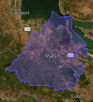
Boundary map of Kelseyville.
Crime Index for 95451
85
The crime index in 95451 is 85, which is 0.8 times lower than national average.
Market Trends
Historical market data near 6765 Highway 29 over selected time period.
Nearby Properties on Highway 29
- 7110 Highway 29, Kelseyville, CA 95451 is a 1,640 square foot, 2 bedroom, 2 bathroom, 21.02 acre property. It was built in 1972 and has an estimate of $480,270 with a price per ft² of $293.
- 7703 Highway 29, Kelseyville, CA 95451 is a 1,408 square foot, 1 bedroom, 1 bathroom, 20 acre property.
- 7763 Highway 29, Kelseyville, CA 95451 is a 1,440 square foot, 2 bedroom, 1 bathroom, 114.37 acre property. It was built in 1965 and has an estimate of $1,208,190 with a price per ft² of $839.
- 7672 Highway 29, Kelseyville, CA 95451 is a 1,080 square foot, 2 bedroom, 1 bathroom, 2.21 acre property. It was built in 1961 and has an estimate of $399,754 with a price per ft² of $370.
- 7659 Highway 29, Kelseyville, CA 95451 is a 2,089 square foot, 5 bedroom, 3 bathroom, 9.66 acre property. It was built in 1971 and has an estimate of $599,453 with a price per ft² of $287.
- 7661 Highway 29, Kelseyville, CA 95451 is a 1,406 square foot, 2 bedroom, 2 bathroom, 40.41 acre property. It was built in 1967 and has an estimate of $544,763 with a price per ft² of $387.
- 7620 Highway 29, Kelseyville, CA 95451 is a 630 square foot, 2 bedroom, 1 bathroom, 22.47 acre property. It was built in 1952 and has an estimate of $373,996 with a price per ft² of $594.
- 7560 Highway 29, Kelseyville, CA 95451 is a 2,112 square foot, 3 bedroom, 1.25 bathroom, 20 acre property. It was built in 2000 and has an estimate of $1,091,500 with a price per ft² of $517.
- 7555 Highway 29, Kelseyville, CA 95451 is a 3,976 square foot, 4 bedroom, 5.25 bathroom, 2.71 acre property. It was built in 1969 and has an estimate of $868,568 with a price per ft² of $218.
- 7510 Highway 29, Kelseyville, CA 95451 is a 2,659 square foot, 3 bedroom, 3 bathroom, 44.11 acre property. It was built in 1999 and has an estimate of $911,008 with a price per ft² of $343.
- 7380 Highway 29, Kelseyville, CA 95451 is a 2,394 square foot, 5 bedroom, 2.5 bathroom, 19 acre property. It was built in 1991 and has an estimate of $729,446 with a price per ft² of $305.
- 7760 Highway 29, Kelseyville, CA 95451 is a 38.7 acre property.
- 7640 Highway 29, Kelseyville, CA 95451 is a 1,491 square foot, 2 bedroom, 0.5 bathroom, 58.77 acre property. It was built in 1952 and has an estimate of $1,304,830 with a price per ft² of $875.
- 7673 Highway 29, Kelseyville, CA 95451 is a 9.09 acre property.
- 7690 Highway 29, Kelseyville, CA 95451 is a 17.64 acre property.
- 7824 Highway 29, Kelseyville, CA 95451 is a 30.69 acre property.
- 7699 Highway 29, Kelseyville, CA 95451 is a 8.95 acre property.
- 7050 Highway 29, Kelseyville, CA 95451 is a 1,613 square foot, 2 bedroom, 2 bathroom, 11.38 acre property. It was built in 2005 and has an estimate of $442,900 with a price per ft² of $275.
- 8060 Highway 29, Kelseyville, CA 95451 is a 15 acre property.
- 7663 Highway 29, Kelseyville, CA 95451 is a 1.95 acre property.
- 8009 Highway 29, Kelseyville, CA 95451 is a 960 square foot, 2 bedroom, 2.25 bathroom, 7.96 acre property. It was built in 1989 and has an estimate of $222,979 with a price per ft² of $232.
- 7645 Highway 29, Kelseyville, CA 95451 is a 209.35 acre property.
- 7650 Highway 29, Kelseyville, CA 95451 is a 386.44 acre property.
- 7723 Highway 29, Kelseyville, CA 95451 is a 5,404 square foot and 6 acre property.
- 7860 Highway 29, Kelseyville, CA 95451 is a 157.95 acre property.
- View more properties on Highway 29