736 A St
Davis, CA 95616
- 4Beds
- 3Baths
- 1,919ft²Living Area
- 0.3acLot Size
- 1Pool
- 1Car
- 1950Year Built
- -DOM
- 21Permits
Property Valuations
Latest estimates for 736 A St based on TopHap automated valuation model (AVM).
TopHap Estimate
$861,750
$449/ft²
+$190K above Sold Price
Updated 3 months ago
Last Sold Price
$671,500
$350/ft²
8 years ago
736 A St is valued at $861,750 by TopHap AVM 3 months ago.
736 A St was last sold in 2015 for $671,500.
Permits
736 A St has 21 permit records of total value of $463,981.
Current Ownership
Information about the current owner(s).
Taxes Billed
Taxes billed in 2023$9,765.72From latest Total Assessed Value1.28%Total Assessed Value$763,740=Land+
Assessed Value$358,413Additions
Assessed Value$405,327
In 2023, taxes billed for 736 A St were $9,765.72, which is 1.28% from latest Total Assessed Value of $763,740.
Property History
736 A St has undefined property events records (listings, deeds, permits, tax, foreclosure, loan).
Environment
Environmental factors around 736 A St
Hazard Risks
Earthquake179Nat'l Avg100Particulates93Ozone84Air Pollution82Carb Mono74Lead41Hail2Tornado1Weather1Hurricane0Wind0
10 hazards (Carbon Monoxide, Earthquake Risk, Hail Index, Tornado Index, Air Pollution Index, Ozone Index, Weather Risk, Lead Index, Particulate Matter, National Average) are above the national average around 736 A St.
Walkability Index
17 /20
Most Walkable
20-18
Very Walkable
17-15
Somewhat Walkable
14-10
Car Dependent
9-0
736 A St has a walkability score of 17 out of 20, which means that it is in a very walkable area.
Noise Level
46 dB
Quiet Suburban Residential 0-49
Suburban Residential 50-54
Urban Residential 55-59
Noisy Urban Residential 60-64
Very Noisy Urban Residential 65+
Noise at 736 A St is around 46dBs, which is comparable to a Quiet Suburban Residential area.
Temperature
Seasonal temperature sampled over multiple years
Winter
Average
Low
38°F
High
56°F
Summer
Average
Low
56°F
High
92°F
In the winter at 736 A St, temperatures range from 38.43°F to 56.48°F with an average of 47.46°F. In the summer, the temperature ranges from 56.15°F to 92.39°F with and average of 74.27°F.
School Information
Public/private schools serving 736 A St
Public Schools
Nearby public schools serving 736 A St have ratings undefined, undefined, and undefined.
Neighborhood
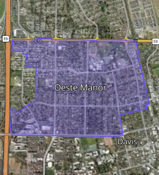
This property is located in Central Davis, Davis, CA 95616.
Seasonal Housing units 95616
12%of housing is for seasonal rent.
Daytime Population for 95616
-9%of people during work hours.
Boundary map of Central Davis.
Crime Index for 95616
107
The crime index in 95616 is 107, which is 1.1 times higher than national average.
Market Trends
Historical market data near 736 A St over selected time period.
Nearby Properties on A St
- 619-621 a St, Davis, CA 95616 (Traynham's) is a 0.25 acre property. It has an estimate of $1,112,000.
- 146 a St, Davis, CA 95616 (University Avenue) is a 1,630 square foot, 2 bedroom, 2 bathroom, 0.04 acre property. It was built in 1978 and has an estimate of $952,476 with a price per ft² of $584.
- 142 a St, Davis, CA 95616 (Jefferson Square) is a 0.01 acre property. It has an estimate of $614,400.
- 138 a St, Davis, CA 95616 (Jefferson Square) is a 1,658 square foot, 2 bedroom, 2 bathroom, 0.05 acre property. It was built in 1978 and has an estimate of $939,025 with a price per ft² of $566.
- 142 a St, Davis, CA 95616 (Jefferson Square) is a 1,630 square foot, 2 bedroom, 2 bathroom, 0.04 acre property. It was built in 1978 and has an estimate of $947,544 with a price per ft² of $581.
- 132 a St, Davis, CA 95616 (University Avenue) is a 1,027 square foot, 2 bedroom, 2 bathroom, 0.08 acre property. It was built in 1930 and has an estimate of $726,776 with a price per ft² of $749.
- 230 a St # 242, Davis, CA 95616 (Campus Manor) is a 9,688 square foot and 0.35 acre property.
- 224 a St, Davis, CA 95616 (Dartmouth Terrace Apartments) is a 15,576 square foot and 0.36 acre property. It was built in 1970 and has an estimate of $5,517,970 with a price per ft² of $354.
- 112 a St, Davis, CA 95616 (University Avenue) is a 0.1 acre property.
- 116 a St, Davis, CA 95616 (University Avenue) is a 0.1 acre property.
- 600 a St, Davis, CA 95616 (Oeste Manor) is a 1.96 acre property.
- View more properties on A St