747 Bourn Dr
Woodland, CA 95776
- 3Beds
- 2Baths
- 1,394ft²Living Area
- 5,227ft²Lot Size
- -Pool
- 2Car
- 2003Year Built
- -DOM
- -Permit
Property Valuations
Latest estimates for 747 Bourn Dr based on TopHap automated valuation model (AVM).
TopHap Estimate
$508,250
$364/ft²
+$93K above Sold Price
Updated 3 months ago
Last Sold Price
$415,000
$298/ft²
3 years ago
747 Bourn Dr is valued at $508,250 by TopHap AVM 3 months ago.
747 Bourn Dr was last sold in 2020 for $415,000.
Current Ownership
Information about the current owner(s).
Taxes Billed
Taxes billed in 2023$5,405.08From latest Total Assessed Value1.25%Total Assessed Value$431,766=Land+
Assessed Value$98,838Additions
Assessed Value$332,928
In 2023, taxes billed for 747 Bourn Dr were $5,405.08, which is 1.25% from latest Total Assessed Value of $431,766.
Property History
747 Bourn Dr has undefined property events records (listings, deeds, permits, tax, foreclosure, loan).
Environment
Environmental factors around 747 Bourn Dr
Hazard Risks
Earthquake154Nat'l Avg100Particulates94Ozone82Air Pollution81Carb Mono71Lead41Tornado6Hail5Weather1Hurricane0Wind0
10 hazards (Carbon Monoxide, Earthquake Risk, Hail Index, Tornado Index, Air Pollution Index, Ozone Index, Weather Risk, Lead Index, Particulate Matter, National Average) are above the national average around 747 Bourn Dr.
Walkability Index
17 /20
Most Walkable
20-18
Very Walkable
17-15
Somewhat Walkable
14-10
Car Dependent
9-0
747 Bourn Dr has a walkability score of 17 out of 20, which means that it is in a very walkable area.
Noise Level
48 dB
Quiet Suburban Residential 0-49
Suburban Residential 50-54
Urban Residential 55-59
Noisy Urban Residential 60-64
Very Noisy Urban Residential 65+
Noise at 747 Bourn Dr is around 48dBs, which is comparable to a Quiet Suburban Residential area.
Temperature
Seasonal temperature sampled over multiple years
Winter
Average
Low
39°F
High
56°F
Summer
Average
Low
57°F
High
93°F
In the winter at 747 Bourn Dr, temperatures range from 38.62°F to 56.17°F with an average of 47.4°F. In the summer, the temperature ranges from 56.85°F to 92.89°F with and average of 74.87°F.
School Information
Public/private schools serving 747 Bourn Dr
Public Schools
Nearby public schools serving 747 Bourn Dr have ratings undefined, undefined, and undefined.
Neighborhood
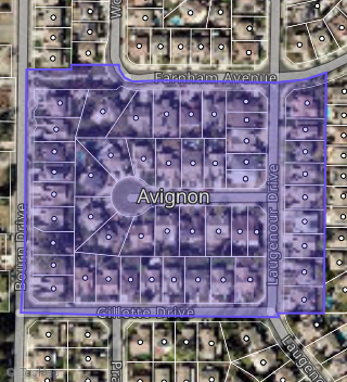
This property is located in Avignon, Woodland, CA 95776.
Seasonal Housing units 95776
33%of housing is for seasonal rent.
Daytime Population for 95776
-1%of people during work hours.
Boundary map of Avignon.
Crime Index for 95776
55
The crime index in 95776 is 55, which is 0.6 times lower than national average.
Market Trends
Historical market data near 747 Bourn Dr over selected time period.
Nearby Properties on Bourn Dr
- 840 Bourn Dr #Spc 82, Woodland, CA 95776 (Royal Palm) is a 1,056 square foot property.
- 840 Bourn Dr #Spc 33, Woodland, CA 95776 (Royal Palm) is a 840 square foot property.
- 840 Bourn Dr #Spc 34, Woodland, CA 95776 (Royal Palm) is a 840 square foot property.
- 840 Bourn Dr #Spc 36, Woodland, CA 95776 (Royal Palm) is a 1,440 square foot property.
- 840 Bourn Dr #Spc 42, Woodland, CA 95776 (Royal Palm) is a 840 square foot property.
- 840 Bourn Dr #Spc 43, Woodland, CA 95776 (Royal Palm) is a 1,152 square foot property.
- 840 Bourn Dr #Spc 47, Woodland, CA 95776 (Royal Palm) is a 840 square foot property.
- 840 Bourn Dr #Spc 49, Woodland, CA 95776 (Royal Palm) is a 672 square foot property.
- 840 Bourn Dr #Spc 58, Woodland, CA 95776 (Royal Palm) is a 648 square foot property.
- 840 Bourn Dr #Spc 23, Woodland, CA 95776 (Royal Palm) is a 1,440 square foot property.
- 840 Bourn Dr #Spc 28, Woodland, CA 95776 (Royal Palm) is a 1,560 square foot property.
- 840 Bourn Dr #Spc 51, Woodland, CA 95776 (Royal Palm) is a 720 square foot property.
- 840 Bourn Dr #Spc 56, Woodland, CA 95776 (Royal Palm) is a 1,344 square foot property.
- 840 Bourn Dr #Spc 14, Woodland, CA 95776 (Royal Palm) is a 1,272 square foot property.
- 840 Bourn Dr #Spc 20, Woodland, CA 95776 (Royal Palm) is a 820 square foot property.
- 907 Bourn Dr #Spc 255, Woodland, CA 95776 (Idle Wheel) is a 21.14 acre property.
- 840 Bourn Dr #Spc 31, Woodland, CA 95776 (Royal Palm) is a 14.43 acre property.
- 840 Bourn Dr #Spc 126, Woodland, CA 95776 (Royal Palm) is a 14.43 acre property.
- 840 Bourn Dr #Spc 19, Woodland, CA 95776 (Royal Palm) is a 14.43 acre property.
- View more properties on Bourn Dr