79 Darby Rd
Bangor, CA 95914
- 2Beds
- 1Bath
- 2,211ft²Living Area
- 4.7acLot Size
- -Pool
- 3Car
- 1956Year Built
- -DOM
- 5Permits
Property Valuations
Latest estimates for 79 Darby Rd based on TopHap automated valuation model (AVM).
TopHap Estimate
$326,500
$147/ft²
+$237K above Sold Price
Updated 3 months ago
Last Sold Price
$90,000
$41/ft²
27 years ago
79 Darby Rd is valued at $326,500 by TopHap AVM 3 months ago.
79 Darby Rd was last sold in 1996 for $90,000.
Permits
79 Darby Rd has 5 permit records of total value of $36,366.
Current Ownership
Information about the current owner(s).
Taxes Billed
Taxes billed in 2023$1,669.44From latest Total Assessed Value1.05%Total Assessed Value$159,245=Land+
Assessed Value$54,772Additions
Assessed Value$104,473
In 2023, taxes billed for 79 Darby Rd were $1,669.44, which is 1.05% from latest Total Assessed Value of $159,245.
Property History
79 Darby Rd has undefined property events records (listings, deeds, permits, tax, foreclosure, loan).
Environment
Environmental factors around 79 Darby Rd
Hazard Risks
Particulates104Earthquake103Nat'l Avg100Carb Mono91Ozone90Air Pollution87Lead42Tornado18Weather5Hail0Hurricane0Wind0
9 hazards (Carbon Monoxide, Earthquake Risk, Tornado Index, Air Pollution Index, Ozone Index, Weather Risk, Lead Index, Particulate Matter, National Average) are above the national average around 79 Darby Rd.
Walkability Index
3 /20
Most Walkable
20-18
Very Walkable
17-15
Somewhat Walkable
14-10
Car Dependent
9-0
79 Darby Rd has a walkability score of 3 out of 20, which means that it is in a car dependent area.
Temperature
Seasonal temperature sampled over multiple years
Winter
Average
Low
37°F
High
56°F
Summer
Average
Low
59°F
High
91°F
In the winter at 79 Darby Rd, temperatures range from 37.49°F to 56.01°F with an average of 46.75°F. In the summer, the temperature ranges from 58.84°F to 91.22°F with and average of 75.03°F.
School Information
Public/private schools serving 79 Darby Rd
Public Schools
Nearby public schools serving 79 Darby Rd have ratings undefined, and undefined.
Neighborhood
This property is located in Bangor.
Seasonal Housing units 95914
40%of housing is for seasonal rent.
Daytime Population for 95914
+2%of people during work hours.
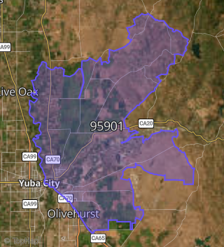
Boundary map of Bangor.
Crime Index for 95914
130
The crime index in 95914 is 130, which is 1.3 times higher than national average.
Market Trends
Historical market data near 79 Darby Rd over selected time period.
Nearby Properties on Darby Rd
- 34 Darby Rd, Bangor, CA 95914 is a 1,000 square foot, 2 bedroom, 2.25 bathroom, 54.65 acre property. It was built in 1968 and has an estimate of $355,912 with a price per ft² of $356.
- 368 Darby Rd, Bangor, CA 95914 is a 1,760 square foot, 3 bedroom, 2 bathroom, 4.91 acre property. It was built in 1983 and has an estimate of $290,747 with a price per ft² of $165.
- 390 Darby Rd, Bangor, CA 95914 is a 1,956 square foot, 3 bedroom, 3.25 bathroom, 6.26 acre property. It was built in 2006 and has an estimate of $98,551 with a price per ft² of $50.
- 75 Darby Rd, Bangor, CA 95914 is a 1,248 square foot, 3 bedroom, 2 bathroom, 5.4 acre property. It was built in 1978 and has an estimate of $267,628 with a price per ft² of $214.
- 428 Darby Rd, Bangor, CA 95914 is a 5.69 acre property.
- 392 Darby Rd, Bangor, CA 95914 is a 1,296 square foot, 6 bedroom, 4 bathroom, 6.22 acre property. It was built in 2018 and has an estimate of $297,852 with a price per ft² of $230.
- 171 Darby Rd, Bangor, CA 95914 is a 858 square foot, 2 bedroom, 1 bathroom, 10 acre property. It was built in 1950 and has an estimate of $223,696 with a price per ft² of $261.
- 167 Darby Rd, Bangor, CA 95914 is a 1,864 square foot, 4 bedroom, 2 bathroom, 40.36 acre property. It was built in 1981 and has an estimate of $330,260 with a price per ft² of $177.
- 104 Darby Rd, Bangor, CA 95914 is a 1,248 square foot, 3 bedroom, 1 bathroom, 5.23 acre property. It was built in 1950 and has an estimate of $255,867 with a price per ft² of $205.
- 364 Darby Rd, Bangor, CA 95914 is a 3,000 square foot, 4 bedroom, 3.25 bathroom, 5.07 acre property. It was built in 2005 and has an estimate of $438,639 with a price per ft² of $146.
- 168 Darby Rd, Bangor, CA 95914 is a 1,782 square foot, 3 bedroom, 2 bathroom, 35.67 acre property. It was built in 1900 and has an estimate of $425,539 with a price per ft² of $239.
- 466 Darby Rd, Bangor, CA 95914 is a 1,536 square foot, 2 bedroom, 2 bathroom, 5.35 acre property. It was built in 1986 and has an estimate of $274,683 with a price per ft² of $179.
- 7 Darby Rd, Bangor, CA 95914 is a 1,519 square foot, 2 bedroom, 2 bathroom, 0.48 acre property. It was built in 1992 and has an estimate of $200,380 with a price per ft² of $132.
- 61 Darby Rd, Bangor, CA 95914 is a 1,152 square foot, 3 bedroom, 2 bathroom, 6.08 acre property. It was built in 1984 and has an estimate of $263,467 with a price per ft² of $229.
- 325 Darby Rd, Bangor, CA 95914 is a 20.2 acre property.
- 89 Darby Rd, Bangor, CA 95914 is a 1,296 square foot, 3 bedroom, 2 bathroom, 6.16 acre property. It was built in 2016 and has an estimate of $319,061 with a price per ft² of $246.
- 476 Darby Rd, Bangor, CA 95914 is a 145.02 acre property.