879 Bundy Dr
Los Angeles, CA 90049
- 4Beds
- 4Baths
- 3,405ft²Living Area
- 7,576ft²Lot Size
- -Pool
- -Car
- 1991Year Built
- -DOM
- 2Permits
Property Valuations
Latest estimates for 879 Bundy Dr based on TopHap automated valuation model (AVM).
TopHap Estimate
$3,433,750
$1,008/ft²
+$2M above Sold Price
Updated 3 months ago
Last Sold Price
$1,720,017
$505/ft²
17 years ago
879 Bundy Dr is valued at $3,433,750 by TopHap AVM 3 months ago.
879 Bundy Dr was last sold in 2006 for $1,720,017.
Permits
879 Bundy Dr has 2 permit records.
Current Ownership
Information about the current owner(s).
Taxes Billed
Taxes billed in 2023$26,891.95From latest Total Assessed Value1.21%Total Assessed Value$2,214,940=Land+
Assessed Value$1,646,658Additions
Assessed Value$568,282
In 2023, taxes billed for 879 Bundy Dr were $26,891.95, which is 1.21% from latest Total Assessed Value of $2,214,940.
Property History
879 Bundy Dr has undefined property events records (listings, deeds, permits, tax, foreclosure, loan).
Environment
Environmental factors around 879 Bundy Dr
Hazard Risks
Earthquake440Carb Mono163Ozone112Air Pollution110Particulates106Lead105Nat'l Avg100Tornado61Weather24Hurricane8Hail0Wind0
10 hazards (Carbon Monoxide, Earthquake Risk, Tornado Index, Hurricane Index, Air Pollution Index, Ozone Index, Weather Risk, Lead Index, Particulate Matter, National Average) are above the national average around 879 Bundy Dr.
Walkability Index
18 /20
Most Walkable
20-18
Very Walkable
17-15
Somewhat Walkable
14-10
Car Dependent
9-0
879 Bundy Dr has a walkability score of 18 out of 20, which means that it is in a most walkable area.
Noise Level
46 dB
Quiet Suburban Residential 0-49
Suburban Residential 50-54
Urban Residential 55-59
Noisy Urban Residential 60-64
Very Noisy Urban Residential 65+
Noise at 879 Bundy Dr is around 46dBs, which is comparable to a Quiet Suburban Residential area.
Temperature
Seasonal temperature sampled over multiple years
Winter
Average
Low
48°F
High
66°F
Summer
Average
Low
59°F
High
81°F
In the winter at 879 Bundy Dr, temperatures range from 47.56°F to 66.16°F with an average of 56.86°F. In the summer, the temperature ranges from 59.32°F to 81.14°F with and average of 70.23°F.
School Information
Public/private schools serving 879 Bundy Dr
Public Schools
Nearby public schools serving 879 Bundy Dr have ratings undefined, undefined, and undefined.
Neighborhood
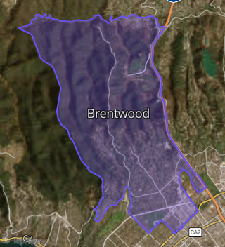
This property is located in Brentwood, Los Angeles, CA 90049.
Seasonal Housing units 90049
14%of housing is for seasonal rent.
Daytime Population for 90049
+30%of people during work hours.
Boundary map of Brentwood.
Crime Index for 90049
117
The crime index in 90049 is 117, which is 1.2 times higher than national average.
Market Trends
Historical market data near 879 Bundy Dr over selected time period.
Nearby Properties on Bundy Dr
- 1550 S Bundy Dr, Los Angeles, CA 90025 (1550 S Bundy Drive) is a 4,676 square foot, 6 bedroom, 9 bathroom, 0.12 acre property. It was built in 1969 and has an estimate of $2,614,148 with a price per ft² of $559.
- 1528 S Bundy Dr, Los Angeles, CA 90025 (1528 S Bundy Drive) is a 6,458 square foot, 9 bedroom, 10 bathroom, 0.14 acre property. It was built in 1962 and has an estimate of $3,843,730 with a price per ft² of $595.
- 1516 S Bundy Dr, Los Angeles, CA 90025 (1516 S Bundy Drive) is a 15,135 square foot and 0.23 acre property.
- 1546 S Bundy Dr, Los Angeles, CA 90025 (1546 S Bundy Drive) is a 800 square foot, 2 bedroom, 2 bathroom, 0.2 acre property. It was built in 1987 and has an estimate of $712,112 with a price per ft² of $890.
- 1524 S Bundy Dr, Los Angeles, CA 90025 (1524 S Bundy Drive) is a 6,092 square foot, 11 bedroom, 11 bathroom, 0.14 acre property. It was built in 1972 and has an estimate of $3,028,491 with a price per ft² of $497.
- 1558 S Bundy Dr, Los Angeles, CA 90025 (1558-1576 S Bundy Drive) is a 23,063 square foot, 54 bedroom, 36 bathroom, 0.59 acre property. It was built in 1961 and has an estimate of $11,419,894 with a price per ft² of $495.
- 1565 S Bundy Dr, Los Angeles, CA 90025 (1565 S Bundy Drive) is a 14,756 square foot, 28 bedroom, 28 bathroom, 0.26 acre property. It was built in 1988 and has an estimate of $8,061,932 with a price per ft² of $546.
- 1555 S Bundy Dr, Los Angeles, CA 90025 (The Fall View) is a 23,264 square foot, 36 bedroom, 30 bathroom, 0.26 acre property. It was built in 1988 and has an estimate of $13,447,660 with a price per ft² of $578.
- 1537 S Bundy Dr, Los Angeles, CA 90025 (Century West) is a 13,244 square foot, 28 bedroom, 28 bathroom, 0.27 acre property. It was built in 1988 and has an estimate of $7,259,522 with a price per ft² of $548.
- 883 S Bundy Dr, Los Angeles, CA 90049 (Brentwood) is a 3,192 square foot, 5 bedroom, 4 bathroom, 0.17 acre property. It was built in 1927 and has an estimate of $2,586,656 with a price per ft² of $810.
- 809 S Bundy Dr #Apt 103, Los Angeles, CA 90049 (809 S Bundy Drive) is a 1,520 square foot, 2 bedroom, 2 bathroom, 0.03 acre property. It was built in 1970 and has an estimate of $2,030,746 with a price per ft² of $1,336.
- 809 S Bundy Dr #Apt 105, Los Angeles, CA 90049 (809 S Bundy Drive) is a 1,362 square foot, 2 bedroom, 2 bathroom, 0.79 acre property. It was built in 1973 and has an estimate of $1,055,229 with a price per ft² of $775.
- 809 S Bundy Dr #Apt 107, Los Angeles, CA 90049 (809 S Bundy Drive) is a 1,544 square foot, 3 bedroom, 3 bathroom, 0.79 acre property. It was built in 1973 and has an estimate of $1,255,389 with a price per ft² of $813.
- 809 S Bundy Dr #Apt 108, Los Angeles, CA 90049 (809 S Bundy Drive) is a 1,023 square foot, 1 bedroom, 1 bathroom, 0.02 acre property. It was built in 1970 and has an estimate of $1,543,887 with a price per ft² of $1,509.
- 809 S Bundy Dr #Apt 113, Los Angeles, CA 90049 (809 S Bundy Drive) is a 1,485 square foot, 2 bedroom, 2 bathroom, 0.03 acre property. It was built in 1973 and has an estimate of $1,857,002 with a price per ft² of $1,251.
- 809 S Bundy Dr #Apt 115, Los Angeles, CA 90049 (809 S Bundy Drive) is a 1,398 square foot, 2 bedroom, 2 bathroom, 0.79 acre property. It was built in 1970 and has an estimate of $1,105,706 with a price per ft² of $791.
- 809 S Bundy Dr #Apt 205, Los Angeles, CA 90049 (809 S Bundy Drive) is a 1,362 square foot, 2 bedroom, 2 bathroom, 0.03 acre property. It was built in 1973 and has an estimate of $1,649,013 with a price per ft² of $1,211.
- 809 S Bundy Dr #Apt 211, Los Angeles, CA 90049 (809 S Bundy Drive) is a 1,357 square foot, 2 bedroom, 2 bathroom, 0.03 acre property. It was built in 1973 and has an estimate of $1,716,328 with a price per ft² of $1,265.
- 809 S Bundy Dr #Apt 212, Los Angeles, CA 90049 (809 S Bundy Drive) is a 1,488 square foot, 2 bedroom, 2 bathroom, 0.03 acre property. It was built in 1973 and has an estimate of $1,861,275 with a price per ft² of $1,251.
- 809 S Bundy Dr #Apt 213, Los Angeles, CA 90049 (809 S Bundy Drive) is a 1,578 square foot, 2 bedroom, 2 bathroom, 0.04 acre property. It was built in 1973 and has an estimate of $2,015,680 with a price per ft² of $1,277.
- 809 S Bundy Dr #Apt 215, Los Angeles, CA 90049 (809 S Bundy Drive) is a 1,398 square foot, 2 bedroom, 2 bathroom, 0.03 acre property. It was built in 1970 and has an estimate of $1,975,365 with a price per ft² of $1,413.
- 809 S Bundy Dr #Apt 302, Los Angeles, CA 90049 (809 S Bundy Drive) is a 1,239 square foot, 2 bedroom, 2 bathroom, 0.03 acre property. It was built in 1973 and has an estimate of $1,731,998 with a price per ft² of $1,398.
- 809 S Bundy Dr #Apt 303, Los Angeles, CA 90049 (809 S Bundy Drive) is a 1,550 square foot, 2 bedroom, 2 bathroom, 0.04 acre property. It was built in 1978 and has an estimate of $2,050,748 with a price per ft² of $1,323.
- 809 S Bundy Dr #Apt 307, Los Angeles, CA 90049 (809 S Bundy Drive) is a 1,642 square foot, 3 bedroom, 3 bathroom, 0.04 acre property. It was built in 1973 and has an estimate of $1,852,354 with a price per ft² of $1,128.
- 809 S Bundy Dr #Apt 309, Los Angeles, CA 90049 (809 S Bundy Drive) is a 1,350 square foot, 1 bedroom, 1 bathroom, 0.03 acre property. It was built in 1973 and has an estimate of $1,684,483 with a price per ft² of $1,248.
- View more properties on Bundy Dr