9838 A St
Oakland, CA 94603
- 2Beds
- 2Baths
- 1,375ft²Living Area
- 6,552ft²Lot Size
- -Pool
- -Car
- 1906Year Built
- -DOM
- 12Permits
Property Valuations
Latest estimates for 9838 A St based on TopHap automated valuation model (AVM).
TopHap Estimate
$563,000
$409/ft²
+$433K above Sold Price
Updated 3 months ago
Last Sold Price
$130,000
$95/ft²
24 years ago
9838 A St is valued at $563,000 by TopHap AVM 3 months ago.
9838 A St was last sold in 2000 for $130,000.
Permits
9838 A St has 12 permit records of total value of $92,200.
Current Ownership
Information about the current owner(s).
Taxes Billed
Taxes billed in 2023$4,413.00From latest Total Assessed Value2.3%Total Assessed Value$192,038=Land+
Assessed Value$57,611Additions
Assessed Value$134,427
In 2023, taxes billed for 9838 A St were $4,413, which is 2.30% from latest Total Assessed Value of $192,038.
Property History
9838 A St has undefined property events records (listings, deeds, permits, tax, foreclosure, loan).
Environment
Environmental factors around 9838 A St
Hazard Risks
Earthquake614Carb Mono102Nat'l Avg100Particulates97Ozone86Air Pollution86Lead38Tornado16Weather8Wind1Hail0Hurricane0
10 hazards (Carbon Monoxide, Earthquake Risk, Tornado Index, Air Pollution Index, Ozone Index, Wind Index, Weather Risk, Lead Index, Particulate Matter, National Average) are above the national average around 9838 A St.
Walkability Index
15 /20
Most Walkable
20-18
Very Walkable
17-15
Somewhat Walkable
14-10
Car Dependent
9-0
9838 A St has a walkability score of 15 out of 20, which means that it is in a very walkable area.
Noise Level
42 dB
Quiet Suburban Residential 0-49
Suburban Residential 50-54
Urban Residential 55-59
Noisy Urban Residential 60-64
Very Noisy Urban Residential 65+
Noise at 9838 A St is around 42dBs, which is comparable to a Quiet Suburban Residential area.
Temperature
Seasonal temperature sampled over multiple years
Winter
Average
Low
43°F
High
58°F
Summer
Average
Low
55°F
High
72°F
In the winter at 9838 A St, temperatures range from 43.44°F to 58.34°F with an average of 50.89°F. In the summer, the temperature ranges from 54.93°F to 72.45°F with and average of 63.69°F.
School Information
Public/private schools serving 9838 A St
Public Schools
Nearby public schools serving 9838 A St have ratings undefined, undefined, undefined, undefined, and undefined.
Neighborhood
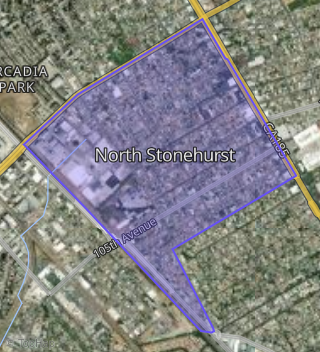
This property is located in North Stonehurst, Oakland, CA 94603.
Seasonal Housing units 94603
3%of housing is for seasonal rent.
Daytime Population for 94603
-29%of people during work hours.
Boundary map of North Stonehurst.
Crime Index for 94603
129
The crime index in 94603 is 129, which is 1.3 times higher than national average.
Market Trends
Historical market data near 9838 A St over selected time period.
Nearby Properties on A St
- 9525 a St, Oakland, CA 94603 (Elmhurst Park) is a 1,494 square foot, 3 bedroom, 2 bathroom, 0.05 acre property. It was built in 1927 and has an estimate of $594,661 with a price per ft² of $398.
- 8901 a St, Oakland, CA 94621 (Highland) is a 1,309 square foot, 4 bedroom, 2 bathroom, 0.09 acre property. It was built in 1944 and has an estimate of $585,510 with a price per ft² of $447.
- 9014 a St, Oakland, CA 94603 (Highland) is a 1,490 square foot, 5 bedroom, 2 bathroom, 0.06 acre property. It was built in 1924 and has an estimate of $561,438 with a price per ft² of $377.
- 9832 a St, Oakland, CA 94603 (North Stonehurst) is a 3,276 square foot, 9 bedroom, 4 bathroom, 0.14 acre property. It was built in 1964 and has an estimate of $987,191 with a price per ft² of $301.
- 9114 a St, Oakland, CA 94603 (Highland) is a 2,748 square foot, 6 bedroom, 4 bathroom, 0.09 acre property. It was built in 1928 and has an estimate of $831,352 with a price per ft² of $303.
- 9028 a St, Oakland, CA 94603 (Highland) is a 1,875 square foot, 5 bedroom, 3 bathroom, 0.15 acre property. It was built in 1948 and has an estimate of $1,069,311 with a price per ft² of $570.
- 8320 a St, Oakland, CA 94621 (Woodland) is a 1,818 square foot, 5 bedroom, 2 bathroom, 0.13 acre property. It was built in 1947 and has an estimate of $622,540 with a price per ft² of $567.
- 8419 a St, Oakland, CA 94621 (Woodland) is a 1,396 square foot, 2 bedroom, 2 bathroom, 0.11 acre property. It was built in 1943 and has an estimate of $499,891 with a price per ft² of $358.
- 9306 a St, Oakland, CA 94603 (Elmhurst Park) is a 1,628 square foot, 4 bedroom, 3 bathroom, 0.13 acre property. It was built in 1944 and has an estimate of $678,100 with a price per ft² of $417.
- 8703 a St, Oakland, CA 94621 (Highland) is a 1,020 square foot, 2 bedroom, 1 bathroom, 0.09 acre property. It was built in 1911 and has an estimate of $454,661 with a price per ft² of $446.
- 9111 a St, Oakland, CA 94603 (Highland) is a 1,050 square foot, 3 bedroom, 1 bathroom, 0.07 acre property. It was built in 1927 and has an estimate of $512,510 with a price per ft² of $488.
- 9946 a St, Oakland, CA 94603 (North Stonehurst) is a 1,620 square foot, 4 bedroom, 2 bathroom, 0.15 acre property. It was built in 1944 and has an estimate of $579,704 with a price per ft² of $358.
- 9022 a St, Oakland, CA 94603 (Highland) is a 1,570 square foot, 4 bedroom, 2 bathroom, 0.12 acre property. It was built in 1944 and has an estimate of $910,335 with a price per ft² of $580.
- 9927 a St, Oakland, CA 94603 (North Stonehurst) is a 1,800 square foot, 4 bedroom, 2 bathroom, 0.1 acre property. It was built in 1948 and has an estimate of $612,655 with a price per ft² of $340.
- 9907 a St, Oakland, CA 94603 (North Stonehurst) is a 1,800 square foot, 4 bedroom, 2 bathroom, 0.1 acre property. It was built in 1948 and has an estimate of $615,855 with a price per ft² of $342.
- 8909 a St, Oakland, CA 94621 (Highland) is a 1,687 square foot, 2 bedroom, 1 bathroom, 0.1 acre property. It was built in 1925 and has an estimate of $416,958 with a price per ft² of $247.
- 9821 a St, Oakland, CA 94603 (North Stonehurst) is a 1,648 square foot, 4 bedroom, 4 bathroom, 0.12 acre property. It was built in 1955 and has an estimate of $721,571 with a price per ft² of $438.
- 8915 a St, Oakland, CA 94621 (Highland) is a 852 square foot, 2 bedroom, 1 bathroom, 0.1 acre property. It was built in 1941 and has an estimate of $453,887 with a price per ft² of $533.
- 8921 a St, Oakland, CA 94621 (Highland) is a 815 square foot, 2 bedroom, 1 bathroom, 0.1 acre property. It was built in 1941 and has an estimate of $477,790 with a price per ft² of $586.
- 8929 a St, Oakland, CA 94621 (Highland) is a 802 square foot, 2 bedroom, 1 bathroom, 0.1 acre property. It was built in 1941 and has an estimate of $468,121 with a price per ft² of $584.
- 8916 a St, Oakland, CA 94621 (Highland) is a 1,106 square foot, 2 bedroom, 1 bathroom, 0.1 acre property. It was built in 1949 and has an estimate of $461,665 with a price per ft² of $417.
- 8910 a St, Oakland, CA 94621 (Highland) is a 890 square foot, 2 bedroom, 1 bathroom, 0.1 acre property. It was built in 1949 and has an estimate of $443,432 with a price per ft² of $498.
- 8707 a St, Oakland, CA 94621 (Highland) is a 2,050 square foot, 4 bedroom, 3.25 bathroom, 0.07 acre property. It was built in 1935 and has an estimate of $728,385 with a price per ft² of $355.
- 8715 a St, Oakland, CA 94621 (Highland) is a 1,149 square foot, 3 bedroom, 1 bathroom, 0.13 acre property. It was built in 1934 and has an estimate of $484,489 with a price per ft² of $422.
- 8623 a St, Oakland, CA 94621 (Highland) is a 2,013 square foot, 2 bedroom, 1.5 bathroom, 0.09 acre property. It was built in 1943 and has an estimate of $409,961 with a price per ft² of $204.
- View more properties on A St