10 Canon Dr
Santa Barbara, CA 93105
- 3Beds
- 2Baths
- 1,455ft²Living Area
- 7,840ft²Lot Size
- -Pool
- -Car
- 1949Year Built
- -DOM
- 7Permits
Property Valuations
Latest estimates for 10 Canon Dr based on TopHap automated valuation model (AVM).
TopHap Estimate
$1,718,750
$1,181/ft²
+$809K above Sold Price
Updated 3 months ago
Last Sold Price
$910,000
$625/ft²
9 years ago
10 Canon Dr is valued at $1,718,750 by TopHap AVM 3 months ago.
10 Canon Dr was last sold in 2014 for $910,000.
Permits
10 Canon Dr has 7 permit records.
Current Ownership
Information about the current owner(s).
Taxes Billed
Taxes billed in 2023$11,392.64From latest Total Assessed Value1.06%Total Assessed Value$1,072,209=Land+
Assessed Value$648,040Additions
Assessed Value$424,169
In 2023, taxes billed for 10 Canon Dr were $11,392.64, which is 1.06% from latest Total Assessed Value of $1,072,209.
Property History
10 Canon Dr has undefined property events records (listings, deeds, permits, tax, foreclosure, loan).
Environment
Environmental factors around 10 Canon Dr
Hazard Risks
Earthquake477Nat'l Avg100Lead100Particulates100Air Pollution100Carb Mono95Ozone95Tornado10Weather6Hurricane1Wind1Hail0
11 hazards (Carbon Monoxide, Earthquake Risk, Tornado Index, Hurricane Index, Air Pollution Index, Ozone Index, Wind Index, Weather Risk, Lead Index, Particulate Matter, National Average) are above the national average around 10 Canon Dr.
Walkability Index
12 /20
Most Walkable
20-18
Very Walkable
17-15
Somewhat Walkable
14-10
Car Dependent
9-0
10 Canon Dr has a walkability score of 12 out of 20, which means that it is in a somewhat walkable area.
Noise Level
51 dB
Quiet Suburban Residential 0-49
Suburban Residential 50-54
Urban Residential 55-59
Noisy Urban Residential 60-64
Very Noisy Urban Residential 65+
Noise at 10 Canon Dr is around 51dBs, which is comparable to a Suburban Residential area.
Temperature
Seasonal temperature sampled over multiple years
Winter
Average
Low
34°F
High
52°F
Summer
Average
Low
55°F
High
88°F
In the winter at 10 Canon Dr, temperatures range from 34.45°F to 52.25°F with an average of 43.35°F. In the summer, the temperature ranges from 54.95°F to 87.52°F with and average of 71.24°F.
School Information
Public/private schools serving 10 Canon Dr
Public Schools
Nearby public schools serving 10 Canon Dr have ratings undefined, undefined, and undefined.
Neighborhood
This property is located in Upper State, Santa Barbara, CA 93105.
Seasonal Housing units 93105
39%of housing is for seasonal rent.
Daytime Population for 93105
+20%of people during work hours.
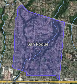
Boundary map of Upper State.
Crime Index for 93105
99
The crime index in 93105 is 99, which is 1.0 times lower than national average.
Market Trends
Historical market data near 10 Canon Dr over selected time period.
Nearby Properties on Canon Dr
- 345 Canon Dr, Santa Barbara, CA 93105 (San Roque) is a 2,852 square foot, 4 bedroom, 4.25 bathroom, 0.25 acre property. It was built in 1946 and has an estimate of $2,460,624 with a price per ft² of $863.
- 277 Canon Dr, Santa Barbara, CA 93105 (San Roque) is a 1,710 square foot, 3 bedroom, 3 bathroom, 0.21 acre property. It was built in 1952 and has an estimate of $2,278,242 with a price per ft² of $1,332.
- 206 Canon Dr, Santa Barbara, CA 93105 (San Roque) is a 3,094 square foot, 4 bedroom, 3 bathroom, 0.31 acre property. It was built in 1930 and has an estimate of $2,785,813 with a price per ft² of $900.
- 382 Canon Dr, Santa Barbara, CA 93105 (San Roque) is a 2,705 square foot, 4 bedroom, 2.5 bathroom, 0.46 acre property. It was built in 1926 and has an estimate of $3,316,405 with a price per ft² of $1,226.
- 247 Canon Dr, Santa Barbara, CA 93105 (San Roque) is a 2,005 square foot, 3 bedroom, 3.25 bathroom, 0.25 acre property. It was built in 1959 and has an estimate of $2,409,031 with a price per ft² of $1,202.
- 270 Canon Dr, Santa Barbara, CA 93105 (San Roque) is a 1,506 square foot, 3 bedroom, 2 bathroom, 0.41 acre property. It was built in 1949 and has an estimate of $2,165,670 with a price per ft² of $1,444.
- 10 Canon Dr, Santa Barbara, CA 93105 (San Roque) is a 1,455 square foot, 3 bedroom, 2 bathroom, 0.18 acre property. It was built in 1949 and has an estimate of $1,740,170 with a price per ft² of $1,196.
- 342 Canon Dr, Santa Barbara, CA 93105 (San Roque) is a 2,300 square foot, 4 bedroom, 4.25 bathroom, 0.26 acre property. It was built in 1936 and has an estimate of $2,647,836 with a price per ft² of $1,151.
- 281 Canon Dr, Santa Barbara, CA 93105 (San Roque) is a 2,279 square foot, 4 bedroom, 3 bathroom, 0.16 acre property. It was built in 1948 and has an estimate of $2,013,420 with a price per ft² of $883.
- 405 Canon Dr, Santa Barbara, CA 93105 (San Roque) is a 4,482 square foot, 5 bedroom, 4.5 bathroom, 0.35 acre property. It was built in 1929 and has an estimate of $3,706,747 with a price per ft² of $827.
- 429 Canon Dr, Santa Barbara, CA 93105 (San Roque) is a 3,179 square foot, 4 bedroom, 4.25 bathroom, 0.36 acre property. It was built in 2004 and has an estimate of $3,182,748 with a price per ft² of $1,001.
- 410 Canon Dr, Santa Barbara, CA 93105 (San Roque) is a 3,550 square foot, 3 bedroom, 5.25 bathroom, 0.29 acre property. It was built in 1937 and has an estimate of $3,286,250 with a price per ft² of $926.
- 194 Canon Dr, Santa Barbara, CA 93105 (San Roque) is a 2,717 square foot, 4 bedroom, 3 bathroom, 0.31 acre property. It was built in 1933 and has an estimate of $2,684,404 with a price per ft² of $988.
- 156 Canon Dr, Santa Barbara, CA 93105 (San Roque) is a 3,566 square foot, 3 bedroom, 4.25 bathroom, 0.22 acre property. It was built in 1945 and has an estimate of $3,048,355 with a price per ft² of $855.
- 215 Canon Dr, Santa Barbara, CA 93105 (San Roque) is a 3,013 square foot, 5 bedroom, 4 bathroom, 0.58 acre property. It was built in 1933 and has an estimate of $3,072,852 with a price per ft² of $1,020.
- 246 Canon Dr, Santa Barbara, CA 93105 (San Roque) is a 3,262 square foot, 5 bedroom, 3.5 bathroom, 0.36 acre property. It was built in 1930 and has an estimate of $2,744,718 with a price per ft² of $725.
- 205 Canon Dr, Santa Barbara, CA 93105 (San Roque) is a 2,259 square foot, 3 bedroom, 3 bathroom, 0.52 acre property. It was built in 1948 and has an estimate of $2,534,446 with a price per ft² of $1,122.
- 212 Canon Dr, Santa Barbara, CA 93105 (San Roque) is a 2,848 square foot, 4 bedroom, 3.5 bathroom, 0.23 acre property.
- 224 Canon Dr, Santa Barbara, CA 93105 (San Roque) is a 2,880 square foot, 4 bedroom, 2.5 bathroom, 0.32 acre property. It was built in 1928 and has an estimate of $2,420,777 with a price per ft² of $841.
- 178 Canon Dr, Santa Barbara, CA 93105 (San Roque) is a 3,463 square foot, 3 bedroom, 3.25 bathroom, 0.32 acre property. It was built in 1941 and has an estimate of $3,299,313 with a price per ft² of $953.
- 23 Canon Dr, Santa Barbara, CA 93105 (Upper State) is a 1,552 square foot, 3 bedroom, 2 bathroom, 0.34 acre property. It was built in 1945 and has an estimate of $1,960,972 with a price per ft² of $1,264.
- 114 Canon Dr, Santa Barbara, CA 93105 (San Roque) is a 2,100 square foot, 3 bedroom, 2 bathroom, 0.32 acre property. It was built in 1941 and has an estimate of $2,586,832 with a price per ft² of $1,232.
- 117 Canon Dr, Santa Barbara, CA 93105 (San Roque) is a 2,365 square foot, 3 bedroom, 3.25 bathroom, 0.29 acre property. It was built in 1947 and has an estimate of $2,809,744 with a price per ft² of $1,188.
- 272 Canon Dr, Santa Barbara, CA 93105 (San Roque) is a 1,506 square foot, 3 bedroom, 2 bathroom, 0.49 acre property. It was built in 1969 and has an estimate of $2,272,445 with a price per ft² of $1,509.
- 280 Canon Dr, Santa Barbara, CA 93105 (San Roque) is a 1,251 square foot, 3 bedroom, 2 bathroom, 0.22 acre property. It was built in 1949 and has an estimate of $1,788,737 with a price per ft² of $1,430.
- View more properties on Canon Dr