10300 Gilespie St
Las Vegas, NV 89183
- -Bed
- -Bath
- -Living Area
- 2.5acLot Size
- -Pool
- -Car
- -Year Built
- -DOM
- 1Permit
Permits
10300 Gilespie St has 1 permit records of total value of $1,472.
Current Ownership
Information about the current owner(s).
Taxes Billed
Taxes billed in 2022$8,821.52From latest Total Assessed Value1.38%Total Assessed Value$641,281=Land+
Assessed Value$641,281Additions
Assessed Value$0
In 2022, taxes billed for 10300 Gilespie St were $8,821.52, which is 1.38% from latest Total Assessed Value of $641,281.
Property History
10300 Gilespie St has undefined property events records (listings, deeds, permits, tax, foreclosure, loan).
Environment
Environmental factors around 10300 Gilespie St
Hazard Risks
Earthquake131Particulates109Nat'l Avg100Carb Mono91Air Pollution90Ozone85Lead56Wind20Tornado11Weather6Hurricane5Hail3
12 hazards (Carbon Monoxide, Earthquake Risk, Hail Index, Tornado Index, Hurricane Index, Air Pollution Index, Ozone Index, Wind Index, Weather Risk, Lead Index, Particulate Matter, National Average) are above the national average around 10300 Gilespie St.
Walkability Index
8 /20
Most Walkable
20-18
Very Walkable
17-15
Somewhat Walkable
14-10
Car Dependent
9-0
10300 Gilespie St has a walkability score of 8 out of 20, which means that it is in a car dependent area.
Temperature
Seasonal temperature sampled over multiple years
Winter
Average
Low
34°F
High
59°F
Summer
Average
Low
70°F
High
101°F
In the winter at 10300 Gilespie St, temperatures range from 33.85°F to 59.14°F with an average of 46.5°F. In the summer, the temperature ranges from 70.49°F to 100.52°F with and average of 85.51°F.
School Information
Public/private schools serving 10300 Gilespie St
Public Schools
Nearby public schools serving 10300 Gilespie St have ratings undefined, undefined, and undefined.
Neighborhood
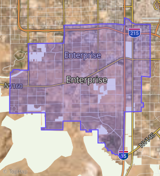
This property is located in Enterprise, Las Vegas, NV 89183.
Seasonal Housing units 89183
36%of housing is for seasonal rent.
Daytime Population for 89183
-33%of people during work hours.
Boundary map of Enterprise.
Crime Index for 89183
70
The crime index in 89183 is 70, which is 0.7 times lower than national average.
Market Trends
Historical market data near 10300 Gilespie St over selected time period.
Nearby Properties on Gilespie St
- 10640 Gilespie St, Las Vegas, NV 89183 is a 2,977 square foot, 3 bedroom, 3 bathroom, 2.2 acre property. It was built in 1979 and has an estimate of $1,388,730 with a price per ft² of $466.
- 10635 Gilespie St, Las Vegas, NV 89183 is a 5,887 square foot, 4 bedroom, 5.5 bathroom, 1.1 acre property. It was built in 1990 and has an estimate of $1,561,934 with a price per ft² of $265.
- 7845 Gilespie St, Las Vegas, NV 89123 (Enterprise) is a 1,674 square foot, 3 bedroom, 4.25 bathroom, 1.01 acre property. It was built in 1992 and has an estimate of $1,039,171 with a price per ft² of $621.
- 7840 Gilespie St, Las Vegas, NV 89123 (Enterprise) is a 3,151 square foot, 4 bedroom, 5.25 bathroom, 0.51 acre property. It was built in 1986 and has an estimate of $1,080,122 with a price per ft² of $343.
- 7830 Gilespie St, Las Vegas, NV 89123 (Enterprise) is a 2,228 square foot, 3 bedroom, 2 bathroom, 0.51 acre property. It was built in 1981 and has an estimate of $599,690 with a price per ft² of $269.
- 7820 Gilespie St, Las Vegas, NV 89123 (Enterprise) is a 3,140 square foot, 5 bedroom, 2 bathroom, 0.61 acre property. It was built in 1980 and has an estimate of $711,822 with a price per ft² of $227.
- 7810 Gilespie St, Las Vegas, NV 89123 (Enterprise) is a 2,323 square foot, 4 bedroom, 3 bathroom, 0.6 acre property. It was built in 1981 and has an estimate of $777,049 with a price per ft² of $335.
- 7980 Gilespie St, Las Vegas, NV 89123 (Enterprise) is a 2,879 square foot, 4 bedroom, 4.25 bathroom, 0.6 acre property. It was built in 1998 and has an estimate of $934,775 with a price per ft² of $325.
- 10045 Gilespie St, Las Vegas, NV 89183 (Enterprise) is a 2,734 square foot, 3 bedroom, 2 bathroom, 2.1 acre property. It was built in 1989 and has an estimate of $1,515,618 with a price per ft² of $554.
- 8015 Gilespie St, Las Vegas, NV 89123 (Enterprise) is a 3,076 square foot, 5 bedroom, 5.25 bathroom, 0.6 acre property. It was built in 2008 and has an estimate of $1,263,095 with a price per ft² of $411.
- 7695 Gilespie St, Las Vegas, NV 89123 (Enterprise) is a 3,409 square foot, 3 bedroom, 4.25 bathroom, 0.48 acre property. It was built in 2001 and has an estimate of $1,061,003 with a price per ft² of $311.
- 7720 Gilespie St, Las Vegas, NV 89123 (Enterprise) is a 1,150 square foot, 2 bedroom, 2 bathroom, 1.93 acre property. It was built in 1942 and has an estimate of $964,598 with a price per ft² of $839.
- 7755 Gilespie St, Las Vegas, NV 89123 (Enterprise) is a 3,026 square foot, 4 bedroom, 4.25 bathroom, 0.55 acre property. It was built in 1999 and has an estimate of $1,079,032 with a price per ft² of $357.
- 7765 Gilespie St, Las Vegas, NV 89123 (Enterprise) is a 4,269 square foot, 4 bedroom, 3 bathroom, 0.56 acre property. It was built in 1998 and has an estimate of $1,278,554 with a price per ft² of $299.
- 7760 Gilespie St, Las Vegas, NV 89123 (Enterprise) is a 4,743 square foot, 7 bedroom, 5.25 bathroom, 0.51 acre property. It was built in 1998 and has an estimate of $1,103,097 with a price per ft² of $233.
- 8045 Gilespie St, Las Vegas, NV 89123 (Enterprise) is a 3,848 square foot, 5 bedroom, 6.25 bathroom, 0.52 acre property. It was built in 2008 and has an estimate of $1,469,528 with a price per ft² of $382.
- 7785 Gilespie St, Las Vegas, NV 89123 (Enterprise) is a 3,748 square foot, 4 bedroom, 3 bathroom, 0.55 acre property. It was built in 1999 and has an estimate of $1,180,578 with a price per ft² of $315.
- 8162 Gilespie St, Las Vegas, NV 89123 (Enterprise) is a 2,885 square foot, 3 bedroom, 2 bathroom, 2.48 acre property. It was built in 1965 and has an estimate of $898,337 with a price per ft² of $311.
- 7775 Gilespie St, Las Vegas, NV 89123 (Enterprise) is a 2,575 square foot, 3 bedroom, 2 bathroom, 0.55 acre property. It was built in 2000 and has an estimate of $818,920 with a price per ft² of $318.
- 10300 Gilespie St, Las Vegas, NV 89183 (Enterprise) is a 2.54 acre property.
- 7790 Gilespie St, Las Vegas, NV 89123 (Enterprise) is a 2,308 square foot, 3 bedroom, 3.25 bathroom, 0.6 acre property. It was built in 1996 and has an estimate of $796,019 with a price per ft² of $345.
- 10975 Gilespie St, Las Vegas, NV 89183 is a 708 square foot, 1 bedroom, 1 bathroom, 1 acre property. It was built in 1990 and has an estimate of $555,396 with a price per ft² of $784.
- 8210 Gilespie St, Las Vegas, NV 89123 (Enterprise) is a 1,784 square foot, 3 bedroom, 3.25 bathroom, 1 acre property. It was built in 1990 and has an estimate of $830,179 with a price per ft² of $465.
- 8230 Gilespie St, Las Vegas, NV 89123 (Enterprise) is a 4,579 square foot, 4 bedroom, 4.25 bathroom, 1.16 acre property. It was built in 1999 and has an estimate of $1,044,620 with a price per ft² of $228.
- 8040 Gilespie St, Las Vegas, NV 89123 (Enterprise) is a 2,336 square foot, 3 bedroom, 2 bathroom, 1.02 acre property. It was built in 1977 and has an estimate of $820,406 with a price per ft² of $351.
- View more properties on Gilespie St