10500 Wigwam Rd
Jamestown, CA 95327
- 3Beds
- 2Baths
- 1,368ft²Living Area
- 0.3acLot Size
- -Pool
- -Car
- 1971Year Built
- -DOM
- 2Permits
Property Valuations
Latest estimates for 10500 Wigwam Rd based on TopHap automated valuation model (AVM).
TopHap Estimate
$380,800
$278/ft²
Updated 3 months ago
10500 Wigwam Rd is valued at $380,800 by TopHap AVM 3 months ago.
Permits
10500 Wigwam Rd has 2 permit records of total value of $8,280.
Current Ownership
Information about the current owner(s).
Taxes Billed
Taxes billed in 2023$2,794.16From latest Total Assessed Value1.02%Total Assessed Value$274,285=Land+
Assessed Value$115,894Additions
Assessed Value$158,391
In 2023, taxes billed for 10500 Wigwam Rd were $2,794.16, which is 1.02% from latest Total Assessed Value of $274,285.
Property History
10500 Wigwam Rd has undefined property events records (listings, deeds, permits, tax, foreclosure, loan).
Environment
Environmental factors around 10500 Wigwam Rd
Hazard Risks
Nat'l Avg100Particulates95Earthquake82Air Pollution81Ozone79Carb Mono77Lead41Hail2Hurricane0Tornado0Weather0Wind0
8 hazards (Carbon Monoxide, Earthquake Risk, Hail Index, Air Pollution Index, Ozone Index, Lead Index, Particulate Matter, National Average) are above the national average around 10500 Wigwam Rd.
Walkability Index
5 /20
Most Walkable
20-18
Very Walkable
17-15
Somewhat Walkable
14-10
Car Dependent
9-0
10500 Wigwam Rd has a walkability score of 5 out of 20, which means that it is in a car dependent area.
Noise Level
51 dB
Quiet Suburban Residential 0-49
Suburban Residential 50-54
Urban Residential 55-59
Noisy Urban Residential 60-64
Very Noisy Urban Residential 65+
Noise at 10500 Wigwam Rd is around 51dBs, which is comparable to a Suburban Residential area.
Temperature
Seasonal temperature sampled over multiple years
Winter
Average
Low
38°F
High
58°F
Summer
Average
Low
58°F
High
92°F
In the winter at 10500 Wigwam Rd, temperatures range from 37.62°F to 57.96°F with an average of 47.79°F. In the summer, the temperature ranges from 58.44°F to 92.42°F with and average of 75.43°F.
School Information
Public/private schools serving 10500 Wigwam Rd
Public Schools
Nearby public schools serving 10500 Wigwam Rd have ratings undefined, undefined, and undefined.
Neighborhood
This property is located in Jamestown.
Seasonal Housing units 95327
70%of housing is for seasonal rent.
Daytime Population for 95327
-16%of people during work hours.
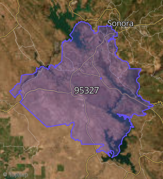
Boundary map of Jamestown.
Crime Index for 95327
88
The crime index in 95327 is 88, which is 0.9 times lower than national average.
Market Trends
Historical market data near 10500 Wigwam Rd over selected time period.
Nearby Properties on Wigwam Rd
- 10512 Wigwam Rd, Jamestown, CA 95327 is a 1,454 square foot, 2 bedroom, 2 bathroom, 1.98 acre property. It was built in 1948 and has an estimate of $416,880 with a price per ft² of $287.
- 10760 Wigwam Rd, Jamestown, CA 95327 is a 1.9 acre property. It has an estimate of $324,316.
- 10500 Wigwam Rd, Jamestown, CA 95327 is a 1,368 square foot, 3 bedroom, 2 bathroom, 0.27 acre property. It was built in 1971 and has an estimate of $333,644 with a price per ft² of $244.
- 10678 Wigwam Rd #Spc 5, Jamestown, CA 95327 is a 1,056 square foot, 2 bedroom, 2 bathroom, 4.98 acre property. It was built in 1987 and has an estimate of $356,133 with a price per ft² of $337.
- 10760 Wigwam Rd #Spc 44, Jamestown, CA 95327 is a 1,152 square foot and 28.43 acre property. It was built in 1960 and has an estimate of $474,904 with a price per ft² of $412.
- 10678 Wigwam Rd #Spc 18, Jamestown, CA 95327 is a 1,056 square foot, 3 bedroom, 2 bathroom, 4.98 acre property. It was built in 1987 and has an estimate of $354,164 with a price per ft² of $335.
- 10760 Wigwam Rd #Spc 2, Jamestown, CA 95327 is a 1,152 square foot, 2 bedroom, 1 bathroom, 28.43 acre property. It was built in 1960 and has an estimate of $518,314 with a price per ft² of $450.
- 10760 Wigwam Rd #Spc 61, Jamestown, CA 95327 is a 1,152 square foot, 3 bedroom, 2 bathroom, 28.43 acre property. It was built in 1960 and has an estimate of $471,921 with a price per ft² of $410.
- 10760 Wigwam Rd #Spc 69, Jamestown, CA 95327 is a 1,152 square foot, 3 bedroom, 2 bathroom, 28.43 acre property. It was built in 1988 and has an estimate of $425,778 with a price per ft² of $370.
- 10760 Wigwam Rd #Spc 60, Jamestown, CA 95327 is a 1,152 square foot, 3 bedroom, 2 bathroom, 28.43 acre property. It was built in 1960 and has an estimate of $458,757 with a price per ft² of $398.
- 10760 Wigwam Rd #Spc 54, Jamestown, CA 95327 is a 1,152 square foot, 3 bedroom, 2 bathroom, 28.43 acre property. It was built in 1960 and has an estimate of $455,328 with a price per ft² of $395.
- 10760 Wigwam Rd #Spc 63, Jamestown, CA 95327 is a 1,152 square foot, 3 bedroom, 2 bathroom, 28.43 acre property. It was built in 1960 and has an estimate of $463,913 with a price per ft² of $403.
- 10760 Wigwam Rd #Spc 73, Jamestown, CA 95327 is a 1,152 square foot, 2 bedroom, 1 bathroom, 28.43 acre property. It was built in 1960 and has an estimate of $455,422 with a price per ft² of $395.
- 10760 Wigwam Rd #Spc 24, Jamestown, CA 95327 is a 1,152 square foot, 2 bedroom, 1 bathroom, 28.43 acre property. It was built in 1997 and has an estimate of $450,606 with a price per ft² of $391.
- 10628 Wigwam Rd, Jamestown, CA 95327 is a 5,453 square foot and 4.98 acre property.
- 10678 Wigwam Rd #Spc 19, Jamestown, CA 95327 is a 1,056 square foot, 2 bedroom, 2 bathroom, 4.98 acre property. It was built in 1987 and has an estimate of $367,128 with a price per ft² of $348.
- 10678 Wigwam Rd #Spc 9, Jamestown, CA 95327 is a 1,056 square foot, 3 bedroom, 2 bathroom, 4.98 acre property. It was built in 1987 and has an estimate of $347,327 with a price per ft² of $329.
- 10678 Wigwam Rd #Spc 2, Jamestown, CA 95327 is a 1,056 square foot, 3 bedroom, 2 bathroom, 4.98 acre property. It was built in 1987 and has an estimate of $347,327 with a price per ft² of $329.
- 10678 Wigwam Rd #Spc 22, Jamestown, CA 95327 is a 1,056 square foot, 3 bedroom, 2 bathroom, 4.98 acre property. It was built in 1987 and has an estimate of $347,327 with a price per ft² of $329.
- 10678 Wigwam Rd #Spc 23, Jamestown, CA 95327 is a 1,056 square foot, 3 bedroom, 2 bathroom, 4.98 acre property. It was built in 1987 and has an estimate of $347,327 with a price per ft² of $329.
- 10678 Wigwam Rd #Spc 14, Jamestown, CA 95327 is a 1,056 square foot, 3 bedroom, 2 bathroom, 4.98 acre property. It was built in 1987 and has an estimate of $360,695 with a price per ft² of $342.
- 10678 Wigwam Rd #Spc 11, Jamestown, CA 95327 is a 1,056 square foot, 2 bedroom, 2 bathroom, 4.98 acre property. It was built in 1987 and has an estimate of $343,770 with a price per ft² of $326.
- 10678 Wigwam Rd #Spc 15, Jamestown, CA 95327 is a 1,056 square foot, 2 bedroom, 2 bathroom, 4.98 acre property. It was built in 1987 and has an estimate of $361,353 with a price per ft² of $342.
- 10678 Wigwam Rd #Spc 3, Jamestown, CA 95327 is a 1,056 square foot, 3 bedroom, 2 bathroom, 4.98 acre property. It was built in 1987 and has an estimate of $342,064 with a price per ft² of $324.
- 10678 Wigwam Rd #Spc 6, Jamestown, CA 95327 is a 1,056 square foot, 2 bedroom, 2 bathroom, 4.98 acre property. It was built in 1987 and has an estimate of $362,029 with a price per ft² of $343.
- View more properties on Wigwam Rd