10878 Arrowood Dr
Stockton, CA 95219
- 3Beds
- 2Baths
- 1,940ft²Living Area
- 5,000ft²Lot Size
- -Pool
- 2Car
- 2004Year Built
- -DOM
- 4Permits
Property Valuations
Latest estimates for 10878 Arrowood Dr based on TopHap automated valuation model (AVM).
TopHap Estimate
$516,500
$266/ft²
+$162K above Sold Price
Updated 3 months ago
Last Sold Price
$355,000
$183/ft²
5 years ago
10878 Arrowood Dr is valued at $516,500 by TopHap AVM 3 months ago.
10878 Arrowood Dr was last sold in 2018 for $355,000.
Permits
10878 Arrowood Dr has 4 permit records of total value of $162,052.
Current Ownership
Information about the current owner(s).
Taxes Billed
Taxes billed in 2023$5,617.52From latest Total Assessed Value1.48%Total Assessed Value$380,629=Land+
Assessed Value$128,663Additions
Assessed Value$251,966
In 2023, taxes billed for 10878 Arrowood Dr were $5,617.52, which is 1.48% from latest Total Assessed Value of $380,629.
Property History
10878 Arrowood Dr has undefined property events records (listings, deeds, permits, tax, foreclosure, loan).
Environment
Environmental factors around 10878 Arrowood Dr
Hazard Risks
Earthquake153Particulates101Nat'l Avg100Air Pollution85Ozone80Carb Mono79Lead42Tornado32Weather12Wind2Hail0Hurricane0
10 hazards (Carbon Monoxide, Earthquake Risk, Tornado Index, Air Pollution Index, Ozone Index, Wind Index, Weather Risk, Lead Index, Particulate Matter, National Average) are above the national average around 10878 Arrowood Dr.
Walkability Index
16 /20
Most Walkable
20-18
Very Walkable
17-15
Somewhat Walkable
14-10
Car Dependent
9-0
10878 Arrowood Dr has a walkability score of 16 out of 20, which means that it is in a very walkable area.
Temperature
Seasonal temperature sampled over multiple years
Winter
Average
Low
38°F
High
57°F
Summer
Average
Low
57°F
High
90°F
In the winter at 10878 Arrowood Dr, temperatures range from 38.17°F to 56.64°F with an average of 47.41°F. In the summer, the temperature ranges from 56.54°F to 89.95°F with and average of 73.25°F.
School Information
Public/private schools serving 10878 Arrowood Dr
Public Schools
Nearby public schools serving 10878 Arrowood Dr have ratings undefined, undefined, and undefined.
Neighborhood
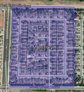
This property is located in Bear Creek, Stockton, CA 95219.
Seasonal Housing units 95219
39%of housing is for seasonal rent.
Daytime Population for 95219
-7%of people during work hours.
Boundary map of Bear Creek.
Crime Index for 95219
96
The crime index in 95219 is 96, which is 1.0 times lower than national average.
Market Trends
Historical market data near 10878 Arrowood Dr over selected time period.
Nearby Properties on Arrowood Dr
- 10828 Arrowood Dr, Stockton, CA 95219 (Monterey) is a 2,981 square foot, 6 bedroom, 3 bathroom, 0.11 acre property. It was built in 2005 and has an estimate of $615,028 with a price per ft² of $206.
- 10816 Arrowood Dr, Stockton, CA 95219 (Monterey) is a 2,981 square foot, 5 bedroom, 3 bathroom, 0.11 acre property. It was built in 2005 and has an estimate of $612,198 with a price per ft² of $205.
- 10874 Arrowood Dr, Stockton, CA 95219 (Monterey) is a 1,674 square foot, 3 bedroom, 2 bathroom, 0.11 acre property. It was built in 2004 and has an estimate of $467,079 with a price per ft² of $279.
- 10810 Arrowood Dr, Stockton, CA 95219 (Monterey) is a 2,194 square foot, 4 bedroom, 2 bathroom, 0.12 acre property. It was built in 2005 and has an estimate of $544,006 with a price per ft² of $248.
- 10886 Arrowood Dr, Stockton, CA 95219 (Monterey) is a 1,940 square foot, 3 bedroom, 2 bathroom, 0.13 acre property. It was built in 2004 and has an estimate of $512,587 with a price per ft² of $264.
- 10882 Arrowood Dr, Stockton, CA 95219 (Monterey) is a 2,194 square foot, 4 bedroom, 2 bathroom, 0.11 acre property. It was built in 2004 and has an estimate of $528,135 with a price per ft² of $241.
- 10840 Arrowood Dr, Stockton, CA 95219 (Monterey) is a 2,981 square foot, 5 bedroom, 3 bathroom, 0.11 acre property. It was built in 2004 and has an estimate of $630,505 with a price per ft² of $212.
- 10834 Arrowood Dr, Stockton, CA 95219 (Monterey) is a 2,194 square foot, 3 bedroom, 2 bathroom, 0.11 acre property. It was built in 2004 and has an estimate of $537,200 with a price per ft² of $245.
- 10846 Arrowood Dr, Stockton, CA 95219 (Monterey) is a 1,940 square foot, 3 bedroom, 2 bathroom, 0.11 acre property. It was built in 2004 and has an estimate of $508,501 with a price per ft² of $262.
- 10822 Arrowood Dr, Stockton, CA 95219 (Monterey) is a 2,769 square foot, 4 bedroom, 3 bathroom, 0.11 acre property. It was built in 2005 and has an estimate of $595,420 with a price per ft² of $215.
- 10852 Arrowood Dr, Stockton, CA 95219 (Monterey) is a 2,194 square foot, 4 bedroom, 3.25 bathroom, 0.11 acre property. It was built in 2004 and has an estimate of $507,605 with a price per ft² of $231.
- 10858 Arrowood Dr, Stockton, CA 95219 (Monterey) is a 1,674 square foot, 3 bedroom, 2 bathroom, 0.11 acre property. It was built in 2004 and has an estimate of $468,428 with a price per ft² of $280.
- 10862 Arrowood Dr, Stockton, CA 95219 (Monterey) is a 2,194 square foot, 4 bedroom, 2 bathroom, 0.11 acre property. It was built in 2004 and has an estimate of $539,884 with a price per ft² of $246.
- 10866 Arrowood Dr, Stockton, CA 95219 (Monterey) is a 2,981 square foot, 4 bedroom, 3.25 bathroom, 0.11 acre property. It was built in 2004 and has an estimate of $588,115 with a price per ft² of $197.
- 10870 Arrowood Dr, Stockton, CA 95219 (Monterey) is a 1,940 square foot, 3 bedroom, 2 bathroom, 0.11 acre property. It was built in 2004 and has an estimate of $498,575 with a price per ft² of $257.
- 10878 Arrowood Dr, Stockton, CA 95219 (Monterey) is a 1,940 square foot, 3 bedroom, 2 bathroom, 0.11 acre property. It was built in 2004 and has an estimate of $490,860 with a price per ft² of $253.