111 Ashton Ln
Kingsland, GA 31548
- 4Beds
- 3Baths
- 3,056ft²Living Area
- 1.2acLot Size
- 1Pool
- 2Car
- 2004Year Built
- -DOM
- -Permit
Property Valuations
Latest estimates for 111 Ashton Ln based on TopHap automated valuation model (AVM).
TopHap Estimate
$642,816
$210/ft²
+$23K above Sold Price
Updated 3 months ago
Last Sold Price
$620,000
$203/ft²
13 months ago
111 Ashton Ln is valued at $642,816 by TopHap AVM 3 months ago.
111 Ashton Ln was last sold in 2023 for $620,000.
Current Ownership
Information about the current owner(s).
Taxes Billed
Taxes billed in 2022$6,374.15From latest Total Assessed Value2.61%Total Assessed Value$244,263=Land+
Assessed Value$24,000Additions
Assessed Value$220,263
In 2022, taxes billed for 111 Ashton Ln were $6,374.15, which is 2.61% from latest Total Assessed Value of $244,263.
Property History
111 Ashton Ln has undefined property events records (listings, deeds, permits, tax, foreclosure, loan).
Environment
Environmental factors around 111 Ashton Ln
Hazard Risks
Hurricane381Weather226Nat'l Avg100Particulates95Carb Mono82Tornado81Ozone76Air Pollution74Earthquake34Lead25Wind8Hail0
11 hazards (Carbon Monoxide, Earthquake Risk, Tornado Index, Hurricane Index, Air Pollution Index, Ozone Index, Wind Index, Weather Risk, Lead Index, Particulate Matter, National Average) are above the national average around 111 Ashton Ln.
Walkability Index
8 /20
Most Walkable
20-18
Very Walkable
17-15
Somewhat Walkable
14-10
Car Dependent
9-0
111 Ashton Ln has a walkability score of 8 out of 20, which means that it is in a car dependent area.
Temperature
Seasonal temperature sampled over multiple years
Winter
Average
Low
44°F
High
66°F
Summer
Average
Low
72°F
High
90°F
In the winter at 111 Ashton Ln, temperatures range from 43.93°F to 66.01°F with an average of 54.97°F. In the summer, the temperature ranges from 71.55°F to 90.41°F with and average of 80.98°F.
School Information
Public/private schools serving 111 Ashton Ln
Public Schools
Nearby public schools serving 111 Ashton Ln have ratings undefined, undefined, and undefined.
Neighborhood
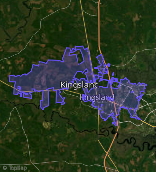
This property is located in Kingsland.
Seasonal Housing units 31548
19%of housing is for seasonal rent.
Daytime Population for 31548
-26%of people during work hours.
Boundary map of Kingsland.
Crime Index for 31548
100
The crime index in 31548 is 100, which is 1.0 times lower than national average.
Market Trends
Historical market data near 111 Ashton Ln over selected time period.
Nearby Properties on Ashton Ln
- 105 Ashton Ln, Kingsland, GA 31548 is a 2,299 square foot, 4 bedroom, 3 bathroom, 1.04 acre property. It was built in 2004 and has an estimate of $431,000 with a price per ft² of $187.
- 116 Ashton Ln, Kingsland, GA 31548 is a 2,424 square foot, 4 bedroom, 3.25 bathroom, 0.75 acre property. It was built in 2004 and has an estimate of $381,996 with a price per ft² of $158.
- 103 Ashton Ln, Kingsland, GA 31548 is a 2,921 square foot, 4 bedroom, 3 bathroom, 1.47 acre property. It was built in 2006 and has an estimate of $466,022 with a price per ft² of $160.
- 114 Ashton Ln, Kingsland, GA 31548 is a 3,228 square foot, 5 bedroom, 3 bathroom, 0.8 acre property. It was built in 2005 and has an estimate of $349,250 with a price per ft² of $108.
- 119 Ashton Ln, Kingsland, GA 31548 is a 2,531 square foot, 3 bedroom, 2 bathroom, 3.6 acre property. It was built in 2003 and has an estimate of $499,438 with a price per ft² of $197.
- 117 Ashton Ln, Kingsland, GA 31548 is a 2,842 square foot, 4 bedroom, 3 bathroom, 1.43 acre property. It was built in 2005 and has an estimate of $493,473 with a price per ft² of $174.
- 113 Ashton Ln, Kingsland, GA 31548 is a 1,984 square foot, 4 bedroom, 2 bathroom, 1.07 acre property. It was built in 2004 and has an estimate of $435,000 with a price per ft² of $219.
- 107 Ashton Ln, Kingsland, GA 31548 is a 4,260 square foot, 5 bedroom, 5.5 bathroom, 1.31 acre property. It was built in 2005 and has an estimate of $575,000 with a price per ft² of $135.
- 121 Ashton Ln, Kingsland, GA 31548 is a 4,979 square foot, 4 bedroom, 3 bathroom, 7.25 acre property. It was built in 2005 and has an estimate of $834,686 with a price per ft² of $168.
- 111 Ashton Ln, Kingsland, GA 31548 is a 3,056 square foot, 4 bedroom, 3 bathroom, 0.99 acre property. It was built in 2004 and has an estimate of $526,222 with a price per ft² of $172.
- 119 Ashton Ln, Kingsland, GA 31548 is a 4.75 acre property.