128 Anderson Dr
Watsonville, CA 95076
- 3Beds
- 2Baths
- 1,289ft²Living Area
- 6,447ft²Lot Size
- 1Pool
- 1Car
- 1951Year Built
- -DOM
- -Permit
Property Valuations
Latest estimates for 128 Anderson Dr based on TopHap automated valuation model (AVM).
TopHap Estimate
$681,700
$528/ft²
Updated 3 months ago
128 Anderson Dr is valued at $681,700 by TopHap AVM 3 months ago.
Current Ownership
Information about the current owner(s).
Taxes Billed
Taxes billed in 2023$6,264.96From latest Total Assessed Value1.35%Total Assessed Value$463,265=Land+
Assessed Value$331,789Additions
Assessed Value$131,476
In 2023, taxes billed for 128 Anderson Dr were $6,264.96, which is 1.35% from latest Total Assessed Value of $463,265.
Property History
128 Anderson Dr has undefined property events records (listings, deeds, permits, tax, foreclosure, loan).
Environment
Environmental factors around 128 Anderson Dr
Hazard Risks
Earthquake510Particulates102Nat'l Avg100Air Pollution84Ozone82Carb Mono76Lead43Tornado13Weather2Hail0Hurricane0Wind0
9 hazards (Carbon Monoxide, Earthquake Risk, Tornado Index, Air Pollution Index, Ozone Index, Weather Risk, Lead Index, Particulate Matter, National Average) are above the national average around 128 Anderson Dr.
Walkability Index
12 /20
Most Walkable
20-18
Very Walkable
17-15
Somewhat Walkable
14-10
Car Dependent
9-0
128 Anderson Dr has a walkability score of 12 out of 20, which means that it is in a somewhat walkable area.
Temperature
Seasonal temperature sampled over multiple years
Winter
Average
Low
39°F
High
61°F
Summer
Average
Low
51°F
High
75°F
In the winter at 128 Anderson Dr, temperatures range from 39.48°F to 61.46°F with an average of 50.47°F. In the summer, the temperature ranges from 51.25°F to 74.77°F with and average of 63.01°F.
School Information
Public/private schools serving 128 Anderson Dr
Public Schools
Nearby public schools serving 128 Anderson Dr have ratings undefined, undefined, and undefined.
Neighborhood
This property is located in Bone, Watsonville, CA 95076.
Seasonal Housing units 95076
51%of housing is for seasonal rent.
Daytime Population for 95076
-10%of people during work hours.
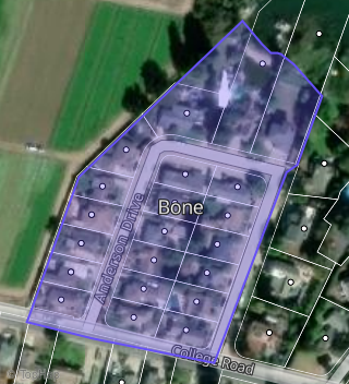
Boundary map of Bone.
Crime Index for 95076
73
The crime index in 95076 is 73, which is 0.7 times lower than national average.
Market Trends
Historical market data near 128 Anderson Dr over selected time period.
Nearby Properties on Anderson Dr
- 114 Anderson Dr, Watsonville, CA 95076 (Bone) is a 976 square foot, 2 bedroom, 1 bathroom, 0.14 acre property. It was built in 1949 and has an estimate of $707,592 with a price per ft² of $725.
- 113 Anderson Dr, Watsonville, CA 95076 (Bone) is a 1,288 square foot, 1 bedroom, 1 bathroom, 0.15 acre property. It was built in 1950 and has an estimate of $447,862 with a price per ft² of $348.
- 127 Anderson Dr, Watsonville, CA 95076 (Bone) is a 996 square foot, 2 bedroom, 1 bathroom, 0.15 acre property. It was built in 1951 and has an estimate of $561,139 with a price per ft² of $563.
- 139 Anderson Dr, Watsonville, CA 95076 is a 2,529 square foot, 4 bedroom, 2.5 bathroom, 0.3 acre property. It was built in 1985 and has an estimate of $1,137,582 with a price per ft² of $450.
- 124 Anderson Dr, Watsonville, CA 95076 (Bone) is a 1,559 square foot, 3 bedroom, 2 bathroom, 0.15 acre property. It was built in 1957 and has an estimate of $751,623 with a price per ft² of $470.
- 111 Anderson Dr, Watsonville, CA 95076 (Bone) is a 1,620 square foot, 3 bedroom, 1 bathroom, 0.15 acre property. It was built in 1948 and has an estimate of $769,828 with a price per ft² of $475.
- 120 Anderson Dr, Watsonville, CA 95076 (Bone) is a 1,904 square foot, 4 bedroom, 2 bathroom, 0.15 acre property. It was built in 1949 and has an estimate of $864,379 with a price per ft² of $467.
- 141 Anderson Dr, Watsonville, CA 95076 is a 2,851 square foot, 4 bedroom, 2 bathroom, 0.3 acre property. It was built in 1983 and has an estimate of $1,025,294 with a price per ft² of $360.
- 137 Anderson Dr, Watsonville, CA 95076 is a 2,628 square foot, 4 bedroom, 2 bathroom, 0.28 acre property. It was built in 1981 and has an estimate of $965,782 with a price per ft² of $367.
- 125 Anderson Dr, Watsonville, CA 95076 (Bone) is a 1,073 square foot, 2 bedroom, 1 bathroom, 0.15 acre property. It was built in 1948 and has an estimate of $671,804 with a price per ft² of $626.
- 126 Anderson Dr, Watsonville, CA 95076 (Bone) is a 1,038 square foot, 3 bedroom, 1 bathroom, 0.14 acre property. It was built in 1949 and has an estimate of $715,896 with a price per ft² of $696.
- 118 Anderson Dr, Watsonville, CA 95076 (Bone) is a 1,356 square foot, 3 bedroom, 1 bathroom, 0.15 acre property. It was built in 1949 and has an estimate of $621,347 with a price per ft² of $458.
- 123 Anderson Dr, Watsonville, CA 95076 (Bone) is a 1,382 square foot, 3 bedroom, 2 bathroom, 0.3 acre property. It was built in 1951 and has an estimate of $833,141 with a price per ft² of $603.
- 135 Anderson Dr, Watsonville, CA 95076 is a 1,617 square foot, 3 bedroom, 2 bathroom, 0.33 acre property. It was built in 1978 and has an estimate of $951,877 with a price per ft² of $589.
- 128 Anderson Dr, Watsonville, CA 95076 (Bone) is a 1,289 square foot, 3 bedroom, 2 bathroom, 0.15 acre property. It was built in 1951 and has an estimate of $662,744 with a price per ft² of $514.
- 108 Anderson Dr, Watsonville, CA 95076 (Bone) is a 1,378 square foot, 3 bedroom, 1 bathroom, 0.13 acre property. It was built in 1948 and has an estimate of $649,128 with a price per ft² of $471.
- 112 Anderson Dr, Watsonville, CA 95076 (Bone) is a 1,723 square foot, 3 bedroom, 1 bathroom, 0.15 acre property. It was built in 1949 and has an estimate of $664,017 with a price per ft² of $385.
- 116 Anderson Dr, Watsonville, CA 95076 (Bone) is a 1,036 square foot, 2 bedroom, 1 bathroom, 0.15 acre property. It was built in 1952 and has an estimate of $617,684 with a price per ft² of $596.
- 117 Anderson Dr, Watsonville, CA 95076 (Bone) is a 1,123 square foot, 2 bedroom, 2 bathroom, 0.14 acre property. It was built in 1952 and has an estimate of $626,006 with a price per ft² of $557.
- 133 Anderson Dr, Watsonville, CA 95076 (Bone) is a 4,271 square foot, 5 bedroom, 5.5 bathroom, 0.62 acre property. It was built in 1977 and has an estimate of $1,549,272 with a price per ft² of $363.
- 115 Anderson Dr, Watsonville, CA 95076 (Bone) is a 1,247 square foot, 2 bedroom, 1 bathroom, 0.15 acre property. It was built in 1954 and has an estimate of $659,607 with a price per ft² of $529.
- 119 Anderson Dr, Watsonville, CA 95076 (Bone) is a 1,997 square foot, 3 bedroom, 1.5 bathroom, 0.18 acre property. It was built in 1949 and has an estimate of $841,729 with a price per ft² of $599.
- 131 Anderson Dr, Watsonville, CA 95076 is a 2,662 square foot, 4 bedroom, 3 bathroom, 1.09 acre property. It was built in 1976 and has an estimate of $1,710,118 with a price per ft² of $642.
- 110 Anderson Dr, Watsonville, CA 95076 (Bone) is a 1,536 square foot, 3 bedroom, 1 bathroom, 0.14 acre property. It was built in 1948 and has an estimate of $665,414 with a price per ft² of $433.