12933 Atkinson Rd
Lodi, CA 95240
- 4Beds
- 2Baths
- 1,830ft²Living Area
- 1.4acLot Size
- -Pool
- 2Car
- 1976Year Built
- -DOM
- 9Permits
Property Valuations
Latest estimates for 12933 Atkinson Rd based on TopHap automated valuation model (AVM).
TopHap Estimate
$1,096,000
$598/ft²
Updated 3 months ago
12933 Atkinson Rd is valued at $1,096,000 by TopHap AVM 3 months ago.
Permits
12933 Atkinson Rd has 9 permit records of total value of $9,036.
Current Ownership
Information about the current owner(s).
Taxes Billed
Taxes billed in 2023$7,572.26From latest Total Assessed Value1.09%Total Assessed Value$697,068=Land+
Assessed Value$171,666Additions
Assessed Value$525,402
In 2023, taxes billed for 12933 Atkinson Rd were $7,572.26, which is 1.09% from latest Total Assessed Value of $697,068.
Property History
12933 Atkinson Rd has undefined property events records (listings, deeds, permits, tax, foreclosure, loan).
Environment
Environmental factors around 12933 Atkinson Rd
Hazard Risks
Earthquake120Particulates102Nat'l Avg100Ozone88Air Pollution85Carb Mono77Lead43Tornado29Weather11Hail0Hurricane0Wind0
9 hazards (Carbon Monoxide, Earthquake Risk, Tornado Index, Air Pollution Index, Ozone Index, Weather Risk, Lead Index, Particulate Matter, National Average) are above the national average around 12933 Atkinson Rd.
Walkability Index
4 /20
Most Walkable
20-18
Very Walkable
17-15
Somewhat Walkable
14-10
Car Dependent
9-0
12933 Atkinson Rd has a walkability score of 4 out of 20, which means that it is in a car dependent area.
Temperature
Seasonal temperature sampled over multiple years
Winter
Average
Low
38°F
High
56°F
Summer
Average
Low
57°F
High
91°F
In the winter at 12933 Atkinson Rd, temperatures range from 37.98°F to 56.37°F with an average of 47.18°F. In the summer, the temperature ranges from 56.61°F to 90.87°F with and average of 73.74°F.
School Information
Public/private schools serving 12933 Atkinson Rd
Public Schools
Nearby public schools serving 12933 Atkinson Rd have ratings undefined, and undefined.
Neighborhood
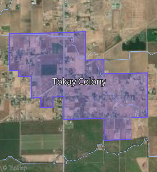
This property is located in Tokay Colony, Lodi, CA 95240.
Seasonal Housing units 95240
27%of housing is for seasonal rent.
Daytime Population for 95240
-4%of people during work hours.
Boundary map of Tokay Colony.
Crime Index for 95240
124
The crime index in 95240 is 124, which is 1.2 times higher than national average.
Market Trends
Historical market data near 12933 Atkinson Rd over selected time period.
Nearby Properties on Atkinson Rd
- 12551 Atkinson Rd, Lodi, CA 95240 (Tokay Colony) is a 1,248 square foot, 3 bedroom, 2 bathroom, 6.54 acre property. It was built in 1994 and has an estimate of $568,858 with a price per ft² of $456.
- 13000 Atkinson Rd, Lodi, CA 95240 (Tokay Colony) is a 1,200 square foot, 3 bedroom, 2 bathroom, 4.99 acre property. It was built in 1996 and has an estimate of $447,880 with a price per ft² of $373.
- 12255 Atkinson Rd, Lodi, CA 95240 is a 1,149 square foot, 3 bedroom, 1 bathroom, 3.2 acre property. It was built in 1968 and has an estimate of $490,521 with a price per ft² of $427.
- 12322 Atkinson Rd, Lodi, CA 95240 is a 1,080 square foot, 3 bedroom, 1 bathroom, 0.6 acre property. It was built in 1965 and has an estimate of $489,952 with a price per ft² of $454.
- 12358 Atkinson Rd, Lodi, CA 95240 is a 1,548 square foot, 4 bedroom, 2 bathroom, 0.6 acre property. It was built in 1965 and has an estimate of $529,004 with a price per ft² of $342.
- 12920 Atkinson Rd, Lodi, CA 95240 (Tokay Colony) is a 1,640 square foot, 2 bedroom, 2 bathroom, 4.78 acre property. It was built in 2011 and has an estimate of $788,996 with a price per ft² of $481.
- 12828 Atkinson Rd, Lodi, CA 95240 (Tokay Colony) is a 2,008 square foot, 3 bedroom, 2 bathroom, 5 acre property. It was built in 2002 and has an estimate of $780,677 with a price per ft² of $365.
- 12630 Atkinson Rd, Lodi, CA 95240 (Tokay Colony) is a 2,092 square foot, 3 bedroom, 3 bathroom, 5.57 acre property. It was built in 2002 and has an estimate of $932,006 with a price per ft² of $446.
- 12872 Atkinson Rd, Lodi, CA 95240 (Tokay Colony) is a 2,246 square foot, 4 bedroom, 2 bathroom, 4.86 acre property. It was built in 1977 and has an estimate of $837,687 with a price per ft² of $373.
- 12879 Atkinson Rd, Lodi, CA 95240 (Tokay Colony) is a 1,647 square foot, 3 bedroom, 2 bathroom, 5.06 acre property. It was built in 1960 and has an estimate of $728,861 with a price per ft² of $443.
- 12765 Atkinson Rd, Lodi, CA 95240 (Tokay Colony) is a 2,347 square foot, 3 bedroom, 2 bathroom, 10.18 acre property. It was built in 1948 and has an estimate of $860,485 with a price per ft² of $367.
- 12899 Atkinson Rd, Lodi, CA 95240 (Tokay Colony) is a 1,653 square foot, 3 bedroom, 2 bathroom, 5.1 acre property. It was built in 1988 and has an estimate of $796,837 with a price per ft² of $482.
- 12750 Atkinson Rd, Lodi, CA 95240 (Tokay Colony) is a 1,793 square foot, 3 bedroom, 2 bathroom, 4.82 acre property. It was built in 1975 and has an estimate of $752,141 with a price per ft² of $419.
- 12975 Atkinson Rd, Lodi, CA 95240 (Tokay Colony) is a 800 square foot, 1 bedroom, 1 bathroom, 1.81 acre property. It was built in 1950 and has an estimate of $356,862 with a price per ft² of $446.
- 12633 Atkinson Rd, Lodi, CA 95240 (Tokay Colony) is a 9.91 acre property.
- 12933 Atkinson Rd, Lodi, CA 95240 (Tokay Colony) is a 1,830 square foot, 4 bedroom, 2 bathroom, 1.41 acre property. It was built in 1976 and has an estimate of $651,227 with a price per ft² of $356.
- 12270 Atkinson Rd, Lodi, CA 95240 is a 2,495 square foot, 3 bedroom, 2 bathroom, 0.68 acre property. It was built in 1966 and has an estimate of $743,476 with a price per ft² of $298.
- 13151 Atkinson Rd, Lodi, CA 95240 (Tokay Colony) is a 3,009 square foot, 3 bedroom, 2 bathroom, 6.9 acre property. It was built in 1978 and has an estimate of $1,027,766 with a price per ft² of $342.
- 13227 Atkinson Rd, Lodi, CA 95240 (Tokay Colony) is a 1,640 square foot, 3 bedroom, 2 bathroom, 4.9 acre property. It was built in 1977 and has an estimate of $756,607 with a price per ft² of $461.
- 13066 Atkinson Rd, Lodi, CA 95240 (Tokay Colony) is a 967 square foot, 2 bedroom, 1 bathroom, 9.85 acre property. It was built in 1908 and has an estimate of $578,012 with a price per ft² of $598.
- 12361 Atkinson Rd, Lodi, CA 95240 is a 2,376 square foot, 4 bedroom, 2 bathroom, 3.76 acre property. It was built in 1999 and has an estimate of $909,588 with a price per ft² of $383.
- 13293 Atkinson Rd, Lodi, CA 95240 (Tokay Colony) is a 1,624 square foot, 3 bedroom, 2 bathroom, 4.6 acre property. It was built in 2005 and has an estimate of $780,558 with a price per ft² of $481.
- 12425 Atkinson Rd, Lodi, CA 95240 (Tokay Colony) is a 1,490 square foot, 4 bedroom, 2 bathroom, 0.37 acre property. It was built in 1945 and has an estimate of $484,024 with a price per ft² of $325.
- 12455 Atkinson Rd, Lodi, CA 95240 is a 2,399 square foot, 3 bedroom, 2 bathroom, 4.51 acre property. It was built in 1973 and has an estimate of $967,454 with a price per ft² of $403.
- 12451 Atkinson Rd, Lodi, CA 95240 is a 1,800 square foot, 3 bedroom, 2 bathroom, 1.2 acre property. It was built in 1976 and has an estimate of $670,612 with a price per ft² of $373.
- View more properties on Atkinson Rd