130 Ramada Ln
Aptos, CA 95003
- 3Beds
- 2Baths
- 1,706ft²Living Area
- 0.5acLot Size
- -Pool
- 2Car
- 1976Year Built
- -DOM
- 2Permits
Property Valuations
Latest estimates for 130 Ramada Ln based on TopHap automated valuation model (AVM).
TopHap Estimate
$954,000
$559/ft²
-$446K below Sold Price
Updated 3 months ago
Last Sold Price
$1,400,000
$821/ft²
2 years ago
130 Ramada Ln is valued at $954,000 by TopHap AVM 3 months ago.
130 Ramada Ln was last sold in 2021 for $1,400,000.
Permits
130 Ramada Ln has 2 permit records.
Current Ownership
Information about the current owner(s).
Taxes Billed
Taxes billed in 2023$2,091.34From latest Total Assessed Value1.26%Total Assessed Value$165,610=Land+
Assessed Value$135,800Additions
Assessed Value$29,810
In 2023, taxes billed for 130 Ramada Ln were $2,091.34, which is 1.26% from latest Total Assessed Value of $165,610.
Property History
130 Ramada Ln has undefined property events records (listings, deeds, permits, tax, foreclosure, loan).
Environment
Environmental factors around 130 Ramada Ln
Hazard Risks
Earthquake423Particulates101Nat'l Avg100Ozone84Air Pollution84Carb Mono73Lead42Tornado6Weather4Hail0Hurricane0Wind0
9 hazards (Carbon Monoxide, Earthquake Risk, Tornado Index, Air Pollution Index, Ozone Index, Weather Risk, Lead Index, Particulate Matter, National Average) are above the national average around 130 Ramada Ln.
Walkability Index
6 /20
Most Walkable
20-18
Very Walkable
17-15
Somewhat Walkable
14-10
Car Dependent
9-0
130 Ramada Ln has a walkability score of 6 out of 20, which means that it is in a car dependent area.
Noise Level
54 dB
Quiet Suburban Residential 0-49
Suburban Residential 50-54
Urban Residential 55-59
Noisy Urban Residential 60-64
Very Noisy Urban Residential 65+
Noise at 130 Ramada Ln is around 54dBs, which is comparable to a Suburban Residential area.
Temperature
Seasonal temperature sampled over multiple years
Winter
Average
Low
39°F
High
61°F
Summer
Average
Low
51°F
High
76°F
In the winter at 130 Ramada Ln, temperatures range from 39.34°F to 61.32°F with an average of 50.33°F. In the summer, the temperature ranges from 50.73°F to 76.44°F with and average of 63.59°F.
School Information
Public/private schools serving 130 Ramada Ln
Public Schools
Nearby public schools serving 130 Ramada Ln have ratings undefined, undefined, and undefined.
Neighborhood
This property is located in Terra Alta, Aptos, CA 95003.
Seasonal Housing units 95003
70%of housing is for seasonal rent.
Daytime Population for 95003
-4%of people during work hours.
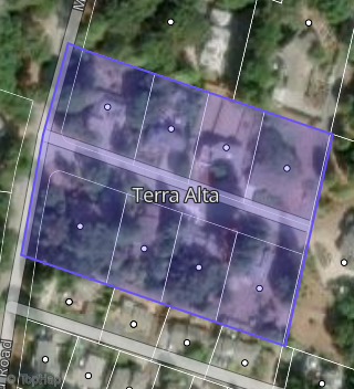
Boundary map of Terra Alta.
Crime Index for 95003
99
The crime index in 95003 is 99, which is 1.0 times lower than national average.
Market Trends
Historical market data near 130 Ramada Ln over selected time period.
Nearby Properties on Ramada Ln
- 220 Ramada Ln, Aptos, CA 95003 is a 2,200 square foot, 3 bedroom, 2.5 bathroom, 4.55 acre property. It was built in 1985 and has an estimate of $1,582,144 with a price per ft² of $719.
- 199 Ramada Ln, Aptos, CA 95003 is a 2,760 square foot, 4 bedroom, 2.5 bathroom, 1.27 acre property. It was built in 1978 and has an estimate of $1,714,278 with a price per ft² of $693.
- 150 Ramada Ln, Aptos, CA 95003 (Terra Alta) is a 1,080 square foot, 2 bedroom, 2 bathroom, 0.36 acre property. It was built in 1976 and has an estimate of $1,027,318 with a price per ft² of $940.
- 214 Ramada Ln, Aptos, CA 95003 is a 2,096 square foot, 3 bedroom, 2 bathroom, 4.81 acre property. It was built in 1987 and has an estimate of $1,603,601 with a price per ft² of $765.
- 206 Ramada Ln, Aptos, CA 95003 is a 3,738 square foot, 4 bedroom, 3.5 bathroom, 1.14 acre property. It was built in 1992 and has an estimate of $2,034,141 with a price per ft² of $544.
- 130 Ramada Ln, Aptos, CA 95003 (Terra Alta) is a 1,706 square foot, 3 bedroom, 2 bathroom, 0.48 acre property. It was built in 1976 and has an estimate of $1,255,088 with a price per ft² of $736.
- 180 Ramada Ln, Aptos, CA 95003 (Terra Alta) is a 1,647 square foot, 3 bedroom, 2 bathroom, 0.36 acre property. It was built in 1978 and has an estimate of $1,189,162 with a price per ft² of $722.
- 200 Ramada Ln, Aptos, CA 95003 (Terra Alta) is a 2,632 square foot, 3 bedroom, 3 bathroom, 0.43 acre property. It was built in 1975 and has an estimate of $1,469,141 with a price per ft² of $558.
- 195 Ramada Ln, Aptos, CA 95003 (Terra Alta) is a 1,627 square foot, 2 bathroom, 0.44 acre property. It was built in 1977 and has an estimate of $1,061,150 with a price per ft² of $652.
- 179 Ramada Ln, Aptos, CA 95003 (Terra Alta) is a 1,693 square foot, 3 bedroom, 2 bathroom, 0.37 acre property. It was built in 1975 and has an estimate of $1,208,009 with a price per ft² of $714.
- 155 Ramada Ln, Aptos, CA 95003 (Terra Alta) is a 2,034 square foot, 4 bedroom, 3 bathroom, 0.36 acre property. It was built in 1979 and has an estimate of $1,317,101 with a price per ft² of $648.
- 129 Ramada Ln, Aptos, CA 95003 (Terra Alta) is a 1,672 square foot, 4 bedroom, 2 bathroom, 0.48 acre property. It was built in 1976 and has an estimate of $1,452,720 with a price per ft² of $869.