133 Tennessee Ln
Marysville, CA 95901
- 2Beds
- 1Bath
- 1,149ft²Living Area
- 18.3acLot Size
- -Pool
- -Car
- 1943Year Built
- -DOM
- 1Permit
Permits
133 Tennessee Ln has 1 permit records of total value of $15,243.
Current Ownership
Information about the current owner(s).
Taxes Billed
Taxes billed in 2023$1,102.38From latest Total Assessed Value1.05%Total Assessed Value$104,814=Land+
Assessed Value$36,218Additions
Assessed Value$68,596
In 2023, taxes billed for 133 Tennessee Ln were $1,102.38, which is 1.05% from latest Total Assessed Value of $104,814.
Property History
133 Tennessee Ln has undefined property events records (listings, deeds, permits, tax, foreclosure, loan).
Environment
Environmental factors around 133 Tennessee Ln
Hazard Risks
Particulates108Nat'l Avg100Earthquake93Ozone92Air Pollution91Carb Mono85Lead38Tornado8Weather5Hail0Hurricane0Wind0
9 hazards (Carbon Monoxide, Earthquake Risk, Tornado Index, Air Pollution Index, Ozone Index, Weather Risk, Lead Index, Particulate Matter, National Average) are above the national average around 133 Tennessee Ln.
Walkability Index
3 /20
Most Walkable
20-18
Very Walkable
17-15
Somewhat Walkable
14-10
Car Dependent
9-0
133 Tennessee Ln has a walkability score of 3 out of 20, which means that it is in a car dependent area.
Temperature
Seasonal temperature sampled over multiple years
Winter
Average
Low
38°F
High
56°F
Summer
Average
Low
60°F
High
92°F
In the winter at 133 Tennessee Ln, temperatures range from 38.39°F to 55.98°F with an average of 47.19°F. In the summer, the temperature ranges from 59.57°F to 92.25°F with and average of 75.91°F.
School Information
Public/private schools serving 133 Tennessee Ln
Public Schools
Nearby public schools serving 133 Tennessee Ln have ratings undefined, and undefined.
Neighborhood
This property is located in Bangor.
Seasonal Housing units 95901
9%of housing is for seasonal rent.
Daytime Population for 95901
-13%of people during work hours.
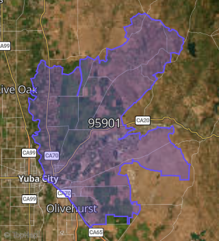
Boundary map of Bangor.
Crime Index for 95901
111
The crime index in 95901 is 111, which is 1.1 times higher than national average.
Market Trends
Historical market data near 133 Tennessee Ln over selected time period.
Nearby Properties on Tennessee Ln
- 119 Tennessee Ln, Marysville, CA 95901 is a 1,957 square foot, 2 bedroom, 1 bathroom, 21.86 acre property. It was built in 1948 and has an estimate of $400,742 with a price per ft² of $205.
- 68 Tennessee Ln, Marysville, CA 95901 is a 1,473 square foot, 3 bedroom, 2 bathroom, 20.93 acre property. It was built in 2010 and has an estimate of $540,878 with a price per ft² of $367.
- 133 Tennessee Ln, Marysville, CA 95901 is a 1,149 square foot, 2 bedroom, 1 bathroom, 18.34 acre property. It was built in 1943 and has an estimate of $364,746 with a price per ft² of $317.
- 196 Tennessee Ln, Marysville, CA 95901 is a 1,729 square foot, 2 bedroom, 1 bathroom, 19.73 acre property. It was built in 1946 and has an estimate of $396,842 with a price per ft² of $230.
- 203 Tennessee Ln, Marysville, CA 95901 is a 1,582 square foot, 3 bedroom, 2 bathroom, 2 acre property. It was built in 1958 and has an estimate of $238,002 with a price per ft² of $150.
- 191 Tennessee Ln, Marysville, CA 95901 is a 2,016 square foot, 3 bedroom, 2.25 bathroom, 16.34 acre property. It was built in 1970 and has an estimate of $399,643 with a price per ft² of $198.
- 177 Tennessee Ln, Marysville, CA 95901 is a 806 square foot, 2 bedroom, 1 bathroom, 1.5 acre property. It was built in 1949 and has an estimate of $104,116 with a price per ft² of $129.