134 Crissara Dr
Watsonville, CA 95076
- -Bed
- -Bath
- 1,695ft²Living Area
- 6,926ft²Lot Size
- -Pool
- 2Car
- 2000Year Built
- -DOM
- -Permit
Property Valuations
Latest estimates for 134 Crissara Dr based on TopHap automated valuation model (AVM).
TopHap Estimate
$914,600
$539/ft²
+$575K above Sold Price
Updated 3 months ago
Last Sold Price
$339,500
$200/ft²
23 years ago
134 Crissara Dr is valued at $914,600 by TopHap AVM 3 months ago.
134 Crissara Dr was last sold in 2000 for $339,500.
Current Ownership
Information about the current owner(s).
Taxes Billed
Taxes billed in 2023$5,747.28From latest Total Assessed Value1.17%Total Assessed Value$490,988=Land+
Assessed Value$244,769Additions
Assessed Value$246,219
In 2023, taxes billed for 134 Crissara Dr were $5,747.28, which is 1.17% from latest Total Assessed Value of $490,988.
Property History
134 Crissara Dr has undefined property events records (listings, deeds, permits, tax, foreclosure, loan).
Environment
Environmental factors around 134 Crissara Dr
Hazard Risks
Earthquake510Particulates102Nat'l Avg100Air Pollution84Ozone82Carb Mono76Lead43Tornado13Weather2Hail0Hurricane0Wind0
9 hazards (Carbon Monoxide, Earthquake Risk, Tornado Index, Air Pollution Index, Ozone Index, Weather Risk, Lead Index, Particulate Matter, National Average) are above the national average around 134 Crissara Dr.
Walkability Index
15 /20
Most Walkable
20-18
Very Walkable
17-15
Somewhat Walkable
14-10
Car Dependent
9-0
134 Crissara Dr has a walkability score of 15 out of 20, which means that it is in a very walkable area.
Temperature
Seasonal temperature sampled over multiple years
Winter
Average
Low
39°F
High
61°F
Summer
Average
Low
51°F
High
75°F
In the winter at 134 Crissara Dr, temperatures range from 39.48°F to 61.46°F with an average of 50.47°F. In the summer, the temperature ranges from 51.25°F to 74.77°F with and average of 63.01°F.
School Information
Public/private schools serving 134 Crissara Dr
Public Schools
Nearby public schools serving 134 Crissara Dr have ratings undefined, undefined, and undefined.
Neighborhood
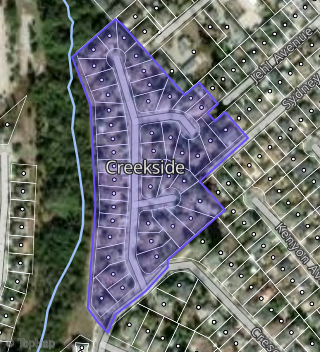
This property is located in Creekside, Watsonville, CA 95076.
Seasonal Housing units 95076
51%of housing is for seasonal rent.
Daytime Population for 95076
-10%of people during work hours.
Boundary map of Creekside.
Crime Index for 95076
73
The crime index in 95076 is 73, which is 0.7 times lower than national average.
Market Trends
Historical market data near 134 Crissara Dr over selected time period.
Nearby Properties on Crissara Dr
- 122 Crissara Dr, Watsonville, CA 95076 (Creekside) is a 1,738 square foot, 3 bedroom, 2.5 bathroom, 0.13 acre property. It was built in 2003 and has an estimate of $755,881 with a price per ft² of $435.
- 123 Crissara Dr, Watsonville, CA 95076 (Creekside) is a 1,674 square foot, 3 bedroom, 2 bathroom, 0.13 acre property. It was built in 2000 and has an estimate of $773,140 with a price per ft² of $462.
- 117 Crissara Dr, Watsonville, CA 95076 (Creekside) is a 1,493 square foot, 3 bedroom, 2 bathroom, 0.13 acre property. It was built in 1999 and has an estimate of $735,643 with a price per ft² of $493.
- 146 Crissara Dr, Watsonville, CA 95076 (Creekside) is a 1,832 square foot, 3 bedroom, 2 bathroom, 0.11 acre property. It was built in 2001 and has an estimate of $723,561 with a price per ft² of $395.
- 125 Crissara Dr, Watsonville, CA 95076 (Creekside) is a 2,061 square foot, 3 bedroom, 2 bathroom, 0.14 acre property. It was built in 2000 and has an estimate of $639,057 with a price per ft² of $318.
- 150 Crissara Dr, Watsonville, CA 95076 (Creekside) is a 1,705 square foot, 3 bedroom, 2 bathroom, 0.12 acre property. It was built in 2000 and has an estimate of $752,552 with a price per ft² of $441.
- 142 Crissara Dr, Watsonville, CA 95076 (Creekside) is a 1,729 square foot, 3 bedroom, 2.5 bathroom, 0.12 acre property. It was built in 2001 and has an estimate of $762,272 with a price per ft² of $441.
- 138 Crissara Dr, Watsonville, CA 95076 (Creekside) is a 2,090 square foot, 4 bedroom, 2.5 bathroom, 0.15 acre property. It was built in 2000 and has an estimate of $735,373 with a price per ft² of $352.
- 134 Crissara Dr, Watsonville, CA 95076 (Creekside) is a 1,695 square foot and 0.16 acre property. It was built in 2000 and has an estimate of $526,332 with a price per ft² of $311.
- 130 Crissara Dr, Watsonville, CA 95076 (Creekside) is a 1,695 square foot, 3 bedroom, 2 bathroom, 0.14 acre property. It was built in 2000 and has an estimate of $687,943 with a price per ft² of $406.
- 126 Crissara Dr, Watsonville, CA 95076 (Creekside) is a 1,662 square foot, 3 bedroom, 2.5 bathroom, 0.12 acre property. It was built in 2000 and has an estimate of $766,685 with a price per ft² of $461.
- 145 Crissara Dr, Watsonville, CA 95076 (Creekside) is a 1,705 square foot, 3 bedroom, 2.5 bathroom, 0.14 acre property. It was built in 2001 and has an estimate of $788,950 with a price per ft² of $463.
- 121 Crissara Dr, Watsonville, CA 95076 (Creekside) is a 1,493 square foot, 3 bedroom, 2 bathroom, 0.14 acre property. It was built in 1999 and has an estimate of $709,669 with a price per ft² of $475.
- 129 Crissara Dr, Watsonville, CA 95076 (Creekside) is a 2,061 square foot, 4 bedroom, 2.5 bathroom, 0.13 acre property. It was built in 2000 and has an estimate of $663,377 with a price per ft² of $352.
- 115 Crissara Dr, Watsonville, CA 95076 (Creekside) is a 1,493 square foot, 3 bedroom, 2 bathroom, 0.13 acre property. It was built in 1999 and has an estimate of $765,136 with a price per ft² of $510.
- 133 Crissara Dr, Watsonville, CA 95076 (Creekside) is a 1,662 square foot, 3 bedroom, 2 bathroom, 0.13 acre property. It was built in 2000 and has an estimate of $727,863 with a price per ft² of $438.
- 113 Crissara Dr, Watsonville, CA 95076 (Creekside) is a 1,493 square foot, 3 bedroom, 2 bathroom, 0.12 acre property. It was built in 1999 and has an estimate of $754,251 with a price per ft² of $505.
- 111 Crissara Dr, Watsonville, CA 95076 (Creekside) is a 2,061 square foot, 3 bedroom, 2.5 bathroom, 0.11 acre property. It was built in 1999 and has an estimate of $740,278 with a price per ft² of $359.
- 137 Crissara Dr, Watsonville, CA 95076 (Creekside) is a 1,695 square foot, 3 bedroom, 2 bathroom, 0.14 acre property. It was built in 2001 and has an estimate of $729,125 with a price per ft² of $430.
- 109 Crissara Dr, Watsonville, CA 95076 (Creekside) is a 2,465 square foot, 3 bedroom, 2 bathroom, 0.11 acre property. It was built in 1999 and has an estimate of $784,528 with a price per ft² of $318.
- 106 Crissara Dr, Watsonville, CA 95076 (Creekside) is a 1,493 square foot, 3 bedroom, 2 bathroom, 0.17 acre property. It was built in 2000 and has an estimate of $731,832 with a price per ft² of $490.
- 102 Crissara Dr, Watsonville, CA 95076 (Creekside) is a 1,695 square foot, 3 bedroom, 2 bathroom, 0.22 acre property. It was built in 2000 and has an estimate of $807,816 with a price per ft² of $477.
- 110 Crissara Dr, Watsonville, CA 95076 (Creekside) is a 1,756 square foot, 3 bedroom, 2.5 bathroom, 0.12 acre property. It was built in 2000 and has an estimate of $767,113 with a price per ft² of $437.
- 114 Crissara Dr, Watsonville, CA 95076 (Creekside) is a 1,662 square foot, 3 bedroom, 2 bathroom, 0.12 acre property. It was built in 2000 and has an estimate of $775,869 with a price per ft² of $467.
- 118 Crissara Dr, Watsonville, CA 95076 (Creekside) is a 1,662 square foot, 3 bedroom, 2 bathroom, 0.11 acre property. It was built in 2000 and has an estimate of $757,728 with a price per ft² of $432.
- View more properties on Crissara Dr