141 Hempstead Ave
Lynbrook, NY 11563
- 7Beds
- 6Baths
- 4,085ft²Living Area
- 0.4acLot Size
- -Pool
- 1Car
- 1913Year Built
- -DOM
- -Permit
Property Valuations
Latest estimates for 141 Hempstead Ave based on TopHap automated valuation model (AVM).
TopHap Estimate
$1,066,748
$261/ft²
+$514K above Sold Price
Updated 3 months ago
Last Sold Price
$552,500
$135/ft²
10 years ago
141 Hempstead Ave is valued at $1,066,748 by TopHap AVM 3 months ago.
141 Hempstead Ave was last sold in 2013 for $552,500.
Current Ownership
Information about the current owner(s).
Taxes Billed
Taxes billed in 2023$15,048.31From latest Total Assessed Value1,770.39%Total Assessed Value$850=Land+
Assessed Value$332Additions
Assessed Value$518
In 2023, taxes billed for 141 Hempstead Ave were $15,048.31, which is 1770.39% from latest Total Assessed Value of $850.
Property History
141 Hempstead Ave has undefined property events records (listings, deeds, permits, tax, foreclosure, loan).
Environment
Environmental factors around 141 Hempstead Ave
Hazard Risks
Wind284Hurricane133Lead123Ozone111Air Pollution110Particulates105Carb Mono104Nat'l Avg100Weather98Earthquake94Hail71Tornado26
12 hazards (Carbon Monoxide, Earthquake Risk, Hail Index, Tornado Index, Hurricane Index, Air Pollution Index, Ozone Index, Wind Index, Weather Risk, Lead Index, Particulate Matter, National Average) are above the national average around 141 Hempstead Ave.
Walkability Index
15 /20
Most Walkable
20-18
Very Walkable
17-15
Somewhat Walkable
14-10
Car Dependent
9-0
141 Hempstead Ave has a walkability score of 15 out of 20, which means that it is in a very walkable area.
Temperature
Seasonal temperature sampled over multiple years
Winter
Average
Low
27°F
High
41°F
Summer
Average
Low
65°F
High
81°F
In the winter at 141 Hempstead Ave, temperatures range from 27.23°F to 40.9°F with an average of 34.07°F. In the summer, the temperature ranges from 64.9°F to 81.39°F with and average of 73.15°F.
School Information
Public/private schools serving 141 Hempstead Ave
Public Schools
Nearby public schools serving 141 Hempstead Ave have ratings undefined, undefined, undefined, and undefined.
Neighborhood
This property is located in Lynbrook, Lynbrook, NY 11563.
Seasonal Housing units 11563
11%of housing is for seasonal rent.
Daytime Population for 11563
+5%of people during work hours.
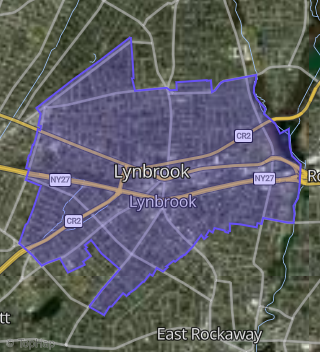
Boundary map of Lynbrook.
Crime Index for 11563
113
The crime index in 11563 is 113, which is 1.1 times higher than national average.
Market Trends
Historical market data near 141 Hempstead Ave over selected time period.
Nearby Properties on Hempstead Ave
- 205 Hempstead Ave, Lynbrook, NY 11563 (Lynbrook) is a 1,864 square foot, 2 bathroom, 0.13 acre property. It was built in 1920 and has an estimate of $663,238 with a price per ft² of $356.
- 213 Hempstead Ave, Lynbrook, NY 11563 (Lynbrook) is a 739 square foot, 1 bedroom, 1 bathroom, 0.22 acre property. It was built in 1920 and has an estimate of $544,100 with a price per ft² of $736.
- 20 Hempstead Ave, Lynbrook, NY 11563 (Lynbrook) is a 942 square foot, 1 bedroom, 1 bathroom, 0.18 acre property. It was built in 1936 and has an estimate of $584,600 with a price per ft² of $621.
- 230-234 Hempstead Ave, Lynbrook, NY 11563 (Lynbrook) is a 4,000 square foot and 0.09 acre property.
- 230-234 Hempstead Ave, Lynbrook, NY 11563 (Lynbrook) is a 20,328 square foot and 0.3 acre property.
- 212 Hempstead Ave, Lynbrook, NY 11563 (Lynbrook) is a 4,639 square foot and 0.17 acre property.
- 229 Hempstead Ave, Lynbrook, NY 11563 (Lynbrook) is a 0 acre property.
- 229 Hempstead Ave, Lynbrook, NY 11563 (Lynbrook) is a 1,956 square foot, 3.25 bathroom, 0.13 acre property. It was built in 1941 and has an estimate of $706,843 with a price per ft² of $361.
- 241 Hempstead Ave, Lynbrook, NY 11563 (Lynbrook) is a 442 square foot and 0.22 acre property.
- 195 Hempstead Ave, Lynbrook, NY 11563 (Lynbrook) is a 1,419 square foot, 2 bathroom, 0.23 acre property. It was built in 1908 and has an estimate of $640,800 with a price per ft² of $452.
- 183 Hempstead Ave, Lynbrook, NY 11563 (Lynbrook) is a 2,250 square foot, 2 bathroom, 0.16 acre property. It was built in 1964 and has an estimate of $740,500 with a price per ft² of $329.
- 141 Hempstead Ave, Lynbrook, NY 11563 (Lynbrook) is a 4,085 square foot, 7 bedroom, 6.5 bathroom, 0.39 acre property. It was built in 1913 and has an estimate of $1,003,464 with a price per ft² of $246.
- 109 Hempstead Ave, Lynbrook, NY 11563 (Lynbrook) is a 1,983 square foot, 2.25 bathroom, 0.24 acre property. It was built in 1930 and has an estimate of $752,824 with a price per ft² of $380.
- 121 Hempstead Ave, Lynbrook, NY 11563 (Lynbrook) is a 3,383 square foot, 3.25 bathroom, 0.17 acre property. It was built in 1928 and has an estimate of $799,745 with a price per ft² of $236.
- 57 Hempstead Ave, Lynbrook, NY 11563 (Lynbrook) is a 11,592 square foot and 1.18 acre property.
- 103 Hempstead Ave, Lynbrook, NY 11563 (Lynbrook) is a 3,294 square foot, 3.25 bathroom, 0.34 acre property. It was built in 1938 and has an estimate of $842,961 with a price per ft² of $256.
- 107 Hempstead Ave, Lynbrook, NY 11563 (Lynbrook) is a 1,664 square foot, 2.25 bathroom, 0.17 acre property. It was built in 1918 and has an estimate of $666,001 with a price per ft² of $400.
- 85 Hempstead Ave, Lynbrook, NY 11563 (Lynbrook) is a 8,000 square foot, 2 bathroom, 0.19 acre property.
- 77 Hempstead Ave, Lynbrook, NY 11563 (Lynbrook) is a 3,696 square foot and 0.23 acre property.
- 78 Hempstead Ave, Lynbrook, NY 11563 (Lynbrook) is a 8,657 square foot and 0.93 acre property.
- 108 Hempstead Ave, Lynbrook, NY 11563 (Lynbrook) is a 2,260 square foot, 2.25 bathroom, 0.13 acre property. It was built in 1919 and has an estimate of $743,081 with a price per ft² of $329.
- 104 Hempstead Ave, Lynbrook, NY 11563 (Lynbrook) is a 1,834 square foot, 2 bathroom, 0.15 acre property. It was built in 1916 and has an estimate of $747,126 with a price per ft² of $407.
- 9 Hempstead Ave, Lynbrook, NY 11563 (Malverne) is a 17,778 square foot and 3.29 acre property.
- 248 Hempstead Ave, Lynbrook, NY 11563 (North Lynbrook) is a 1,674 square foot, 2 bathroom, 0.17 acre property. It was built in 1951 and has an estimate of $637,704 with a price per ft² of $381.
- 150 Hempstead Ave, Lynbrook, NY 11563 (Lynbrook) is a 3,296 square foot, 3 bathroom, 0.32 acre property. It was built in 1917 and has an estimate of $812,347 with a price per ft² of $246.
- View more properties on Hempstead Ave